Much cooler temperatures arrive tomorrow
COLUMBUS, Mississippi (WCBI) – SUMMARY: Significant changes arrive to the forecast beginning tomorrow with a few showers possible and afternoon high temperatures only reaching the low-50s!
TONIGHT: Becoming mostly cloudy with a stray shower possible after midnight. North wind 5-10 mp. Chance of rain: 10%.
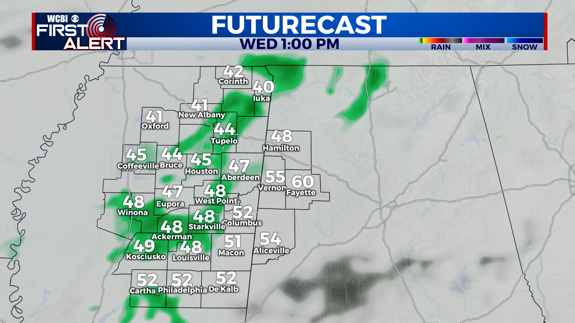
WEDNESDAY: Overcast with isolated showers possible. Much cooler with afternoon highs in the upper-50s. North wind 5-10 mph.
WEDNESDAY NIGHT: Overcast with lows in the low-40s. North wind around 5 mph.
REST OF THE WEEK: We begin a warming trend Friday as high pressure settles into the region. This weekend is looking great with afternoon highs in the sixties Saturday and Sunday under a sunny sky each day.
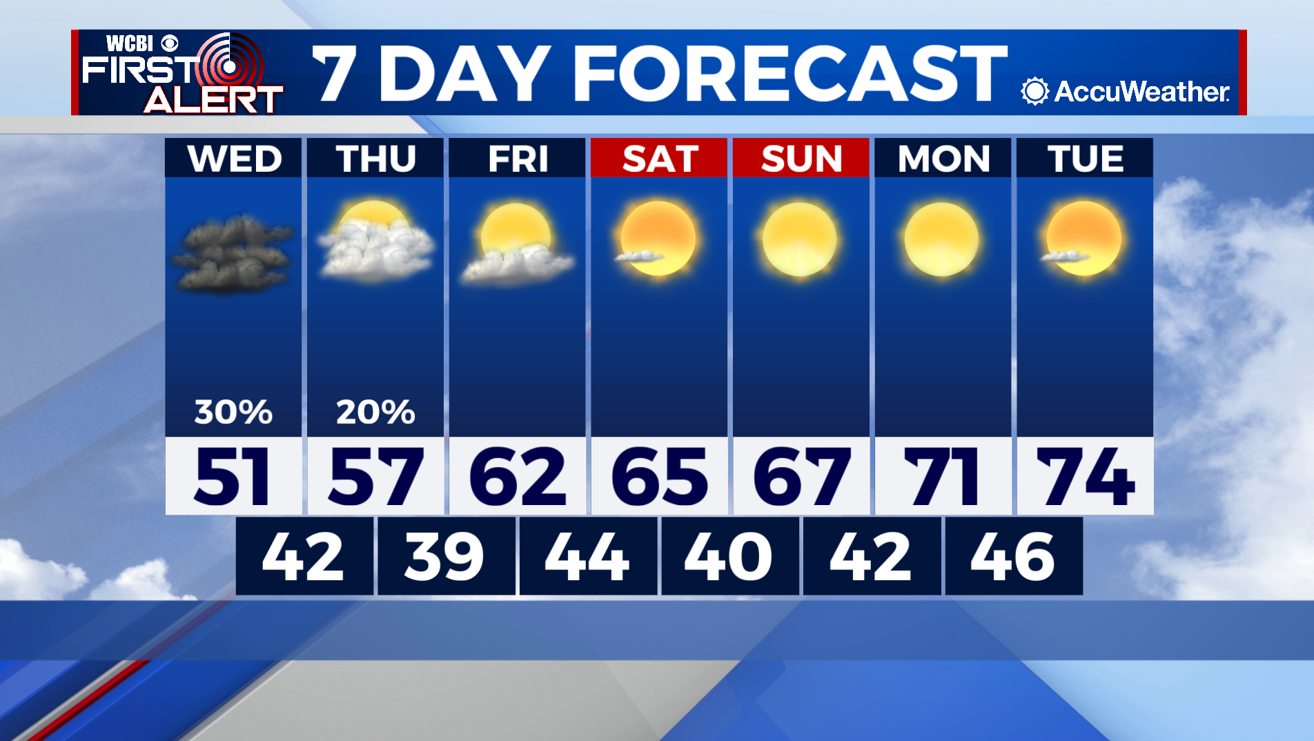
HIGH SCHOOL FOOTBALL: Friday night’s games will be dry with no chance of rain, but still colder than normal. Expect temperatures to be in the low-50s and upper-40s Friday night after kickoff. Bundle up!
TROPICS: Tropical Storm Wanda developed earlier today in the North Atlantic. Wanda will be a fish storm and will not impact land anywhere. Elsewhere across the Atlantic and Gulf of Mexico, all is quiet and tropical storm formation is not expected through this weekend.


