Much nicer conditions ahead
COLUMBUS, Mississippi (WCBI)- It has been an absolutely soggy week. Our Friday ended the week with sun making a return, though temperatures were still a little cool. Nicer conditions are continuing into the beginning of next week.
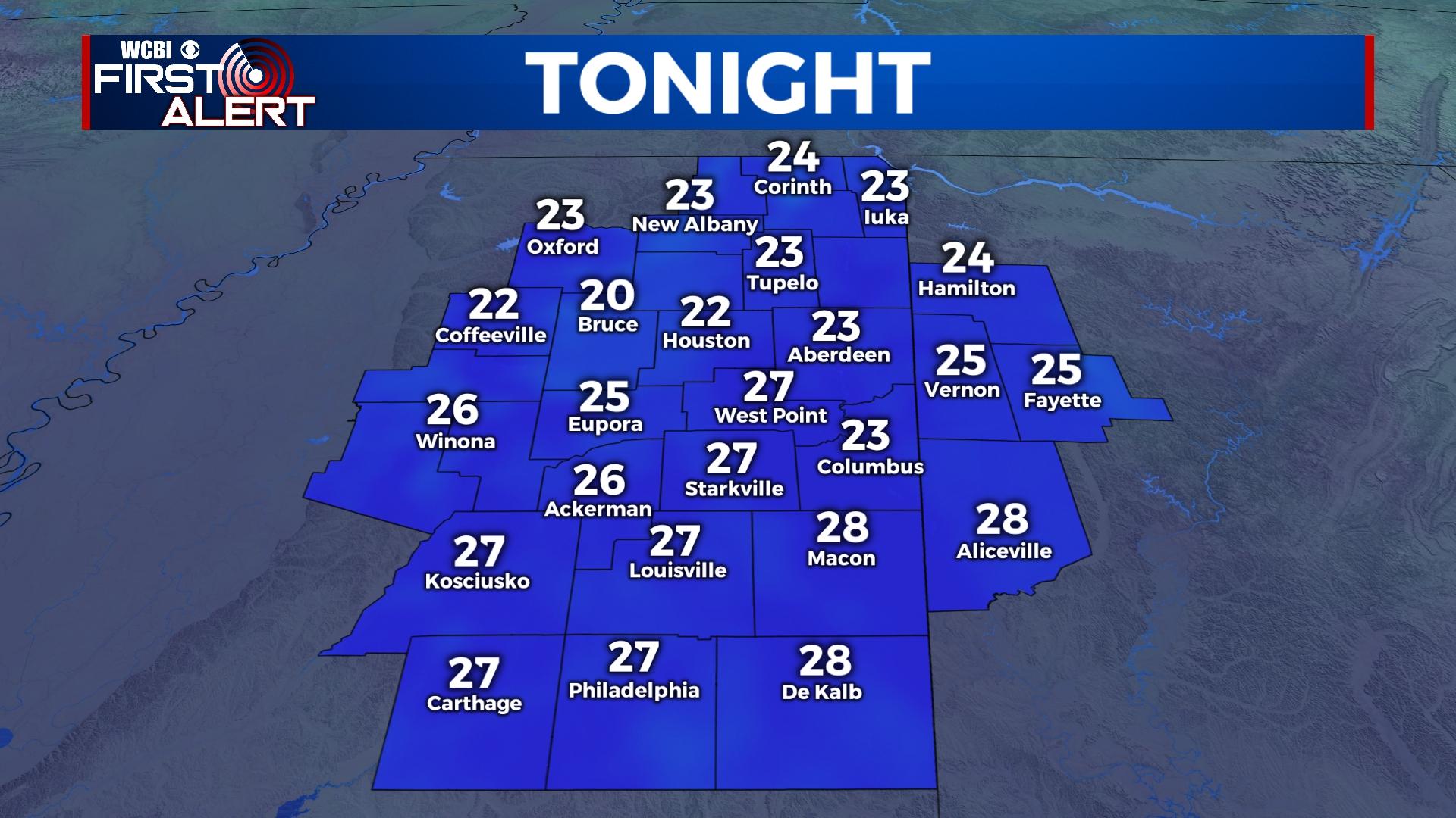
FRIDAY NIGHT: Mostly clear sky conditions will remain through the overnight hours. This will have our overnight low temperatures falling into the low to middle 20s. Patchy black ice may still be an issue tonight for spots that may not have dried up this afternoon. These spots could be in places like on bridges, shaded areas, or in more rural places with less car traffic. Stay cautious on the roadways again tonight.
SATURDAY: High temperatures are going to begin warming up. We are expecting to have temperatures in the middle 50s. The sky will remain mostly clear and sunny throughout the day. Through the late evening and overnight, some cloud coverage will be moving back into the Twin Sate region. Low temperatures will get above freezing, in the middle 30s.
SUNDAY: Cloud coverage from Saturday night will continue into Sunday morning. High temperatures will warm even further, into the lower 60s! The clouds will eventually clear off to the East and Northeast into the evening hours. Temperatures Sunday night will be in the middle to upper 30s.
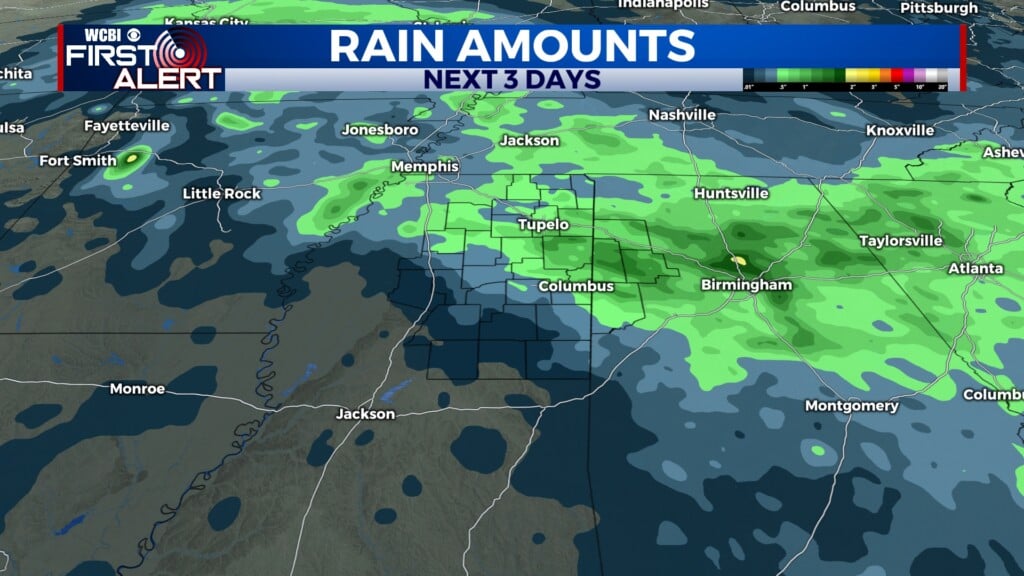
NEXT WEEK: The high temperatures are going to continue heating up and becoming much more mild and tolerable, in the upper 60s to lower 70s. Overnight temperatures will also be kinder, in the 40s and 50s. Rain returns Tuesday evening and will remain again for several days. Along with this next system, there is potential for a severe risk. Stick with WCBI for any updates on this upcoming system over the weekend and next week.