Nice Thursday, severe storms possible Friday morning
COLUMBUS, Mississippi (WCBI) – A really nice, mild Thursday gives way to a quick-moving line of strong to severe storms Friday morning. We’re still watching next week for wintry precip and dangerous cold.
THURSDAY: On the heels of a nice Wednesday, it gets nicer today w/more sunshine! Afternoon highs should reach the low to middle 60s – nearly 10 degrees above average for mid January.
THURSDAY NIGHT: A notable increase in cloud coverage and southerly breezes is expected in the evening & overnight hours. Wind gusts up to 30-35 mph are possible, well before any storms arrive. A few showers and storms are possible near I-55 after midnight.
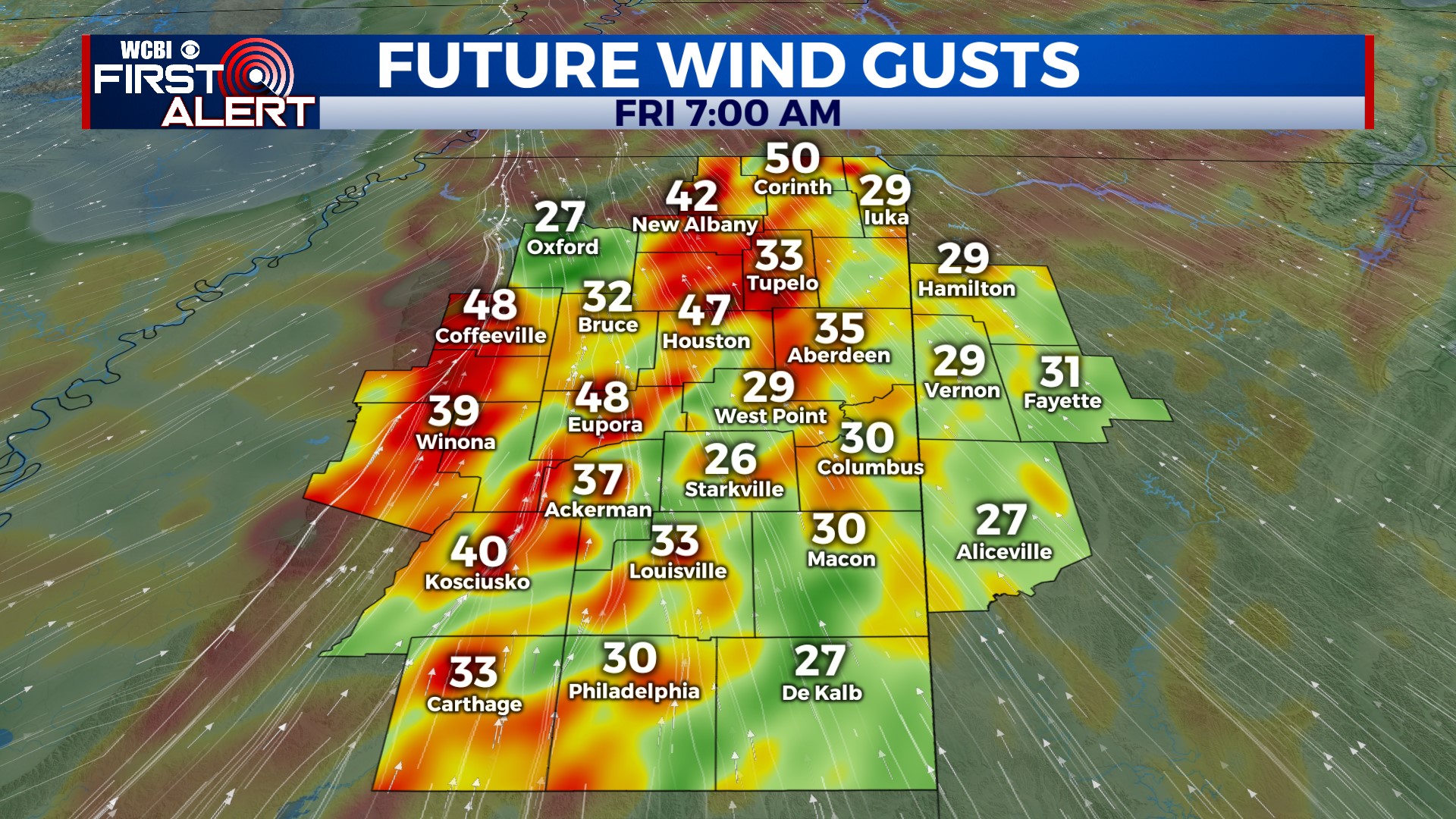
FRIDAY: A quick-moving line of showers and storms will move through the area Friday morning, bringing high wind and tornado potential in the strongest activity. Wind gusts could exceed 60 mph in the strongest parts of the line, and a few areas of rotation are possible. The most likely time frame to see this type of weather will be from roughly 7 AM to lunchtime. The afternoon looks dry with some clearing, though westerly wind gusts up to 30-40 mph are still possible.
WEEKEND: We’ll start Saturday & Sunday morning in the 20s, but the day should at least get into the upper 40s with sunshine. Clouds will begin increasing Sunday evening.
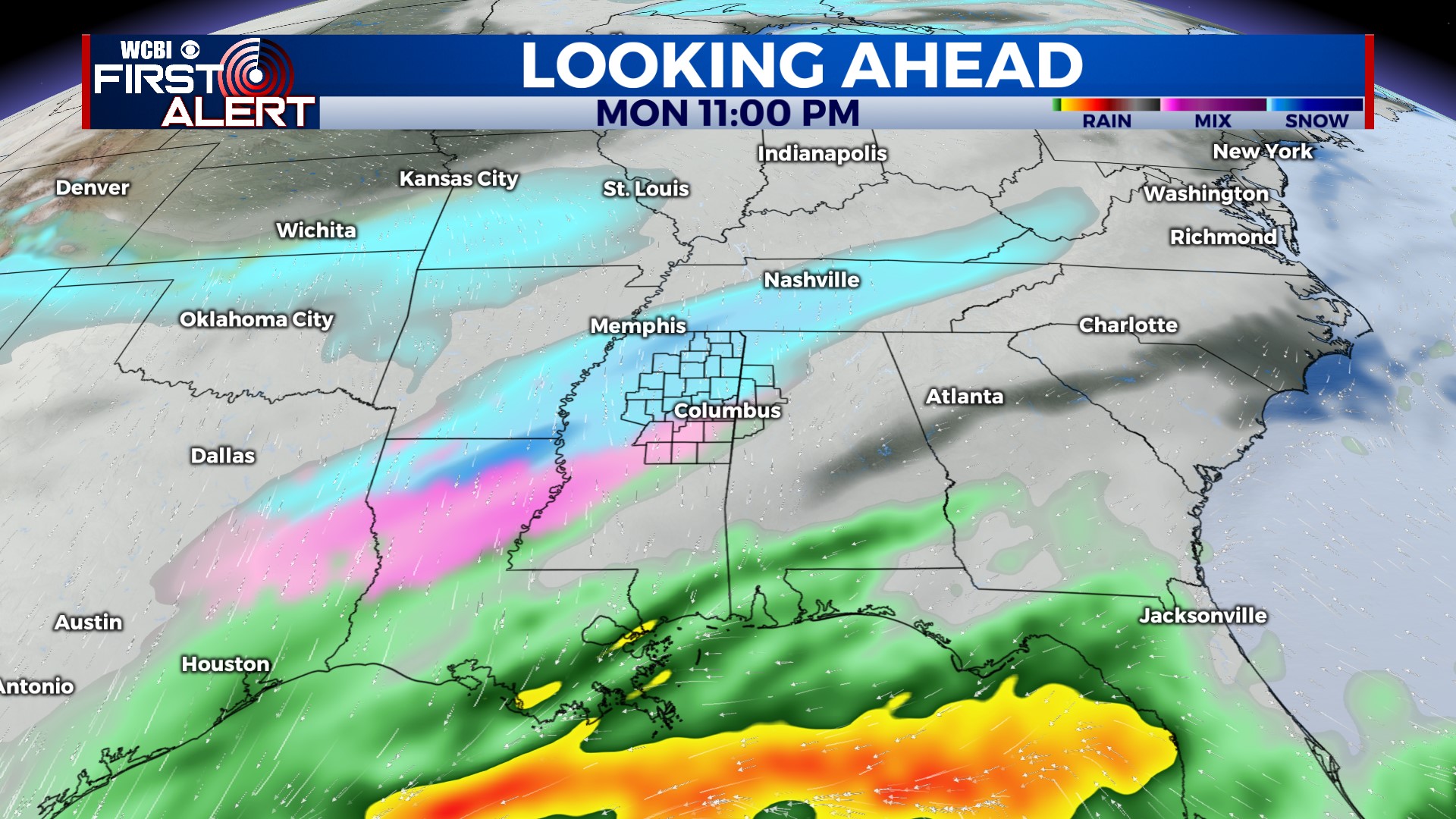
NEXT WEEK: For the most part, no major changes were made to the ongoing forecast. A shallow cold front will bring the coldest air we’ve seen this season to north Mississippi, as well as bring a chance for a mixed bag of precipitation. Models have slowed just a bit, so we’ve now included parts of Tuesday morning to see this mixed bag of precip in addition to Monday. This remains a low-confidence forecast, so we urge our readers and viewers to keep checking back multiple times a day and through the weekend for any potential updates!