Nice weekend, early week rain
COLUMBUS, Mississippi (WCBI) – On and off rain will finish off our Friday. Weekend conditions will clear out and work on getting warmer. Early next week, there is another chance for showers and storms.
FRIDAY NIGHT: The chance for on and off rain will continue throughout the evening, as low temps drop into the lower 50s. A cold front will approach from the NW overnight, helping to clear the rain off to the East and SE.
WEEKEND: An increasing north breeze will be one of the driving factors to clearing out the cloud coverage, leaving the afternoon sunny and breezy! North wind gusts up to 25+ mph are possible with highs in the middle 60s. Overnight lows are expected to fall into the upper 30s. Sunday starts sunny, but high clouds increase by afternoon ahead of the next system early next week. Sunday high temps will be in the lower 70s.
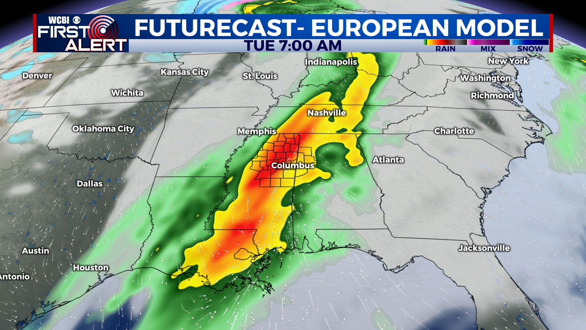
NEXT WEEK: Monday will start dry, but showers and storms will be developing to the west with great interest. A strong cold front is set to move into the Deep South Monday night into Tuesday, bringing a batch of rain and embedded storms. The latest models continue to show excellent wind shear, but moisture and storm energy are lacking. However, it won’t take much energy to create a severe weather risk…so stay tuned through this coming weekend for updates on this potential! Heading into mid-week, we expect slightly cooler than average conditions Wed/Thu with increasing sunshine.


