Pleasant, warm Thursday ahead of rainy and stormy Friday
COLUMBUS, Mississippi (WCBI) – We’ll squeeze one more dry day Thursday before rain & storms become widespread Friday.
THURSDAY: After another round of fog dissipates in the mid-morning, we’ll see a mix of sun and clouds and climbing afternoon temperatures. We should top out in the middle to possibly upper 70s later in the day.
THURSDAY NIGHT: Clouds continue to thicken, and an isolated shower or two could show up after midnight. Lows will only drop to the upper 50s.
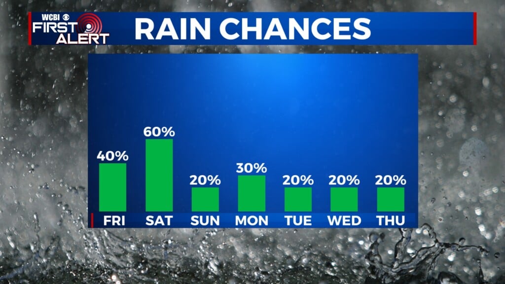
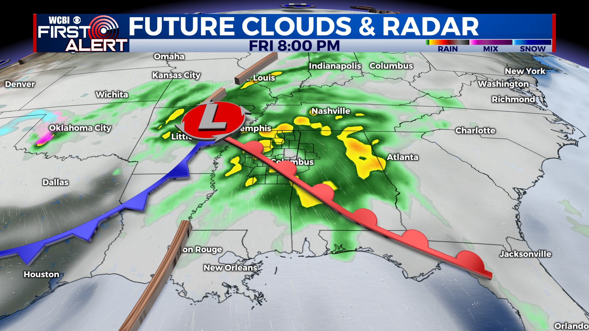
FRIDAY: An active weather day ahead. Rain and storms are likely to overspread the region before lunch, lasting into the afternoon. The severe threat with this round should be limited, though some hail is possible as storms will be elevated. Warmer, more unstable air could then build in behind initial round of storms, and a few strong to severe storms are possible Friday night as the actual front & low pressure move through the area. Confidence in the evening severe potential remains low, so stay tuned for more updates as the risk could still increase or decrease.
WEEKEND: Most of the rain should be done early Saturday, but clouds will be slow to clear. More sunshine is in store Sunday with cooler air! Highs will only reach the low 60s and overnight lows are likely to dip into the 30s Sunday night.
NEXT WEEK: Quite a nice start to spring break! Plenty of sunshine each day Mon-Wed with mild afternoons and pleasant nights.