Rain arrives Monday night, winter blast awaits Friday
COLUMBUS, Mississippi (WCBI) – Rain becomes widespread Monday night into Tuesday. Mild air temporarily sets in for mid-week before an Arctic blast of air arrives Thursday night.
MONDAY: Clouds gradually thicken up today, but rain should hold off until late-day. Temperatures will reach the mid to upper 40s for afternoon highs.
MONDAY NIGHT: Rain looks to overspread much of the region with temperatures in the mid 30s…above freezing! Expect heavier rain south of US 82 toward I-20, and there could even be a rumble or two in the mix.
TUESDAY: Showers to steady rain will start the day, but gradual drying is expected by afternoon. Highs should rebound into the middle 40s as rain exits, but clouds look to linger much of the day.
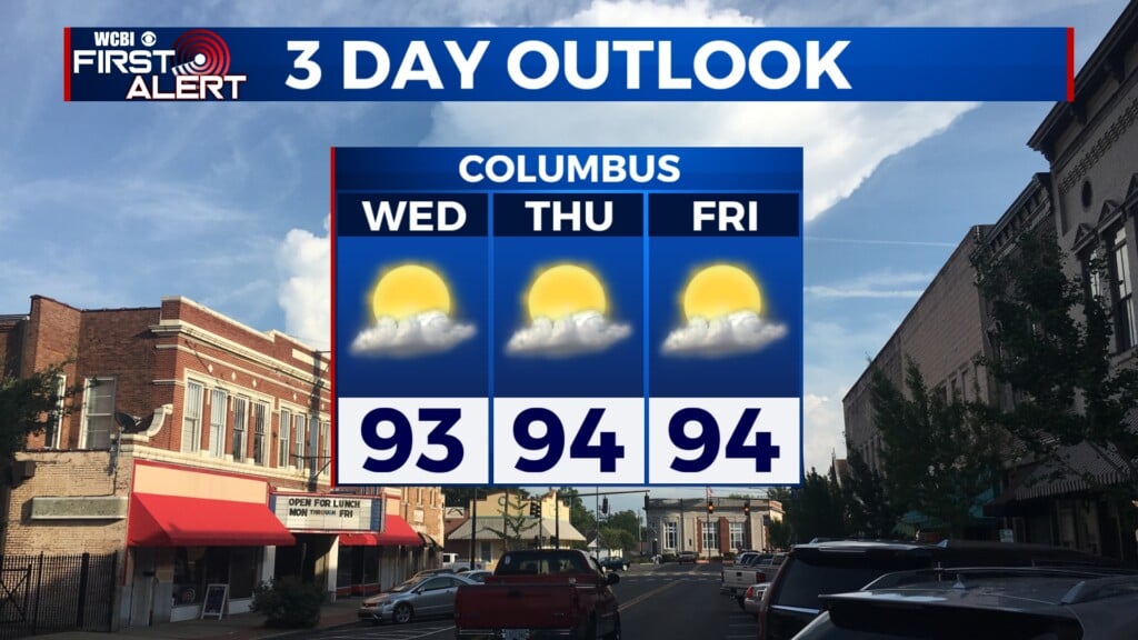
WEDNESDAY: A decent day for comparison – while the sky stays mostly cloudy, intervals of sun warm the afternoon into the 50s.
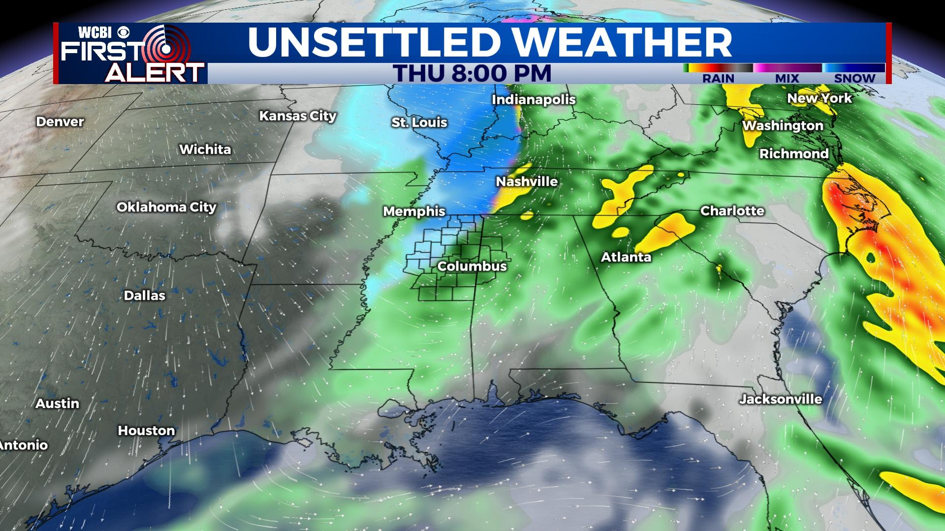
THURSDAY: A wild transition is in store. Clouds thicken up through the day as scattered rain moves in by afternoon & early evening. Temperatures are likely to reach the upper 50s before rain develops. Extremely cold air will rapidly rush in Thursday night, likely changing ongoing light rain to light snow or flurries for areas north of US 82. Low temperatures are likely to reach the 10s. Wind gusts above 20-25 mph will tank wind chills to sub-zero levels.
FRIDAY: Scattered clouds and flurries will remain through the day as temperatures struggle to reach 20 degrees. Sub-zero wind chills will start the day and only improve slightly by afternoon. Another bitter cold night is in store as lows drop to the lower 10s or even upper single digits for some with near/below zero wind chills yet again.
CHRISTMAS WEEKEND: Expect a mix of sun and clouds both days with highs in the 20s Saturday. Another frigid morning is in store for Christmas Day as lows stay in the 10s. Temperatures may reach freezing for a high temperature in the afternoon.