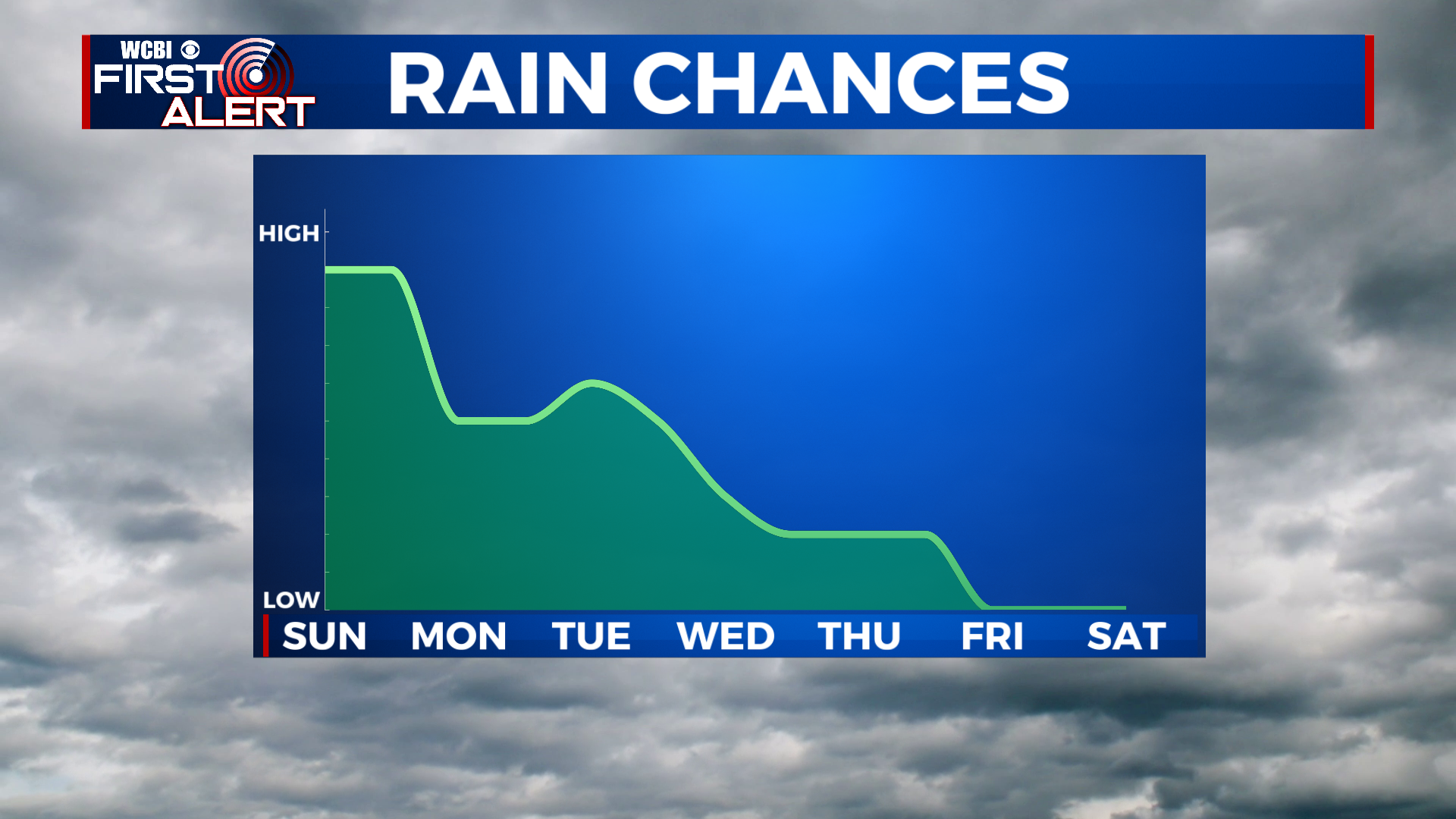
Rain chances stay high for the next few days
SUMMARY: A cold front and associated area of low pressure will be taking their sweet time moving through the southeast, so we have to deal with a few more days of cloudy and rainy weather. Rain chances look highest on Sunday, with less coverage of rain for Monday. Rain chances increase again for Tuesday, before tapering off for Wednesday and leaving the rest of the week dry and clear. Highs will be right around the 80 degree mark through Monday, in the upper 70s Tuesday and Wednesday, and the low 80s for the remainder of the week.
SATURDAY NIGHT: A few scattered showers are possible through the overnight hours. Otherwise, cloudy skies and a low near 68.
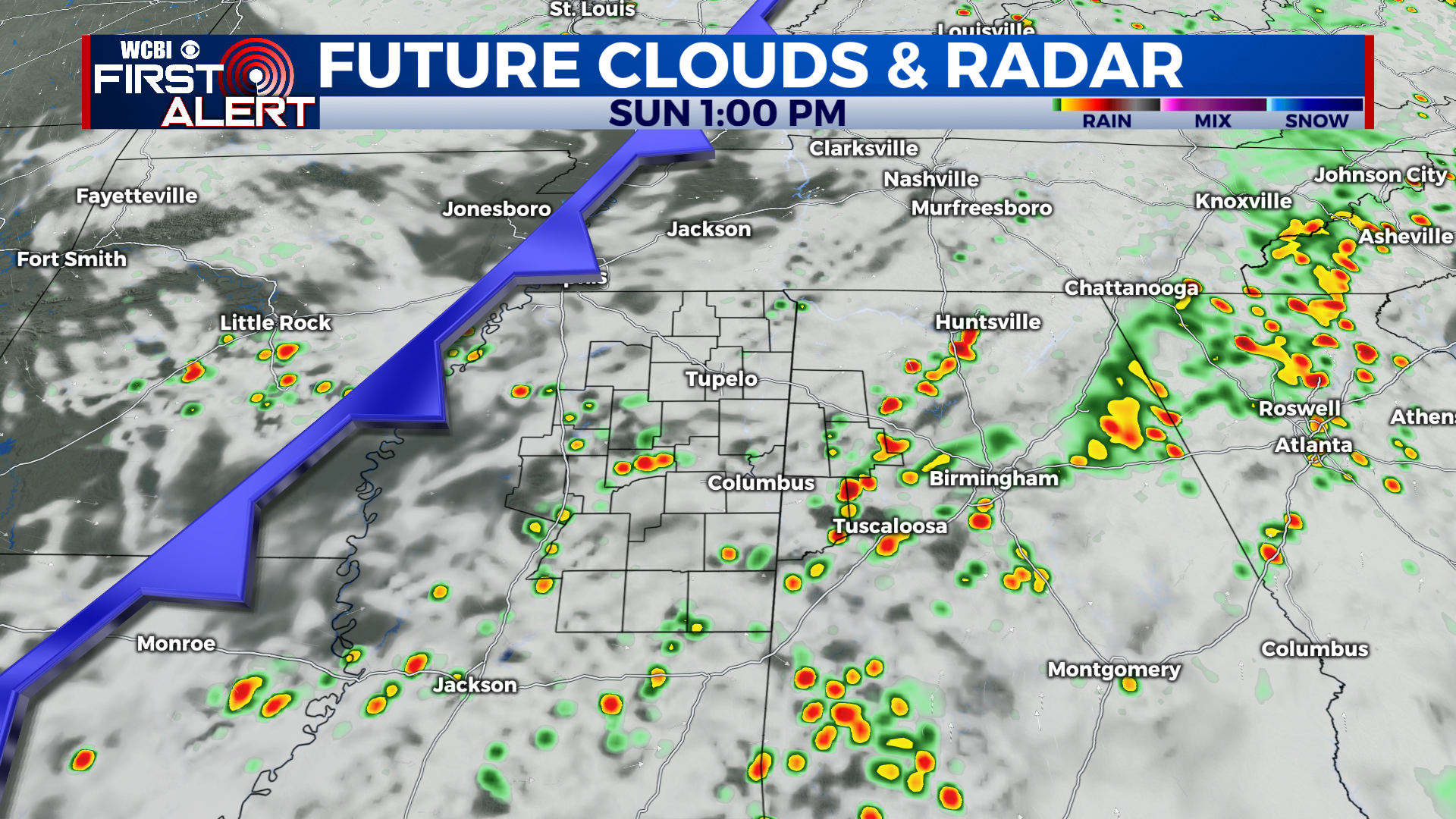
SUNDAY: With a cold front approaching the area, rain chances will be very high for Sunday. Many of us will see multiple rounds of heavy downpours through the day, with a high near 80. There is a low risk of some flash flooding, so take it easy on the roads.
SUNDAY NIGHT: The front clears the rain out for Sunday night, with only a lingering shower or 2 through the nighttime hours. Lows in the mid 60s under cloudy skies.
MONDAY: A bit drier for Monday, some of us should stay dry. Scattered showers and storms are again possible, however, in the afternoon. Highs in the low 80s.
TUESDAY TO SATURDAY: Tuesday, rain chances increase once again as an area of low pressure swings through the state. Highs top out in the upper 70s. Wednesday things look to really dry out with only an isolated shower or 2 possible, with the majority of the area staying dry. Highs once again in the upper 70s. Things really dry out through the end of the week, with lots of sunshine and highs returning to the low 80s.
CONNECT WITH @WCBIWEATHER ON TWITTER, FACEBOOK AND INSTAGRAM


