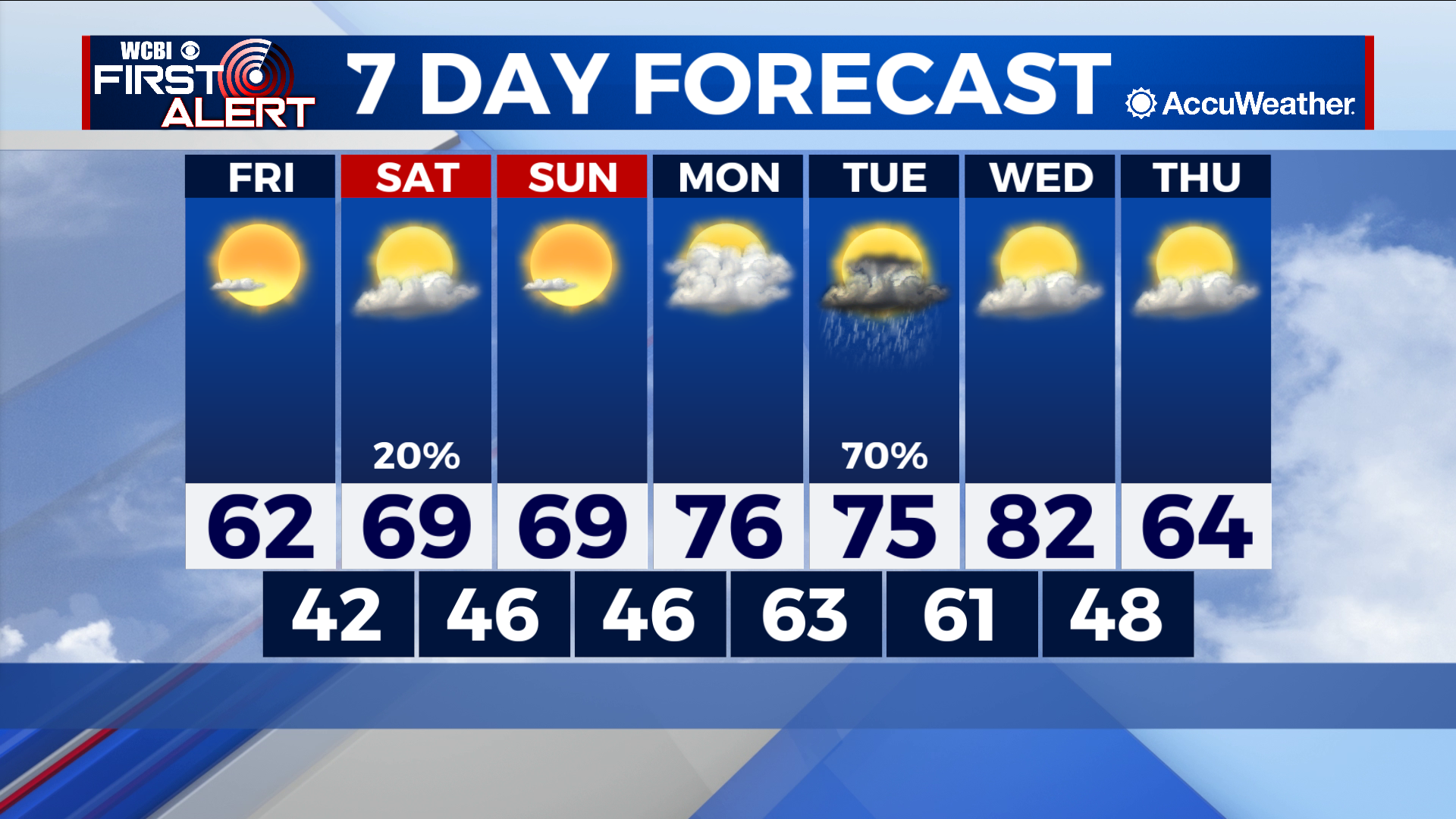
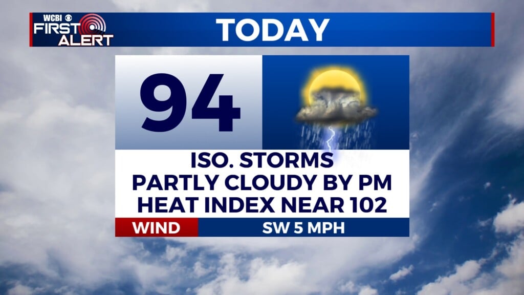
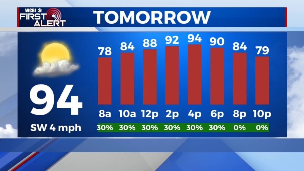
Rain chances Tuesday break up otherwise comfortable week
COLUMBUS – SUMMARY: Highs in the upper 60s and later upper 70s form the general pattern for the next week. Lows remain in the 40s throughout, warming into the low 60s early next week. A cold front Wednesday brings a cool blast of air to the region, and dips highs down into the 60s and lows back into the 40s. The sole rain chance of the week occurs Tuesday, with the chance for thunderstorms across the region.
FRIDAY: Temperatures remain cooler but mild as highs reach into the low 60s. Mostly sunny skies make for a nice day outside, with no rain expected. Overnight lows bottom out in the low 40s.
SATURDAY: Some improvement temperature-wise occurs as highs settle out in the upper 60s. Some clouds return to the area and the stray shower for some of our northern counties cannot be ruled out. Lows experience a marginal increase into the upper 40s.
SUNDAY: Like Saturday, afternoon temperatures Sunday hit the upper 60s range, with lows following suit and sitting in the upper 40s once again. The skies do dry up however, and more sunshine is expected than on Saturday.
NEXT WEEK: The week starts out with a big temperature jump into the upper 70s. The clouds make a comeback as well and on Tuesday the biggest rain chance of the week brings thunderstorms to the region. The question of severe impacts remains open but indications to this point have signaled to more run-of-the-mill thunderstorms. Temperatures max out in the low 80s Wednesday before a cold front the same day knocks highs down into the 60s and lows back into the 40s.