Rain ends tonight then record heat becomes possible next week
COLUMBUS, Mississippi (WCBI) – SUMMARY: Today’s highs were in the upper-80s across the region, and plenty of moisture is in place for tonight’s severe weather potential.
TONIGHT: Scattered showers and thunderstorms. Some storms may be severe with large hail and damaging wind gusts. Lows in the upper-60s. Chance of rain: 90%.
FRIDAY: Isolated showers and thunderstorms before 8am (primarily near the AL/MS state line) then a few isolated showers possible after 2pm. Becoming mostly sunny by the afternoon. Highs in the low-to-mid 80s. West winds 5-15 mph with gusts up to 25 mph. Chance of rain: 30%.
FRIDAY NIGHT: Mostly clear with lows in the low-60s. West winds 5-15 mph with gusts up to 20 mph.
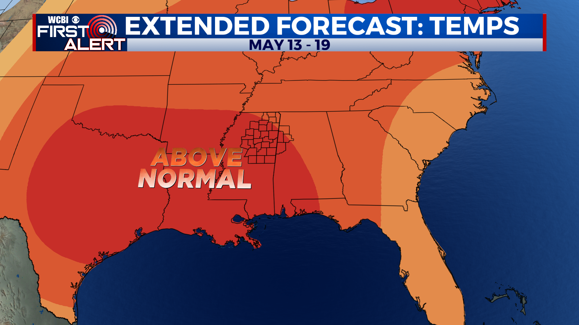
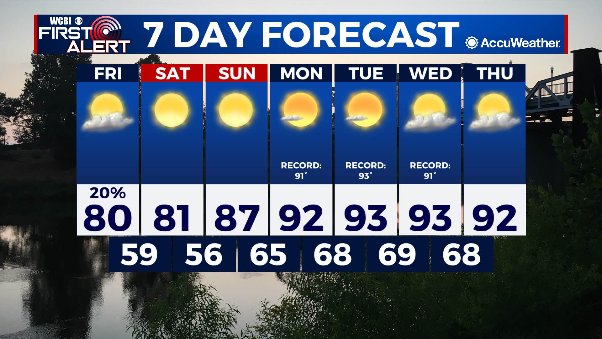
EXTENDED FORECAST: This weekend looks great with highs in the low-80s Saturday. We’ll quickly return to the upper-80s Sunday. A quiet, but hot weather pattern will settle in as we begin next week. Record high temperatures are possible Monday through Thursday with highs in the low-90s.