Rain returns Saturday before cooler temperatures on Sunday
COLUMBUS, Mississippi (WCBI) – SUMMARY: We reached the low-70s across much of the region, but changes are ahead as a cold front moves through the region.
TONIGHT: Scattered showers after midnight. Overnight lows in the mid-60s. South wind 3-5 mph. Patchy fog is possible tonight. Chance of rain: 40%.
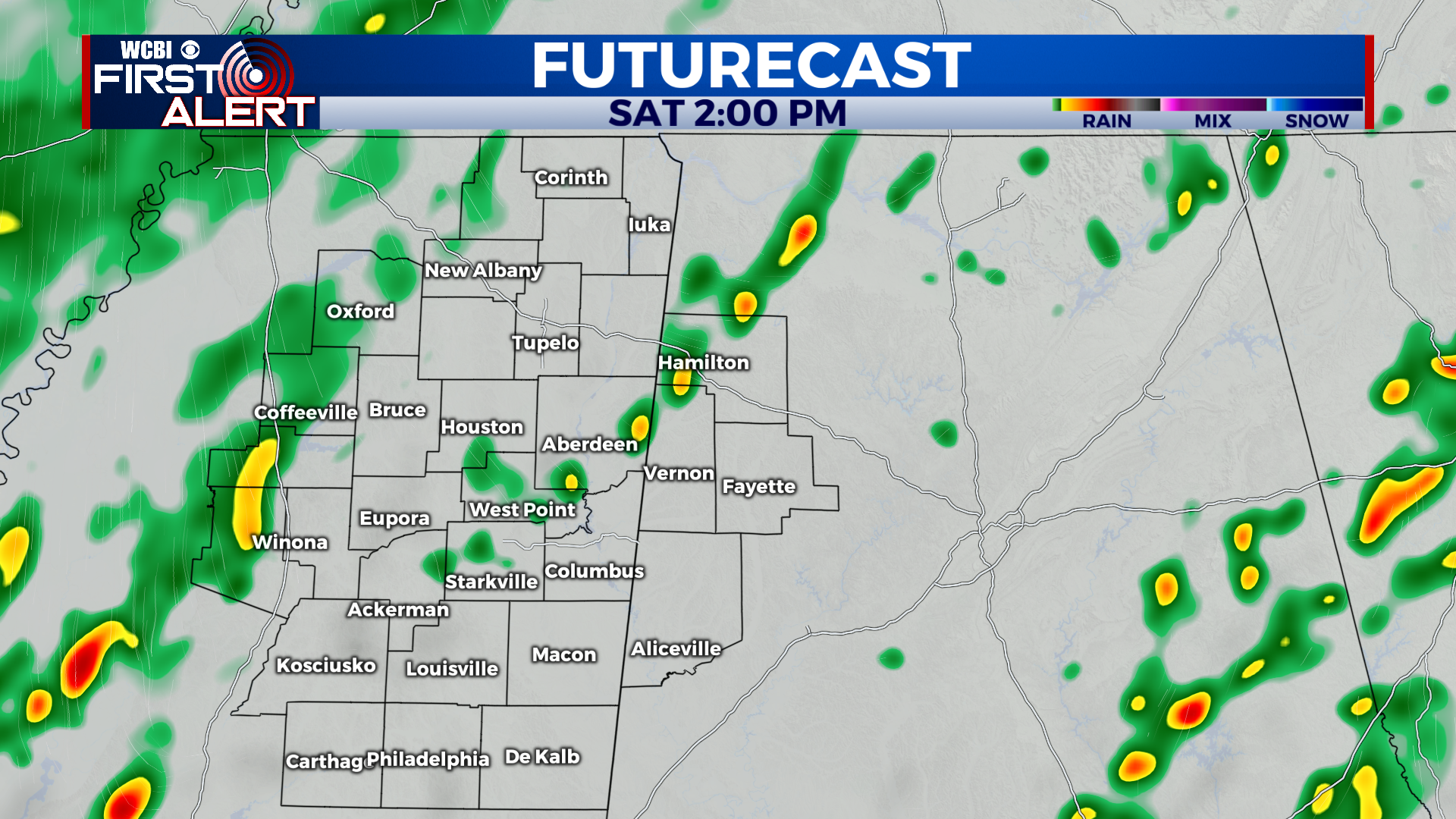
SATURDAY: Isolated showers before 12pm, then scattered showers and thunderstorms during the afternoon. Highs in the low-70s. South wind 5-10 mph, becoming northwest during the afternoon. A few storms may contain frequent lightning, gusty winds, and heavy downpours. Chance of rain: 80%.
SATURDAY NIGHT: Scattered showers ending before midnight. Overnight lows in the low-40s. North wind 5-10 mph. Chance of rain: 60%.
THIS WEEKEND: Scattered showers and thunderstorms were draped across our northern tier of counties last night along a stationary boundary. That same boundary will move southeast across our region Saturday as a cold front, and will initiate showers and even a few thunderstorms across our region. For now, we are expecting the rain to be generally light and less than a quarter of an inch. Any locations which receive thunderstorms may have higher rainfall totals. The front will be well east of our region Sunday, and we will stay mostly cloudy or overcast for much of the day. Sunday’s high temperatures will be cooler and some locations may not even get out of the 40s.