Rain & storm chances for the rest of the workweek
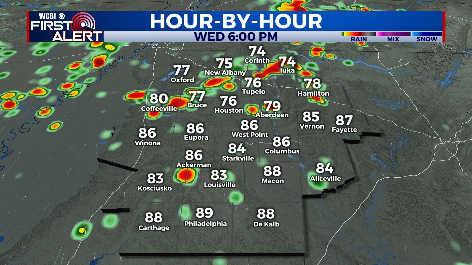
SUMMARY: Showers and a few thundershowers are pushing through the far NW sections of the WCBI Viewing Area. We will be seeing increased chances of showers & storms as we head into the second half of the workweek. The summer heat and humidity will be making a comeback this weekend into next week as we dry out.
WEDNESDAY: Keep the umbrella handy! Clouds will continue to increase with better chances of scattered showers and storms for our Wednesday. Some storms could be on the strong side with gusty winds and heavy downpours. Highs continue to warm up into the lower 90s.
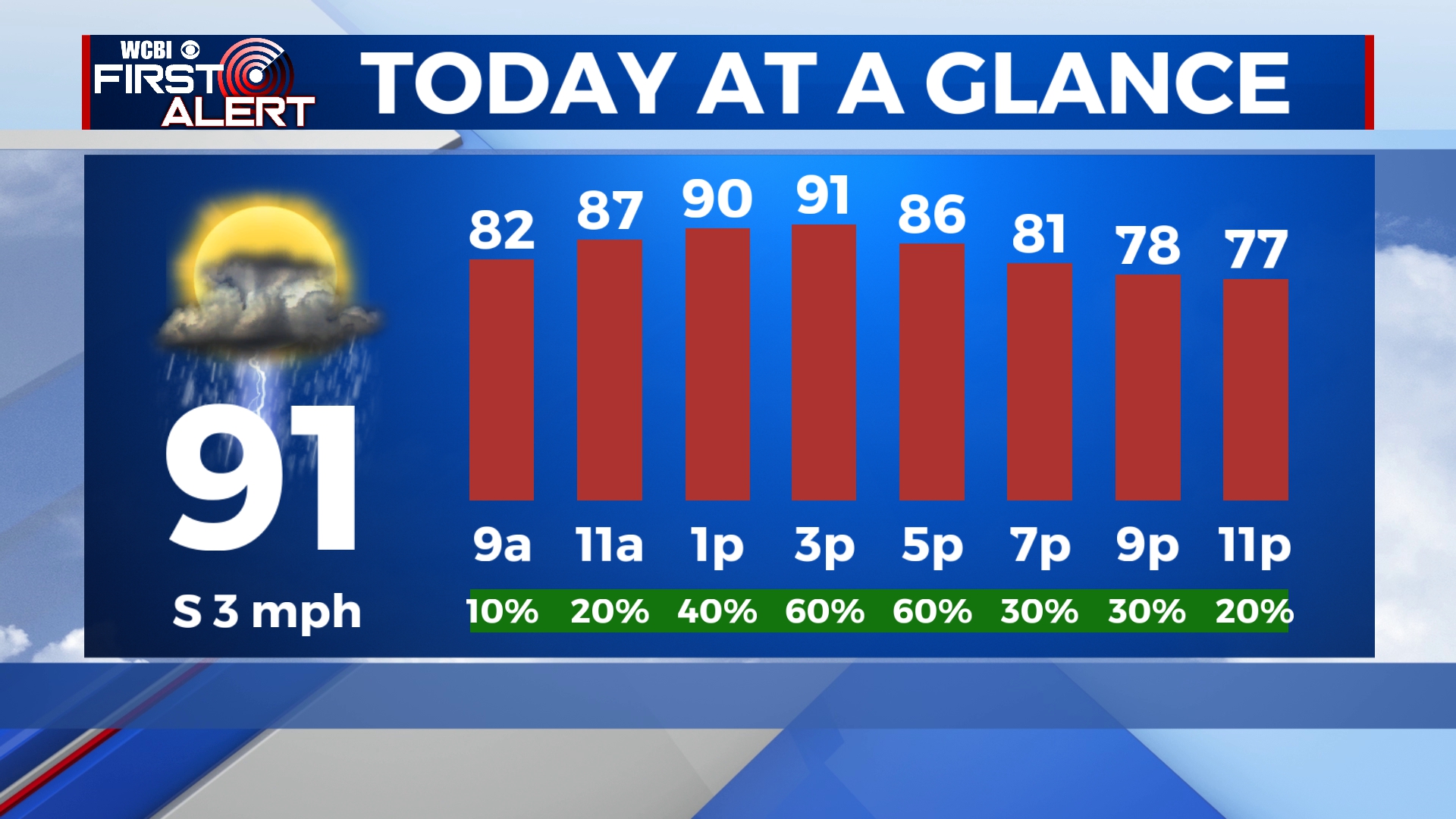
WEDNESDAY NIGHT: Most showers and storms should dissipate, but a few could persist into the overnight hours. Mostly cloudy skies. Overnight lows in the 70s.
THURSDAY: Even wetter for Thursday, with widespread showers and storms throughout the day. Cloud cover and rain holds our highs down into the mid 80s.
FRIDAY: More scattered to widespread showers and storms expected as we end the workweek. Cloudy skies. Highs in the mid to upper 80s.
WEEKEND-TUESDAY: Things should be drier by the weekend. The summer heat & humidity makes a comeback with highs in the lower 90s for Saturday and Sunday. chance of a stray shower or storm. Monday looks very similar, hotter in the low to mid 90s with a mix of sun and clouds skies. Stay tuned!
Stay connected with @WCBIWEATHER on Facebook, Twitter, Instagram and the WCBI News App