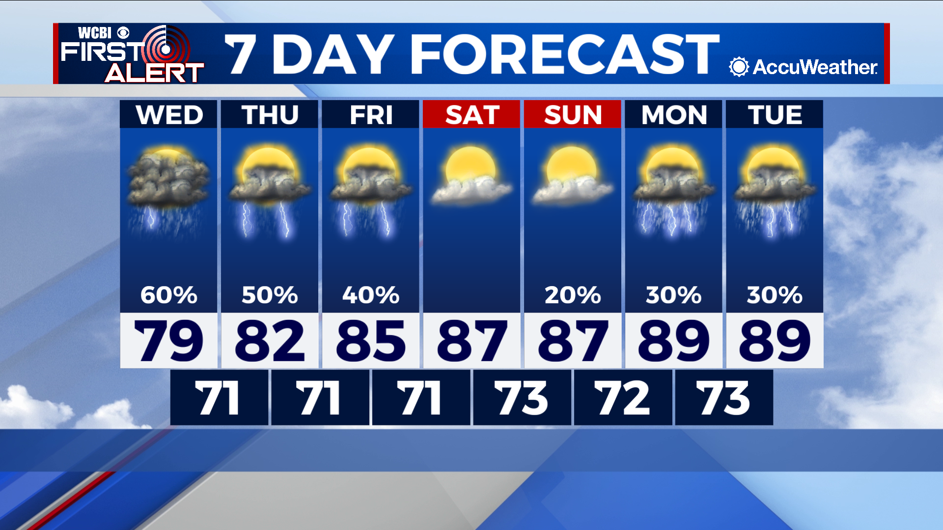
Return to normalcy as rain chances diminish
COLUMBUS – SUMMARY: Rain chances will start to diminish heading into Friday as our low pressure system makes it’s way out of the region. Relatively drier conditions heading into the weekend help bring up highs back into the upper 80s. Lows stabilize in the low 70s.
WEDNESDAY: We get the mild and gloomy treatment for a third day in a row Wednesday. Storms once again remain mostly in the southern portions of our viewing area, tapering off heading into the afternoon. Highs should not climb higher than the upper 70s in the south, while further north highs may reach slightly higher into the low 80s. Overnight lows bottom out in the low 70s.
THURSDAY: We start to see a decline in storm coverage starting Thursday. Scattered showers and thunderstorms become the name of the game Thursday with much less of a chance for super heavy rain totals in a particular area. Highs will reflect this change, warming into the low 80s by the afternoon hours. Lows remain stable in the low 70s.
REST OF THE WEEK: Some chance for scattered showers and storms exists Friday, but the overall trend is headed drier at this point. More sunshine and lack of rain will aid in getting afternoon temperatures back into the upper 80s by Saturday. A few opportunities for some more storm action lie ahead early next week but the magnitude of these events remains to be seen. Lows change little throughout the rest of the week and the low 70s can be expected through next Tuesday.