Saturday looks great, then rain arrives Sunday night
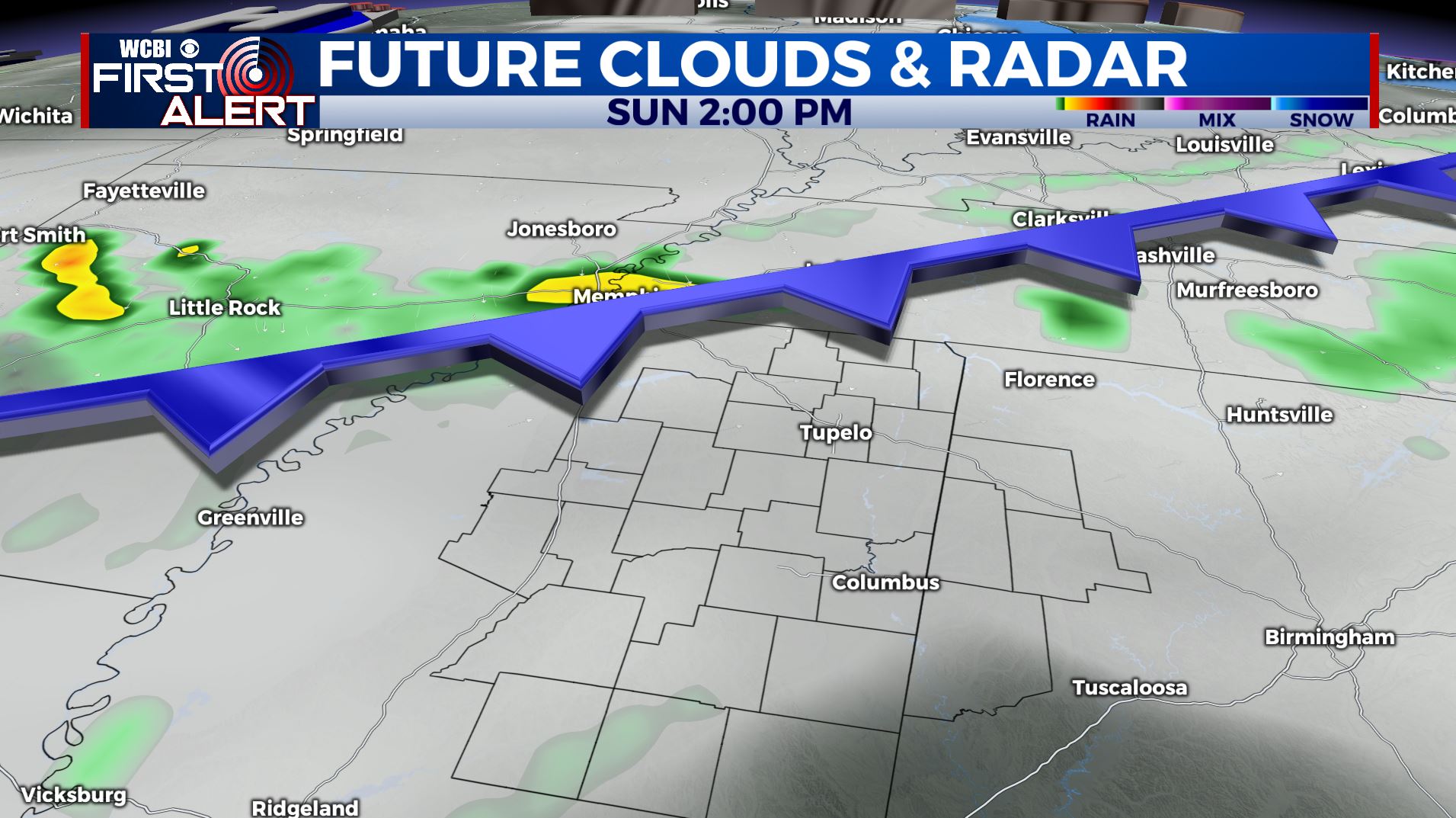
It will be a great weekend to be outside across the region, especially tomorrow and most of Sunday. Expect a partly cloudy day tomorrow with highs in the upper-80s to low-90s. A cold front pushes into the region Sunday evening with scattered showers and thunderstorms expected overnight. There is some inconsistency with the arrival time of the rain, so stay tuned for additional updates. Let’s get to the details…
TONIGHT: Mostly clear and pleasant with lows in the mid-60s.
SATURDAY: Partly cloudy and a few degrees warmer with highs in the upper-80s.
SATURDAY NIGHT: Partly cloudy and seasonable with lows in the upper-60s.
SUNDAY: Partly cloudy through the day with highs in the upper-80s. A few storms will arrive late in the day and become more numerous overnight.
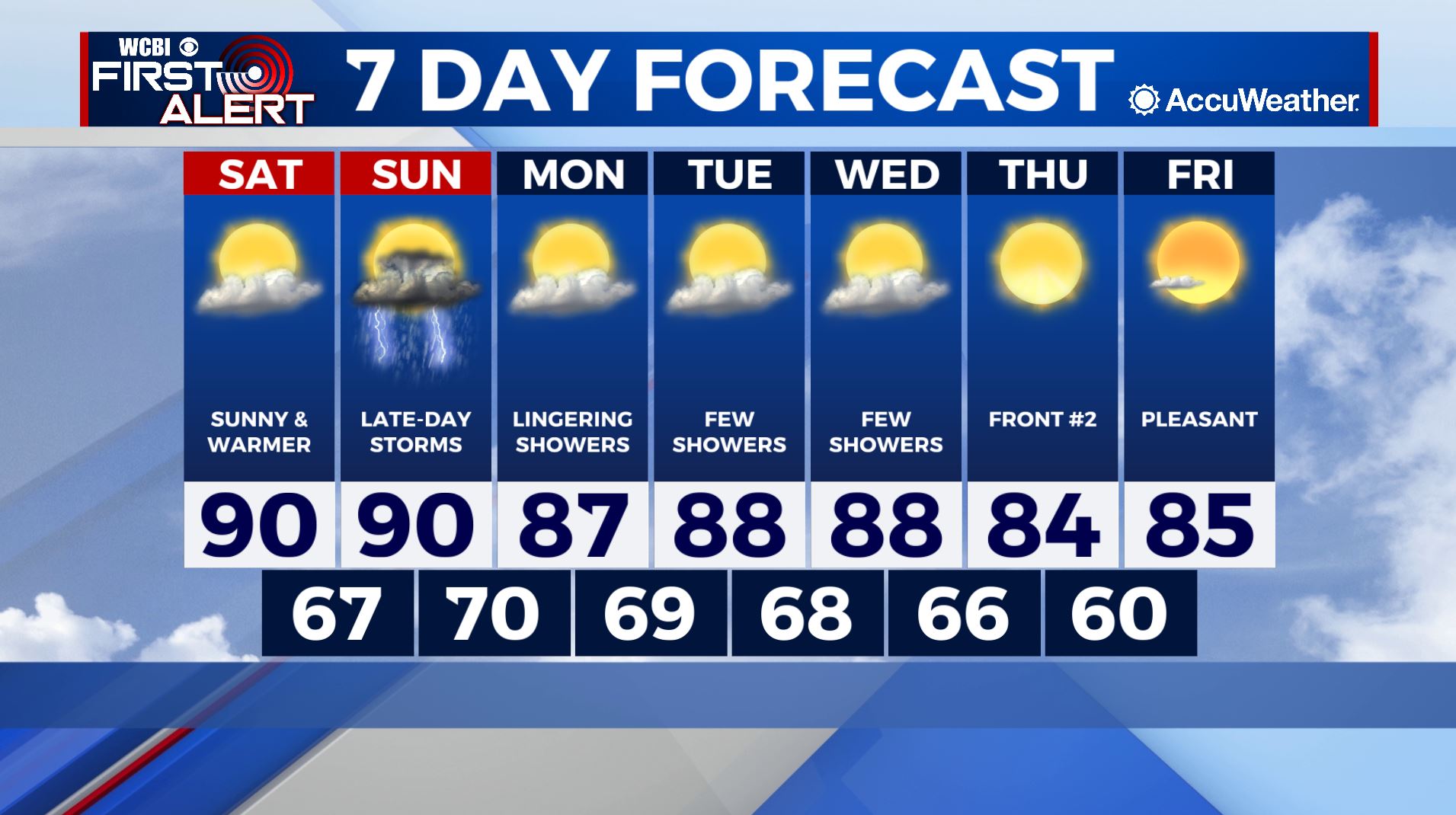
NEXT WEEK: Next week is looking relatively uneventful across the region. Isolated, summertime thunderstorms will be possible Monday through Wednesday with highs in the upper 80s to low 90s. Another front moves through the area Thursday with dry air and a touch cooler temperatures as we head into next weekend. Enjoy the evening!