Scattered afternoon storms today, then less humid end of week
SUMMARY: One last disturbance will bring isolated to scattered showers and storms today before some much improved, drier weather moves in to end the work week. A string of really nice days is in store!
WEDNESDAY: Morning sunshine will destabilize the air into the afternoon with highs reaching well into the upper 80s. Isolated to scattered storms are likely to fire up before 3 PM and move southeast across north MS and west AL. While the coverage should not be widespread, a few of these storms could become locally strong with gusty winds the primary concern.
WEDNESDAY NIGHT: Any storms will push out by sunset, leaving scattered clouds overnight with lows in the upper 60s.
THURSDAY/FRIDAY: These will be two “winners” of weather days – plenty of sunshine and highs in the 80s but with much lower humidity. In fact, Friday morning’s low temperatures are likely to be down in the low 60s!
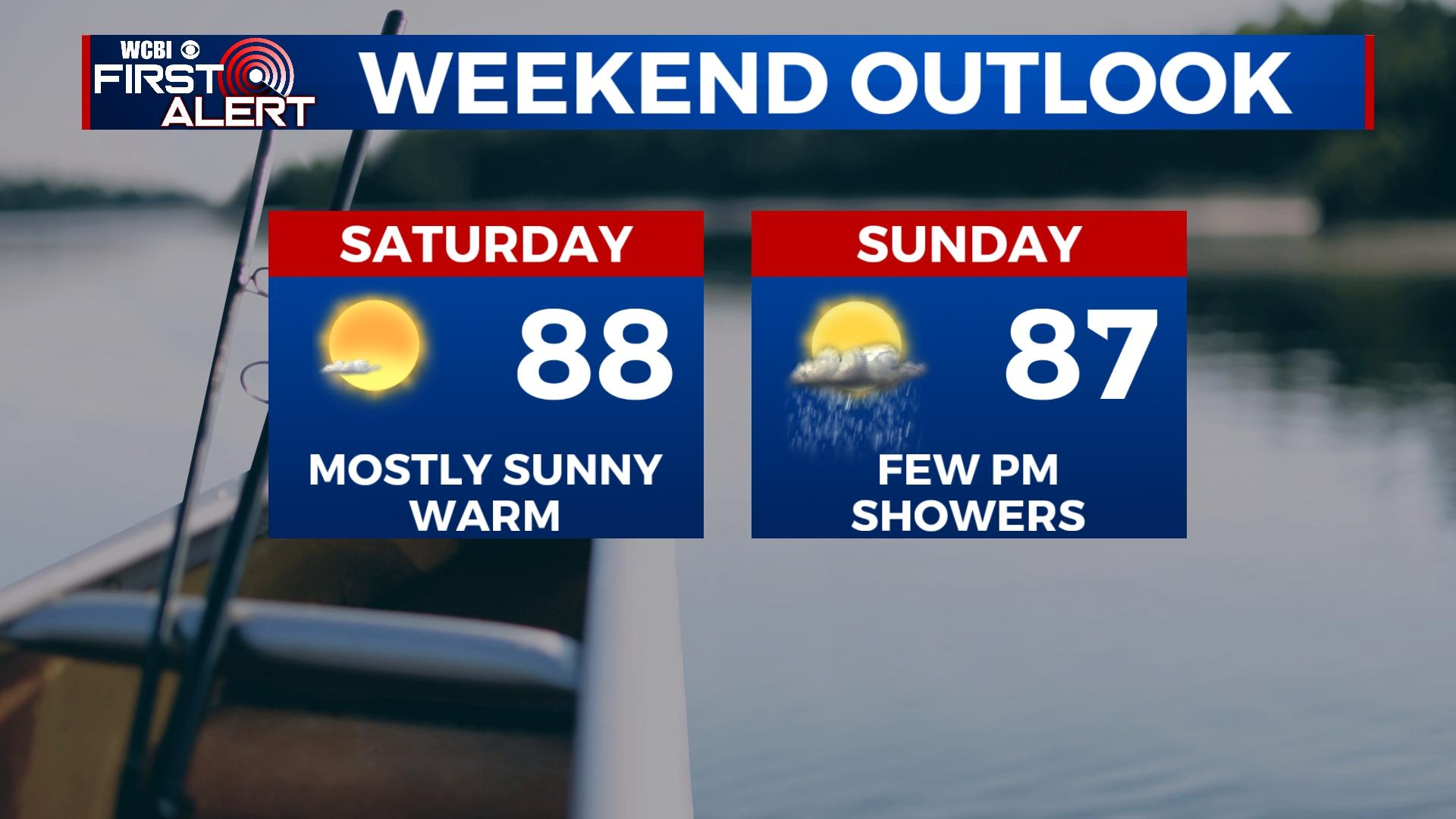
WEEKEND: Saturday keeps the really nice weather going with more sunshine, but a quick-moving front on Sunday could squeeze out a few afternoon showers.
NEXT WEEK: Sunshine is back in the forecast, but a return to more of a summery feel is expected as highs are expected to be near 90 degrees and overnight lows near 70 degrees.