Scattered showers and a couple of rumbles
COLUMBUS, Mississippi (WCBI) – Rain showers and a few storms are possible tonight, but a really great weekend is on the horizon. Temperatures are maintaining above average!
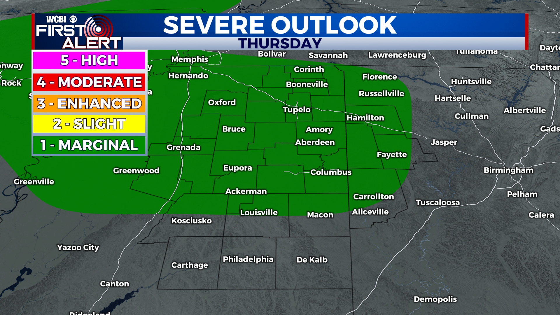
THURSDAY NIGHT: A few sprinkles have already been seen across NE MS, but the rain chance will be increasing through the rest of the night. Scattered showers and storms are likely to move/develop into northern MS after sunset, along with a cold front. The Storm Prediction Center has placed most of our viewing area under a Level 1- Marginal Risk for severe weather tonight. The main risk may come as damaging winds and possibly some small hail. Winds will shift out of the northwest after midnight behind the cold front. Low temperatures tonight in the lower 50s.
FRIDAY: Get that rain out of here! The winds from the NW will help push out the rain chance and heavy cloud coverage by the evening. High temperatures will be warm, in the upper 60s. The rest of the day will be mainly clear, with a nice breeze. Perfect conditions for some baseball watching! Overnight low temperatures will be in the lower 40s.
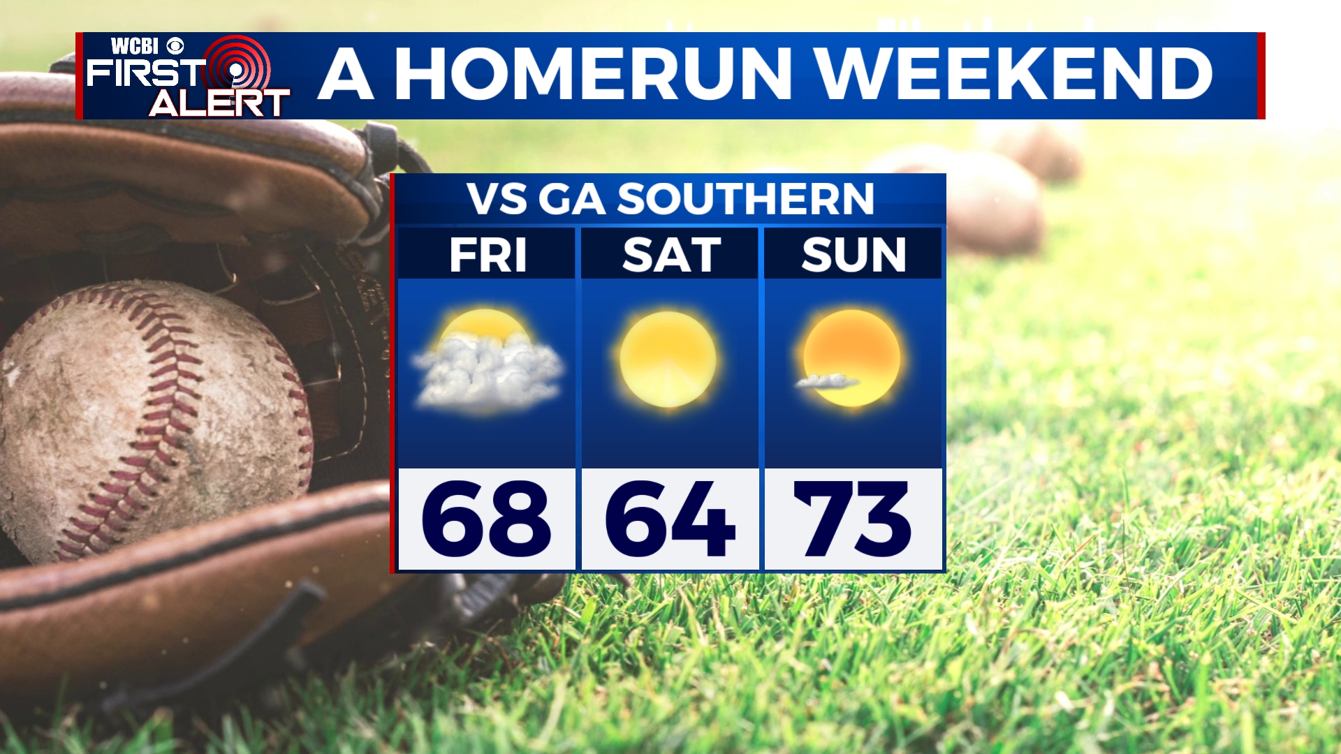
WEEKEND: Continuing some really great conditions into a homerun weekend! High temperatures climb their way back towards the lower 70s. The sky will be staying mostly clear and sunny, thanks to a high pressure system moving into our area. Sunday morning will be chilly, in the middle 30s. Monday morning back to being a bit more mild, in the lower 50s.
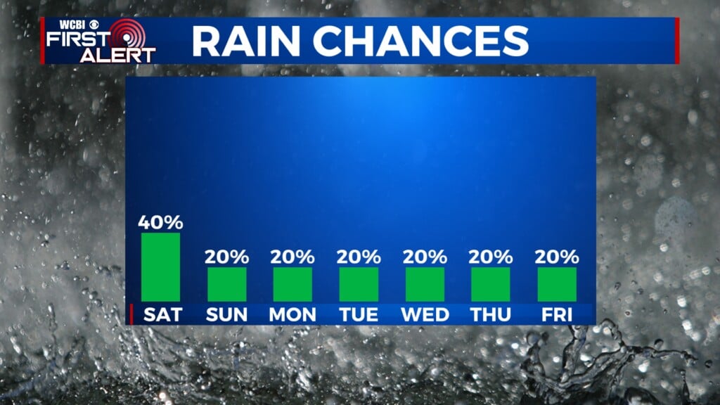
NEXT WEEK: We’ll start off with quiet weather, but there are signs of a strong cold front moving through the Deep South Wednesday. Showers and storms look likely. The SPC has already placed the northern 2/3 of Mississippi under a risk for some sort of severe weather risk. We still need a few more days of studying/assessing weather models before pinning down any specifics. So tune back in for more details!