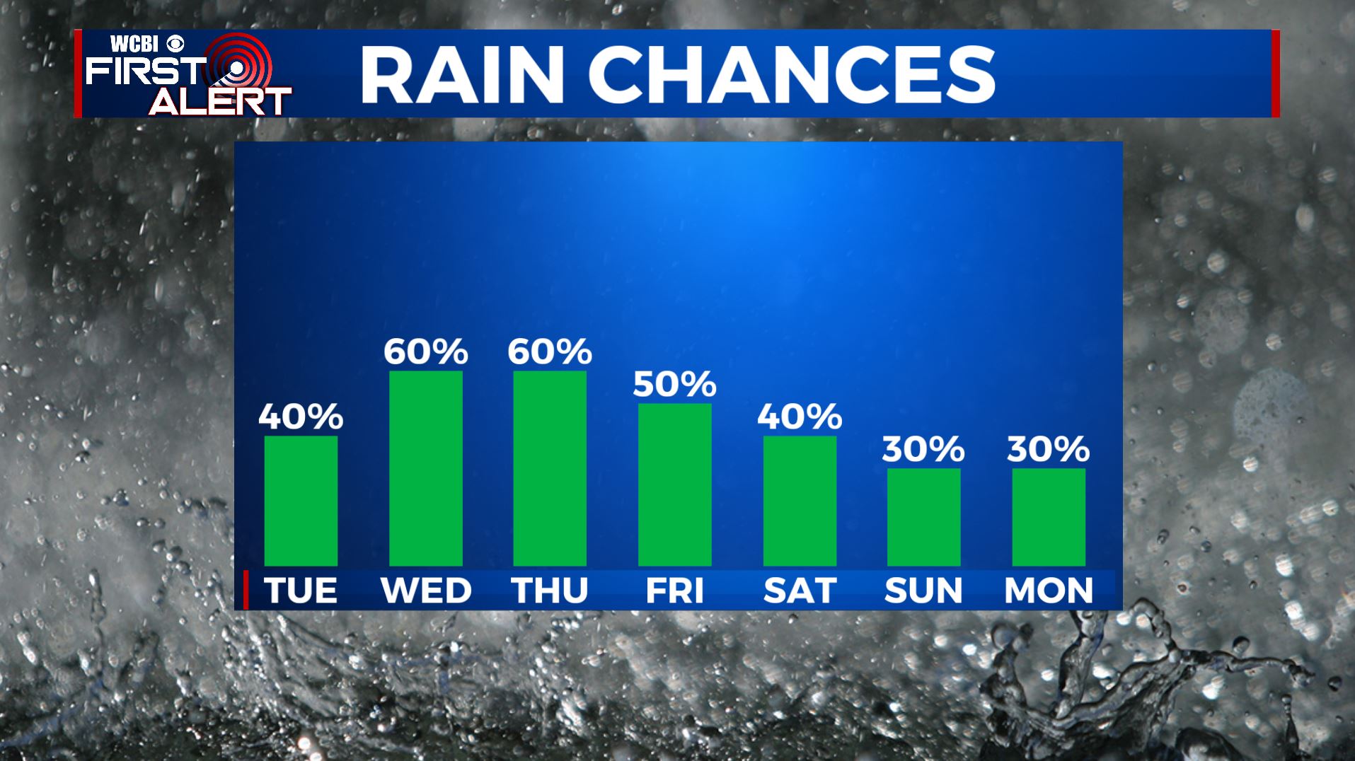
Scattered showers possible Tuesday, with locally heavy rain possible Wednesday
Clouds rolled into the area today with a few isolated showers. We officially recorded 0.01” of rain at Columbus Air Force Base, but a few other locations in Lowndes and Clay counties had higher totals over 0.25″. A few isolated showers will be possible overnight, but most of us will remain rainfree, but muggy until scattered showers arrive tomorrow afternoon.
TONIGHT: Mostly cloudy and humid with lows in the low-70s. A few isolated showers will be possible after midnight. Chance of rain: 20%.
TUESDAY: Mostly cloudy with scattered afternoon showers arriving late in the day. Afternoon high temperatures in the low-80s. Chance of rain: 40%.
TUESDAY NIGHT: Mostly cloudy with scattered showers. Overnight lows in the upper-60s. Chance of rain: 60%.
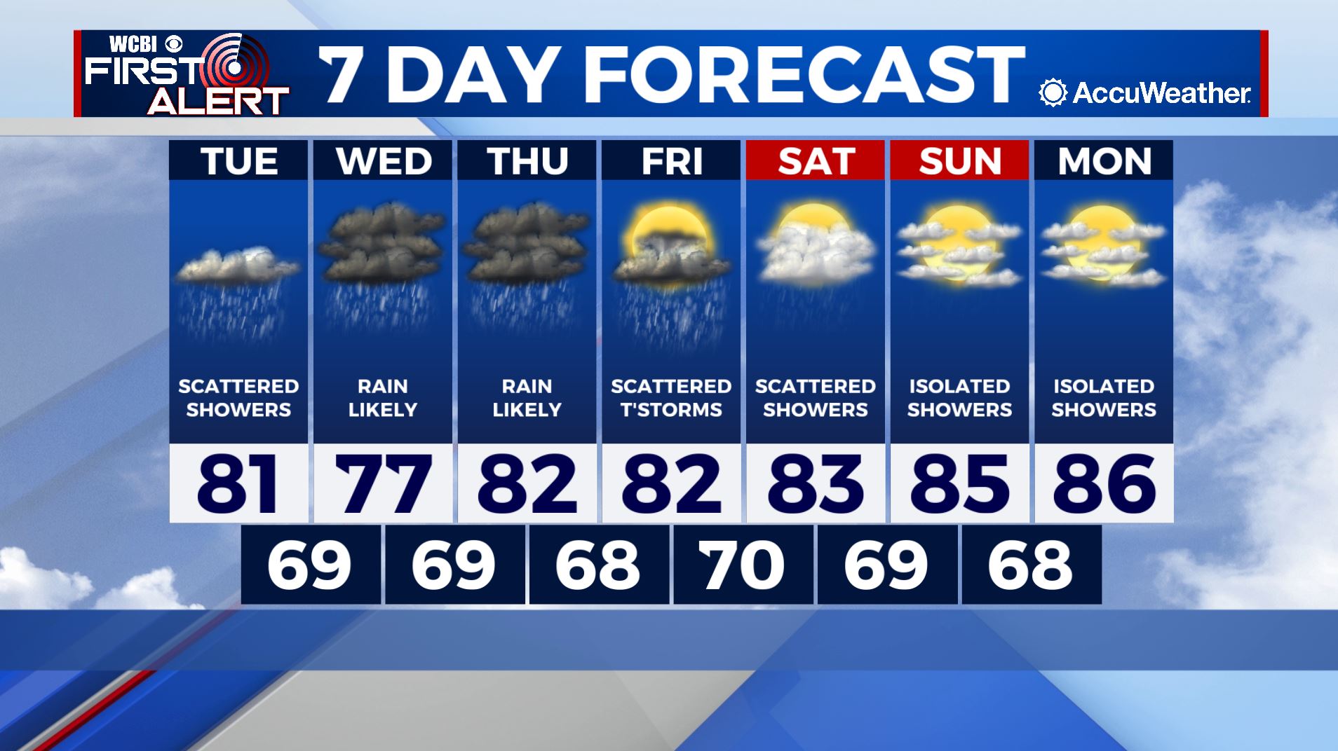
REST OF THE WEEK: Nicholas will continue to slowly move across the deep south this week. The primary impact from this system will be heavy rainfall across the region. 2-4” of rain will be possible, especially across central Mississippi. Tropical moisture will remain in the region through the end of the forecast period, leading to afternoon showers and thunderstorms.