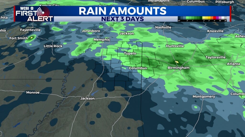
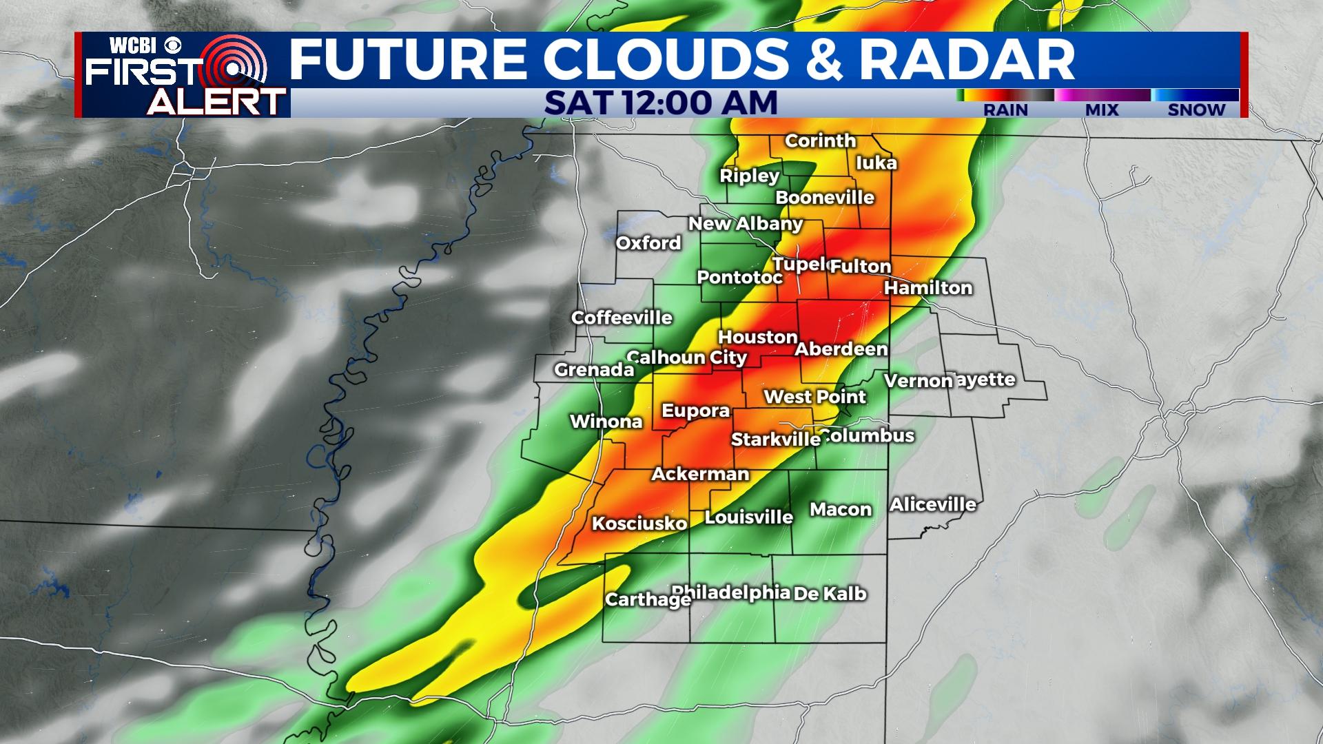
Severe threat into the weekend
COLUMBUS, Mississippi (WCBI)- Temperatures are hitting their peak for the week, in the middle 80s. A severe weather threat is moving in overnight Friday and into Saturday morning. Another rain chance completes the weekend, as temperatures become more tolerable.
THURSDAY NIGHT: We made it into hot temperatures this afternoon, in the low to middle 80s. Temperatures tonight will be mild, in the lower 60s. Cloud coverage will be filling back in across the state overnight and into tomorrow morning. Tonight is the night to make sure everything is in place for tomorrow’s severe weather event. You do not want to wait until the line of storms has arrived.
FRIDAY: Most of the morning and afternoon will be relatively calm, with heavy cloud coverage, as the system builds off West. High temperatures are expected to reach into the low to middle 80s again for Friday. Become more weather aware by Friday afternoon. Severe storms are expected to develop west of the MS River by 3-5p and accelerate toward western & central MS between 5-7p. The rest of the night will be tracking the severe weather across northern Mississippi, ending around 2 AM. The storms within this line are going to become supercell storms, which means tornado potential will be elevated. Hail and damaging winds are also likely.
WEEKEND: The front, along with rain and cloud coverage, will clear out throughout the rest of the morning Saturday. Temperatures will hit the lower 80s once again. With a mostly clear evening, Saturday night’s temperatures will drop towards the upper 40s. Cloud coverage will fill back in for Sunday, bringing another chance for rain showers and possibly a few storms. Temperatures will still be fairly warm, in the upper 70s. Cloud coverage will maintain, keeping the overnight temperatures in the low to middle 50s.