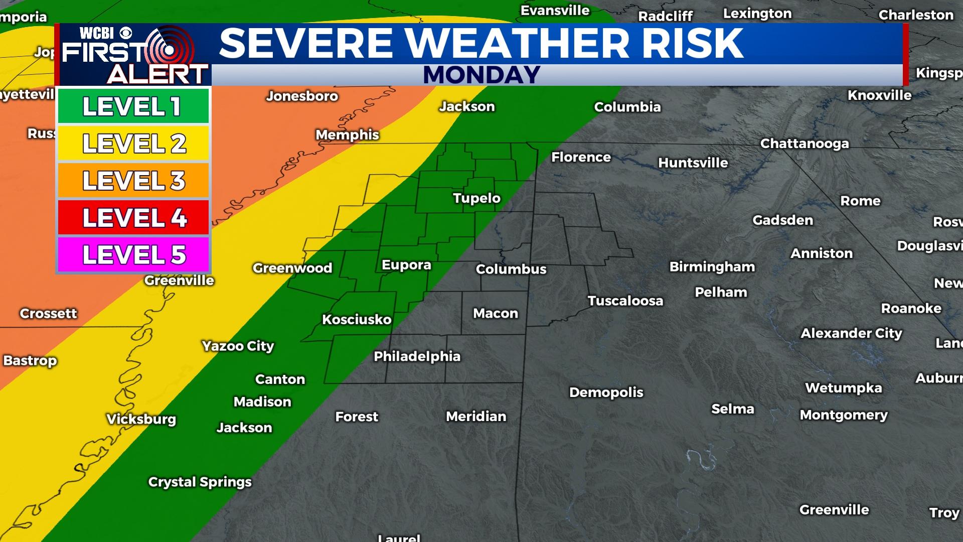
Severe Weather Risk
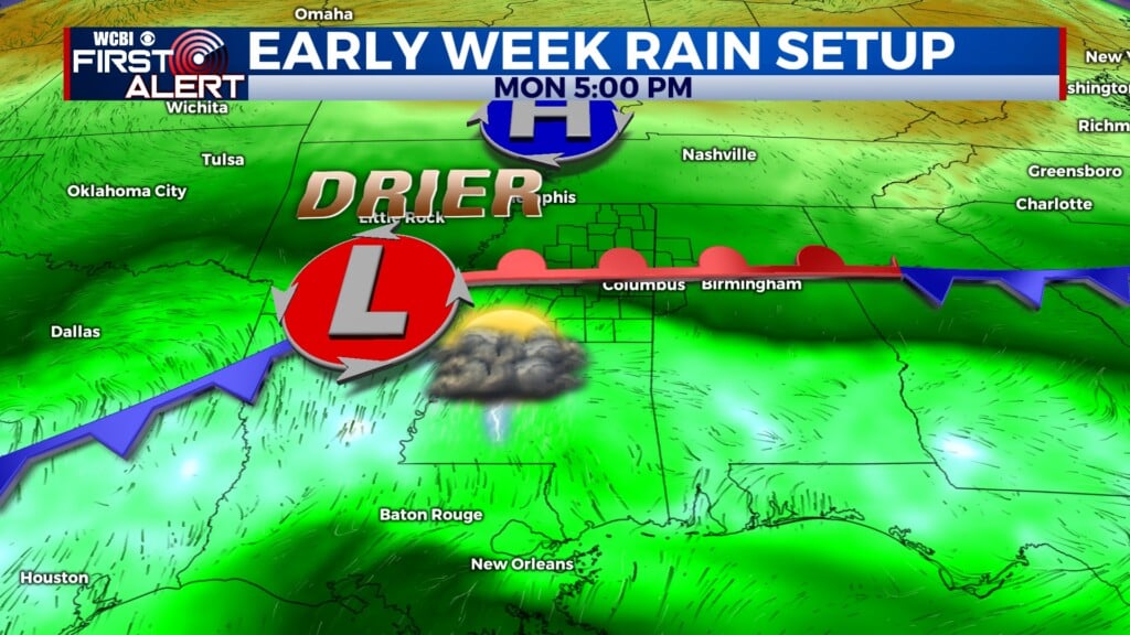
An upper level low-pressure system will permit strong storms Monday into Tuesday
COLUMBUS, Mississippi (WCBI) – Strong storms will arrive this afternoon carrying the potential of becoming severe. Tuesday also brings the risk of severe weather with the rest of the week seeming to shape up nicely.
TODAY: Heavy cloud cover stays in place while high temperatures peak in the low to mid 70s. Scattered showers and a few t-storms will develop after noon and become more widespread through this evening. Some of these storms have the potential to be severe. Be certain to stay informed through WCBI News and through the WCBI News app. https://www.wcbi.com/mobile-app/
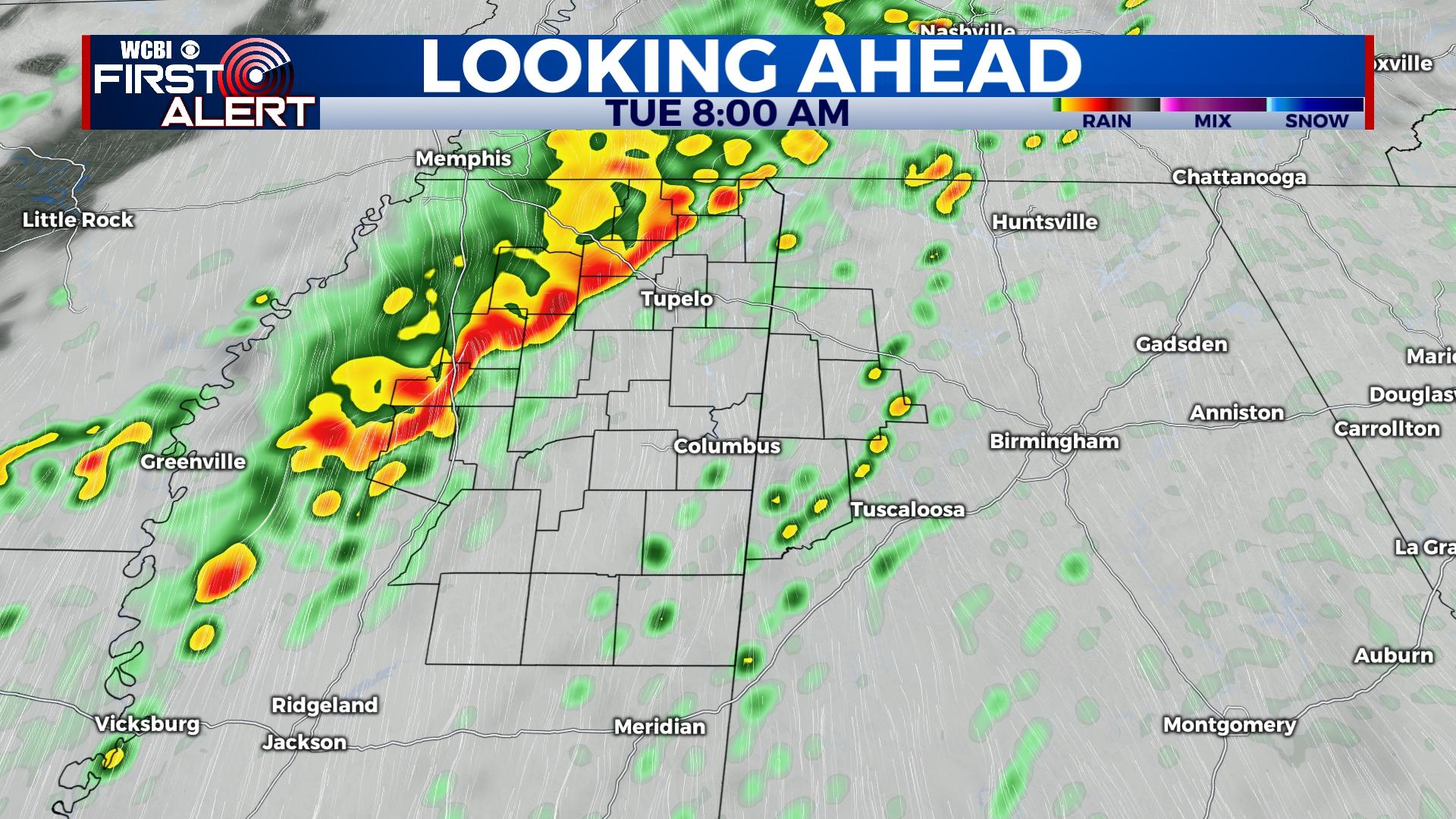
TUESDAY: Although the early morning hours will be quiet, another risk of severe weather arrives after sunrise. A line of convective storms is expected to develop along a cold front and sweep through the region. The WCBI Weather Team will be in studio giving you the latest!
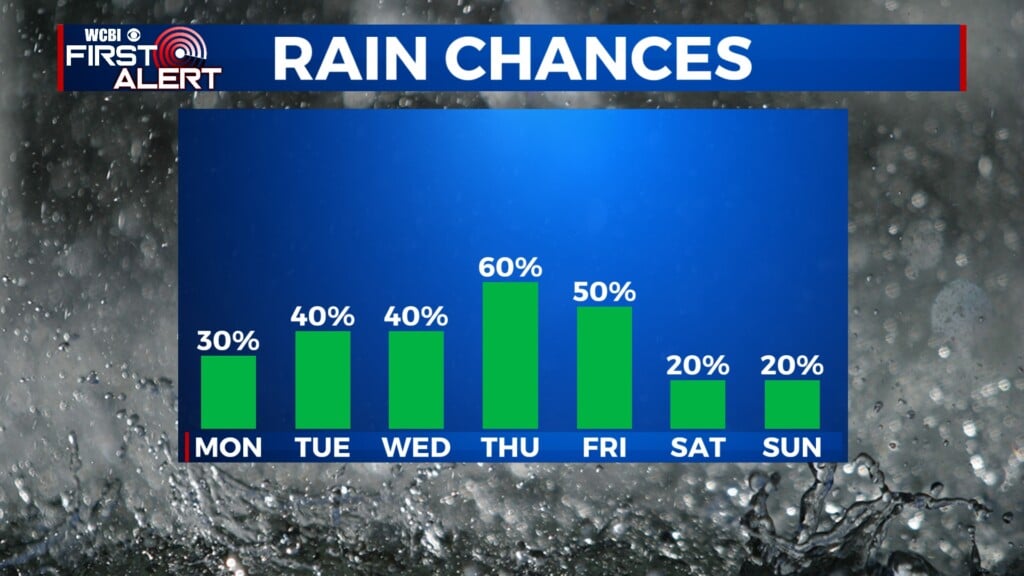
REST OF THE WEEK: Temperatures drop following this dynamic system with highs in the 50s by Thursday. Low temperatures drop near freezing again permitting frost in some areas. Skies will remain mostly clear with the next chance of rain being Sunday.