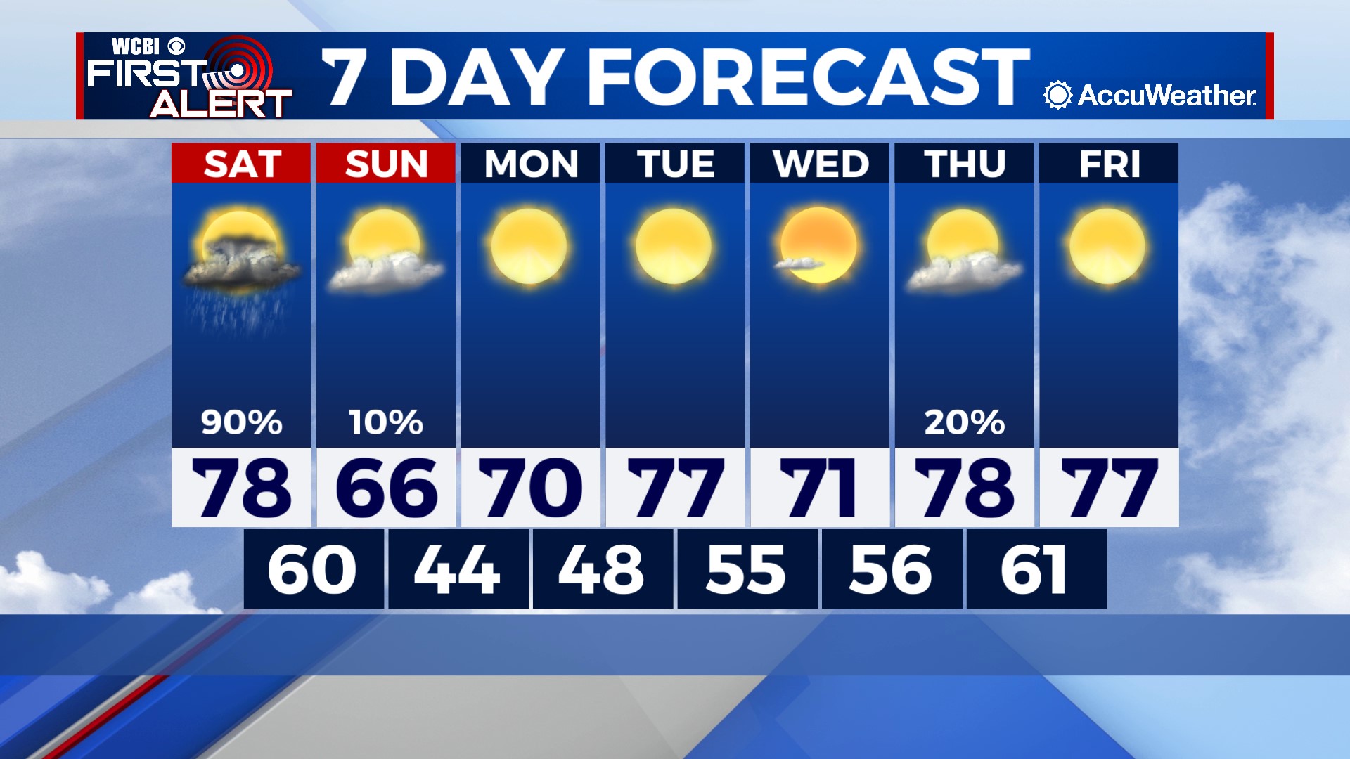
Saturday rain and storms clears way for nicer weather next week
COLUMBUS, Mississippi (WCBI)- A cold front will be bringing in showers and storms for the beginning of the weekend. A limited severe weather potential exists Saturday as well. Temperatures are going to drop on Sunday, but will gradually warm up next week.
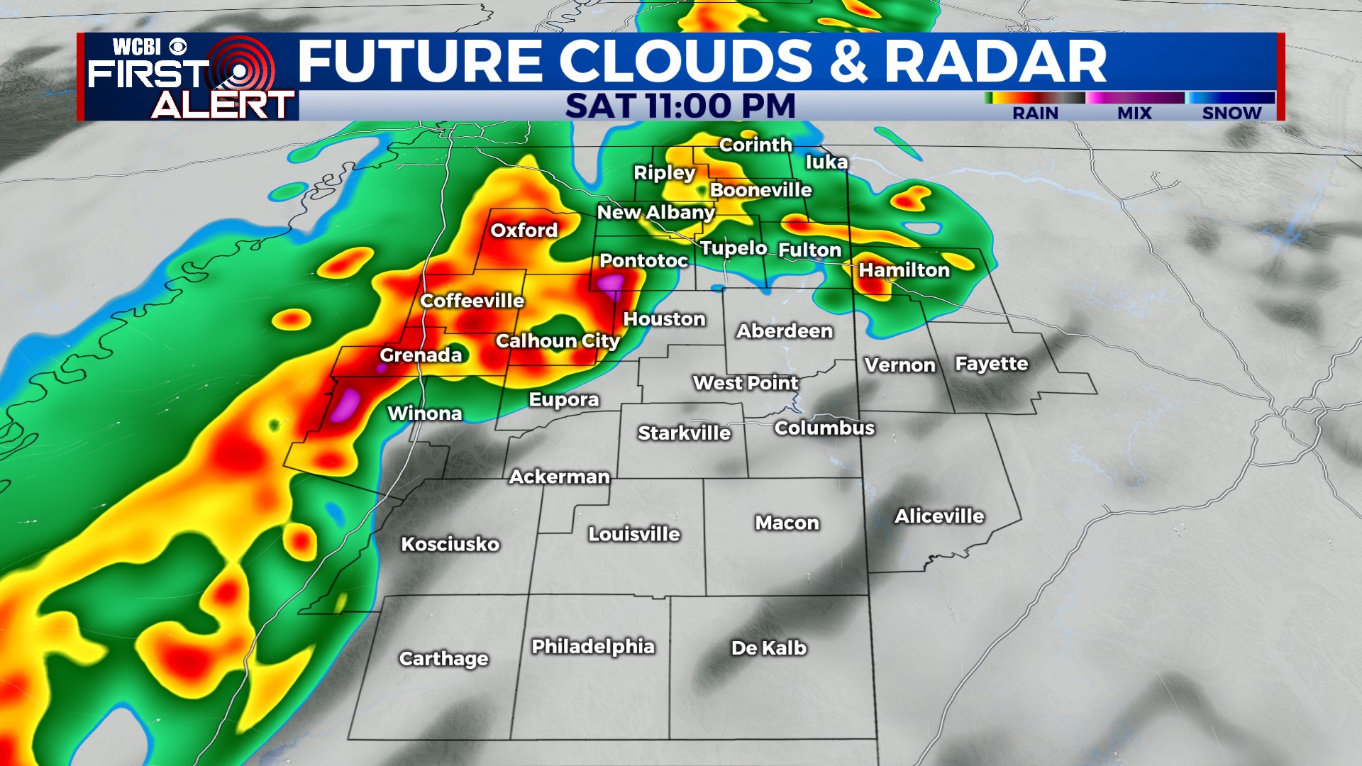
SATURDAY: Temperatures are going to be heating up into the upper 70s to the lower 80s. Partly cloudy skies will accompany a few showers and storms will be moving through northern Mississippi through the morning and afternoon. That area of rain will be ahead of the main line of showers and storms moving in with a cold front overnight Saturday into Sunday morning. There is a limited severe weather risk. Any area of severe storms will stay mostly to the western border, along the river. Any threats encountered will primarily be wind and maybe some isolated large hail. Mild and muggy overnight temperatures, in the upper 50s.
SUNDAY: Colder air will be moving in behind the cold front. High temperatures are going to be cooler, only reaching the upper 60s. Cloud coverage will be clearing out throughout the day too. Overnight temperatures will be in the middle 40s.
NEXT WEEK: Temperatures are going to be warming up throughout the week, heading back to the upper 70s by later next week. Cloud coverage stays clear throughout much of the week. Low temperatures will be in the 50s and 60s as we get later into next week.