Showers and storms Friday, slow clearing for weekend
COLUMBUS, Mississippi (WCBI) – An active weather day sets up Friday, but the weekend will bring quieter weather to the Mid/Deep South regions.
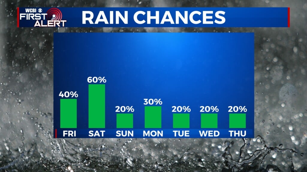
FRIDAY: Heavy rain and storms settle into north and central Mississippi through the day, bringing limited potential for hail in the strongest storms. The good news is the most unstable air will set up well south of the WCBI coverage area, greatly limiting the magnitude of our overall severe weather threat. Up to 2-3″ of rain could fall, with higher totals likely setting up south of US-82.
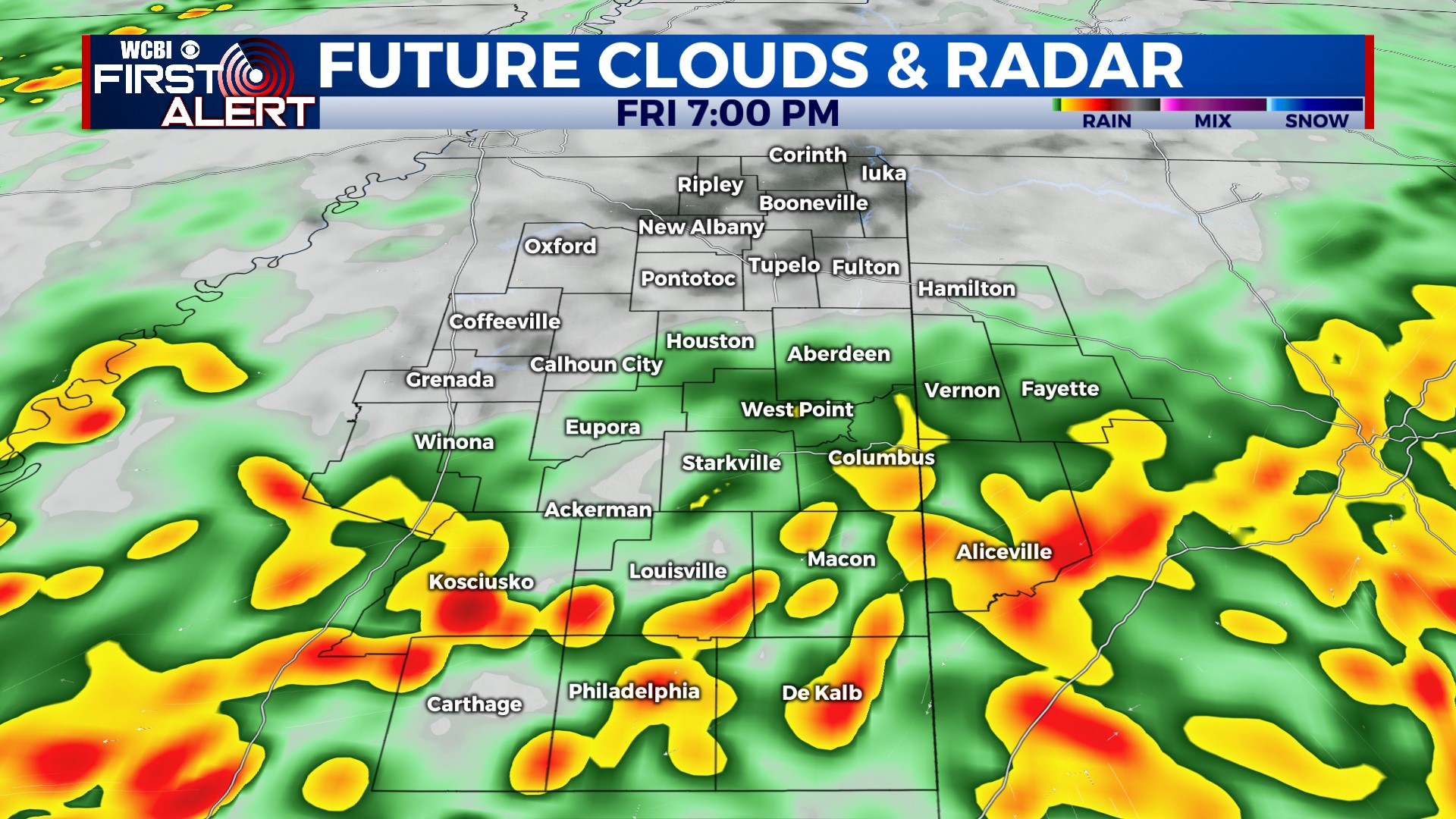
FRIDAY NIGHT: Scattered showers and a few rumbles will continue, but the coverage should be comparatively less than earlier in the day. Temperatures will stay steady in the upper 50s to low 60s.
WEEKEND: Isolated showers stick around early into Saturday but should end by midday. Clouds will linger into the afternoon, and temperatures may actually fall into the upper 50s after lunch. Clearing should eventually occur late, with low temperatures dropping into the upper 30s by Sunday morning. Sunday looks fantastic w/plenty of sun and highs in the low 60s.
NEXT WEEK: Beautiful! Cool mornings and increasingly warm afternoons will be the story each day. Clouds increase by Thursday, and rain chances will likely pick up late Thursday into next Friday.