Snow chances Sunday mark off another week of winter-like weather
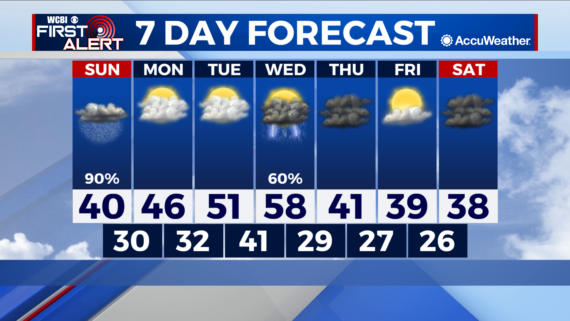
COLUMBUS – SUMMARY: Potential for snow on Sunday brings the chance for some wintry weather back into the area. The temperature pattern throughout next week will be seem to that of the previous week, with highs slowly warming back into the high 50s by Wednesday. A cold front Wednesday brings temperatures back down into the 30s and 40s with lows below freezing.
SUNDAY: We are continuing to monitor the situation on Sunday as it develops but as of now, it seems that the greatest threat for heavier snow totals will remain in our northern counties barring a few outliers. Totals upwards of 3-4 inches are a possibility for some of our northern counties while most of us further south can look to see no more than an inch. Rain will also form a bulk of the precipitation that falls on Sunday. Most of the snow event will occur during the midday and afternoon hours before tailing off into the evening.
NEXT WEEK: We look at a similar pattern to what we saw last week regarding temperatures. Slow warming will occur and bring highs back into the upper 50s by Wednesday before a cold front moves through the same day. Past Wednesday, lows drop back down below freezing and highs struggle to get into the mid 40s. Rain-wise the front on Wednesday does not appear to be a show-stopper but we will be able to get a better grasp of the rain picture closer in.