Snow marks off beginning of seasonable week
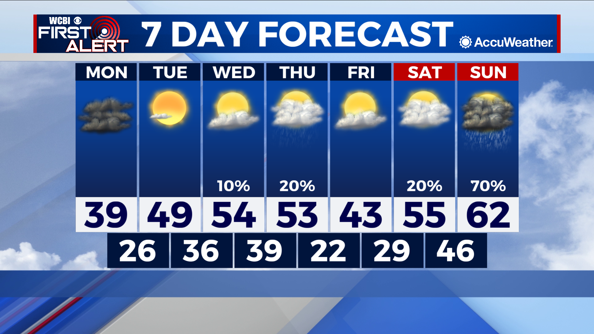
COLUMBUS – SUMMARY: Temperatures remain relatively cold as last Saturday’s cold front dropped highs down into the 30s and 40s. Temperatures will not change too much as yet another cold front is set to move through the area Thursday. Clouds will linger in the area throughout the week although rain chances remain limited until Saturday.
MONDAY: Cold overnight temperatures combined with snowfall Sunday night mean that there is potential for some icy patches on the roads Monday morning. Most of this ice should melt off by late morning however, as temperatures will rapidly climb above freezing. Overcast skies will dominates the scene but no rain chance is expected. Lows will once again bottom out in the mid to high 20s.
TUESDAY: We see a bit of an increase in our high into the 40s and lows into the mid to high 60s. Skies do clear up and again no rain chance is expected.
REST OF THE WEEK: Temperatures do not increase too much further, and indeed another cold front Thursday drops lows back into the 20s again. The skies do remain relatively dry until Saturday when we have a significant chance for rain.