Soggy change to narrative after weekend system
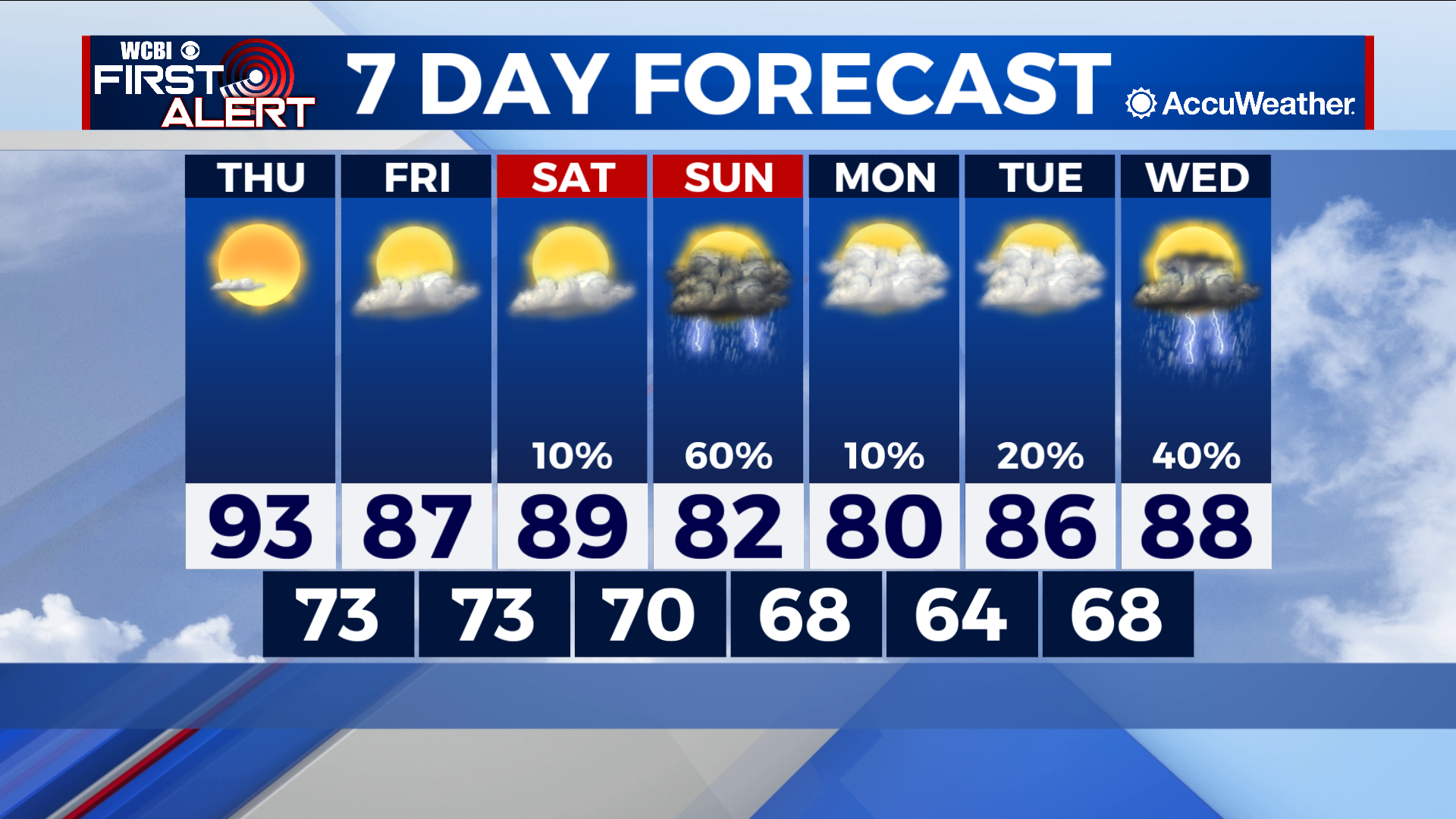
COLUMBUS – SUMMARY: Highs in the 90s will take a dip into the 80s after a cold front makes its way through the region Sunday. Showers and thunderstorms will bring decent rain totals to the region as well as increased cloud cover heading into next week.
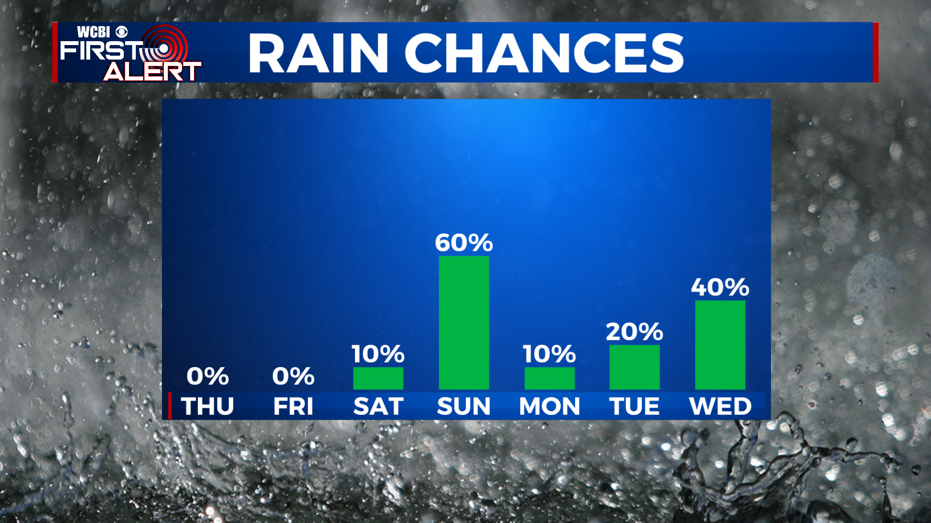
THURSDAY: As part of the continuing heating trend, highs Thursday reach a bit further into the low 90s Thursday. Plenty of sunshine will aid in this warming, and allow for overnight lows to reach the low 70s. No rain is expected Thursday.
FRIDAY: A slight dip in temperatures into the upper 80s is accompanied by an increase in cloud cover. Partly cloudy skies do not bring any rain chance, but allow for some cooling to occur across the region. Lows sit still in the lower 70s overnight.
REST OF THE WEEK: Sunday’s system still looks to provide the greatest benefit in terms of temperature relief. Highs after Sunday will dip into the low 80s and potentially upper 70s for some areas, before increasing back into the upper 80s by next Wednesday. In terms of rain, the primary rain threat is concentrated on Sunday, with the chance for scattered showers and thunderstorms in the days after. Lows will also take a dip into the mid to low-60s by overnight Monday.