Spring-like temps continue this week
COLUMBUS, Mississippi (WCBI) – Warm days and increasingly mild nights highlight the forecast the rest of the week. Unsettled weather begins Thursday and lasts into the weekend.
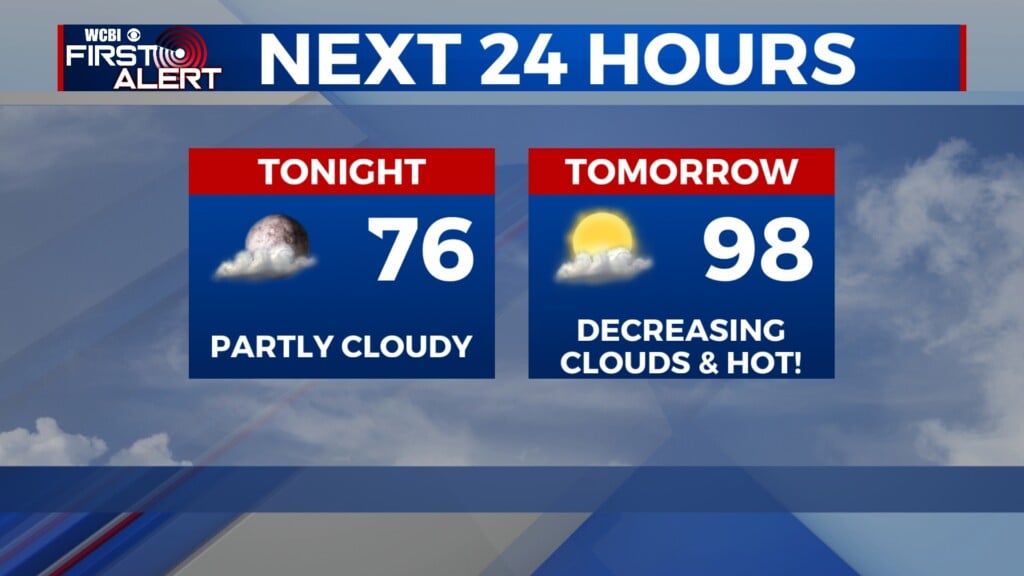
TUESDAY: Lots of sun and warmer! Expect afternoon highs in the low to middle 70s with a southwest breeze up to 15 mph.
TUESDAY NIGHT: Expect a few passing clouds with lows dropping into the 40s – not as chilly as previous nights.
WEDNESDAY: Even warmer! Highs will reach the upper 70s with a mix of sun & clouds.
THURSDAY: Clouds will continue building as moisture increases, but highs should still reach close to 80°. With an attendant increase in storm energy, a few storms could bubble up in the heating of the day…and these could be locally heavy.
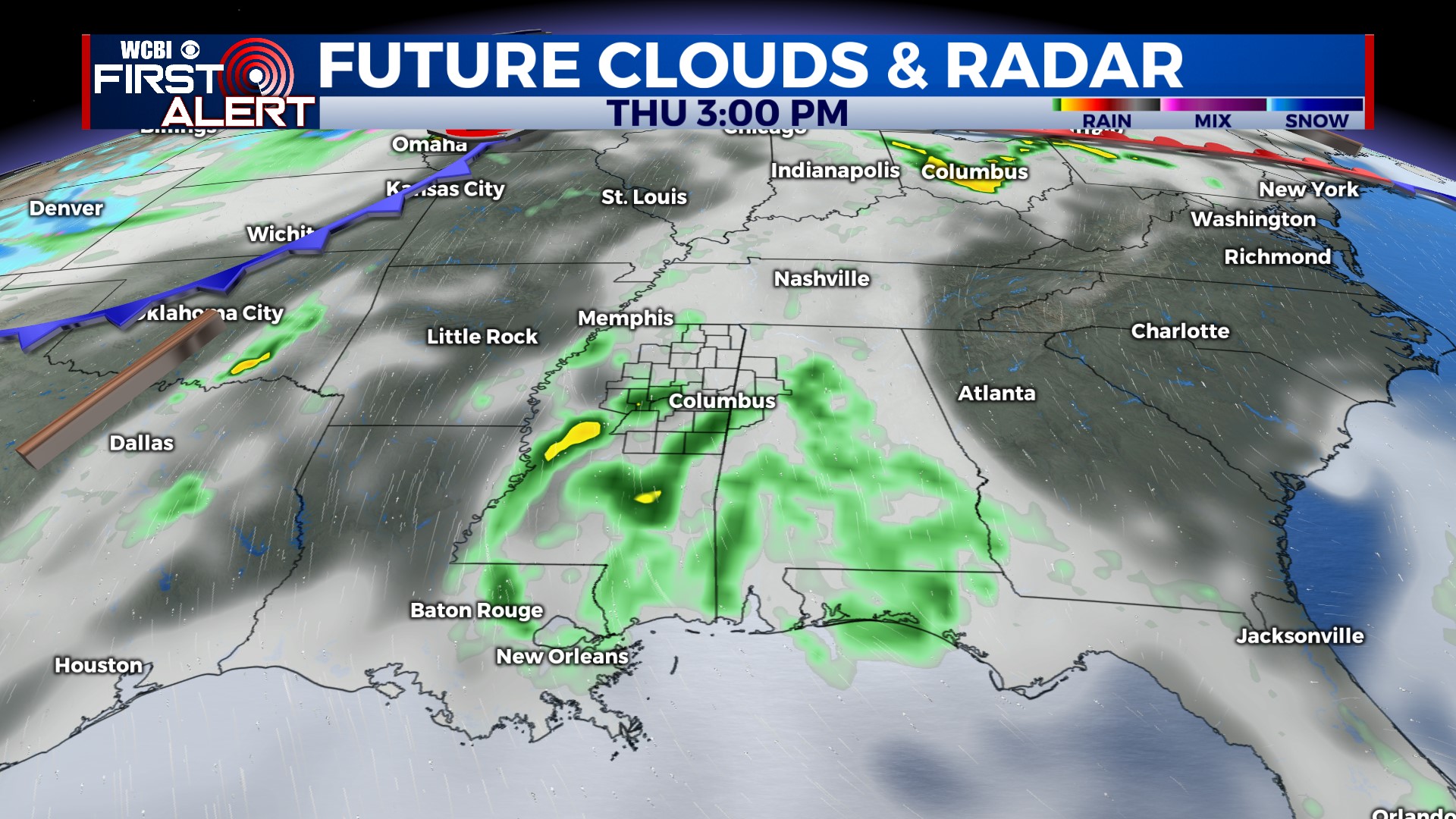
FRIDAY/WEEKEND: Showers and storms still appear likely Friday (possibly arriving after midnight Thursday) as a front slows to a stall across the region. This means repeated rounds of rain and storms are possible into the weekend, though timing remains quite uncertain. At this point, plan for rain Saturday & Sunday at times…and we’ll fine tune the forecast in coming days.