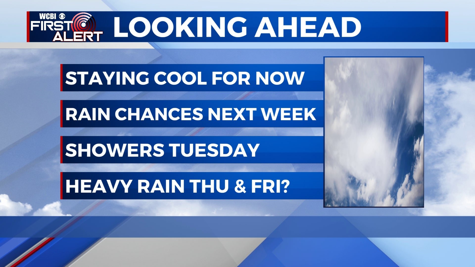
Staying cool for now, rain chances return
The remainder of our weekend will be cool with a mix of sunshine and clouds. Rain chances will return by Tuesday with heavier rain possible by Thursday and Friday.
SATURDAY NIGHT: We’ll be cold once again tonight with clouds slowly increasing after midnight. Lows will be around 30 with a light southwesterly wind.
SUNDAY: We’ll wake up to some clouds but most of the day will be mostly sunny to partly cloudy. We’ll still be cool with highs in the mid 50s and a breezy westerly wind.
MONDAY: Sunshine will continue for Monday as temperatures remain cool. Morning lows will be in the upper 20s with highs in the mid 50s.
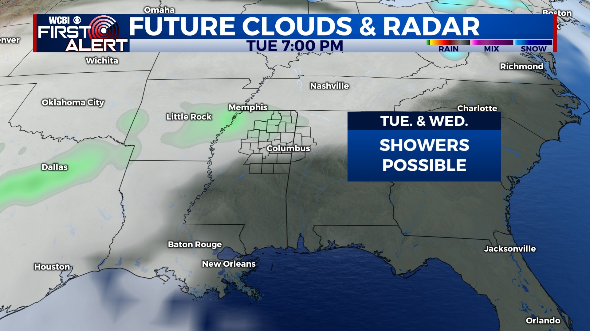
TUESDAY-WEDNESDAY: Clouds will return for the middle of the week with a few showers possible Tuesday night into early Wednesday. Highs will remain in the mid 50s with lows in the 30s and 40s.
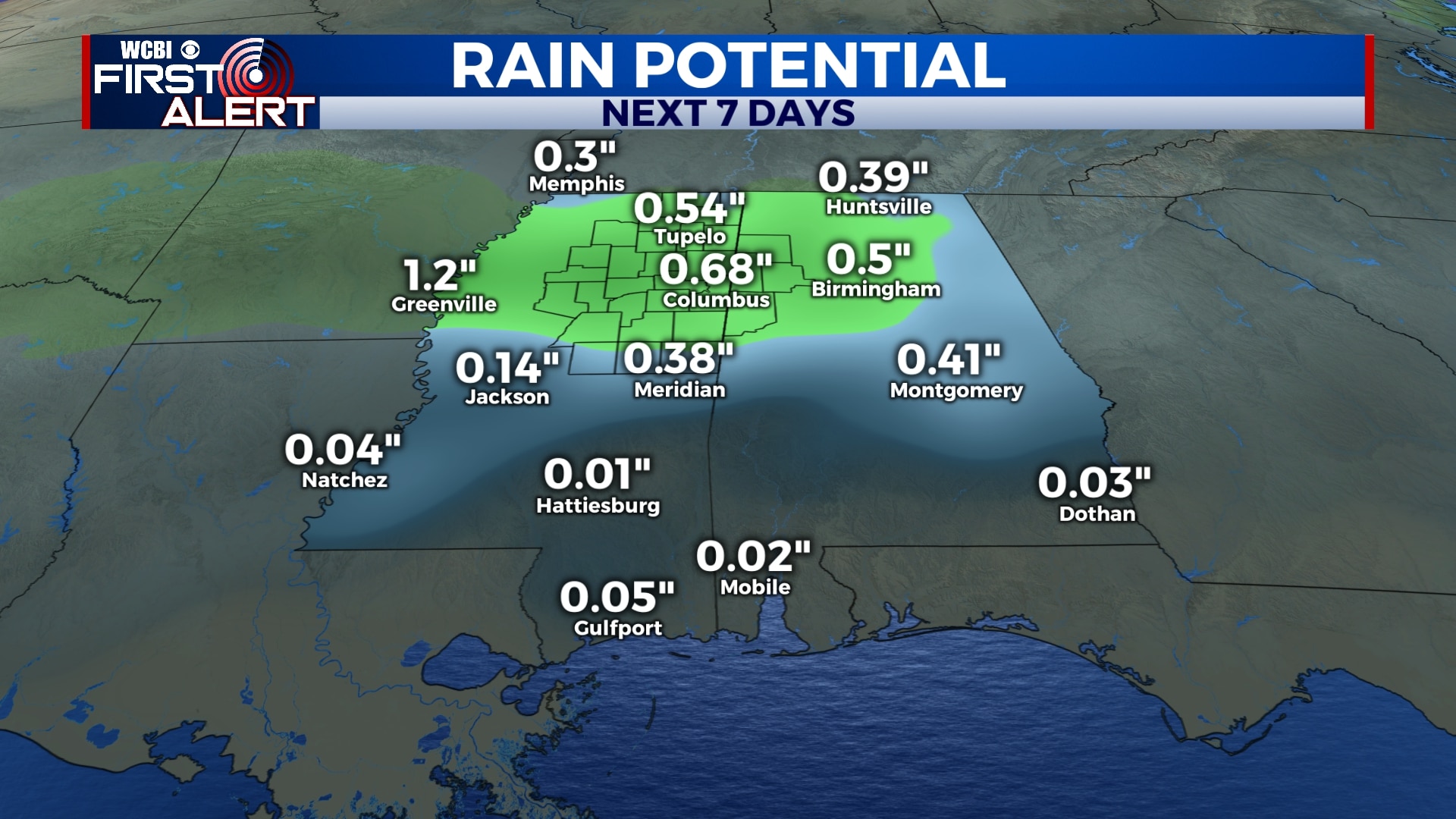
THURSDAY-SATURDAY: Our best chance of rain will be Thursday night and Friday as a storm system moves through the area. Some rain could be heavy at times and some areas could receive nearly an inch of rainfall. Rain will exit and we’ll be dry by Saturday but clouds will likely continue into the weekend. Afternoon high temperatures will remain in the 50s and 60s with overnight lows in the 40s and 50s on Thursday and Friday.
Follow WCBI Weather on Facebook, Twitter, and Instagram
Follow Meteorologist Trevor Birchett on Facebook and Twitter


Leave a Reply