Staying Warm Through Midweek, Showers on the Horizon Tuesday Night
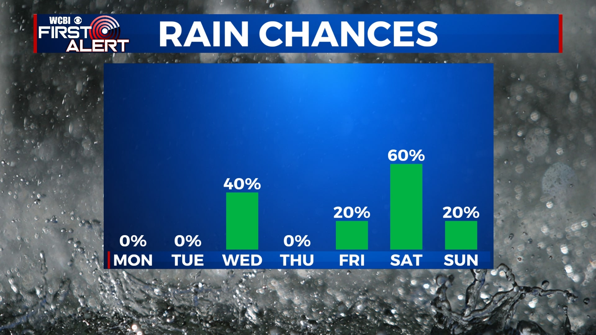
SUMMARY: Sunshine continues for the next couple of days but, of course, we cannot rule out the chance for some rain Tuesday night into Wednesday morning. We’ll see more sunshine Wednesday afternoon but a bit cooler with our high temperatures remaining below average. We’ll warm into the weekend with another chance for some spot showers Friday and some heavier showers Saturday morning.
SUNDAY NIGHT: Remaining cool with low temperatures in the mid-40s but overall a fairly quiet night. Clouds will be on the decreasing making way for mostly sunny skies tomorrow.
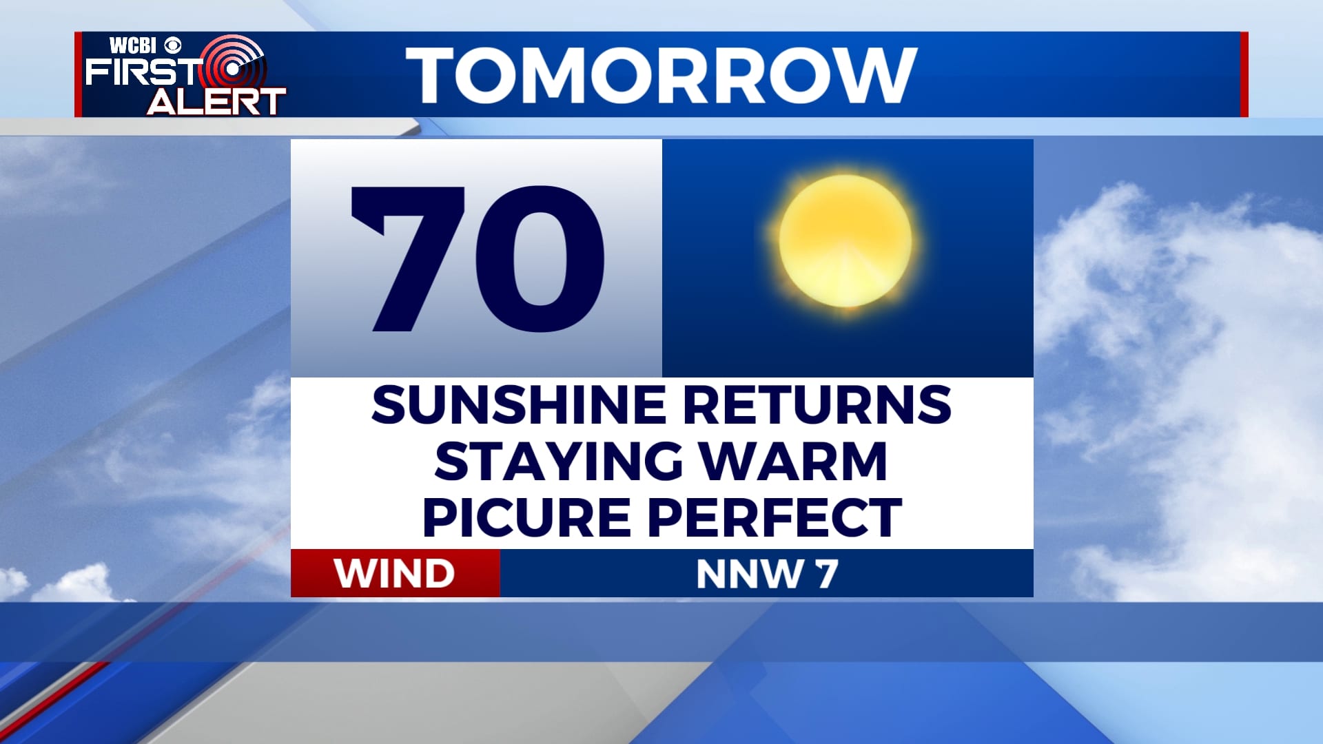
MONDAY: Continuing to warm into the 70s with a lot of sunshine. Overnight lows remain in the 50s.
TUESDAY: Staying warm with high temperatures in the mid-70s. We’ll see the sunshine for most of the day but clouds start to roll in throughout the evening as another cold front swings over the area bringing some scattered showers with it. Severe threat remains low and mainly looking towards just rain. Overnight lows will be chilly in the upper 30s.
WEDNESDAY: Cooler temps after the cold front moves overhead with highs only reaching the low 60s. Sunshine returns for the afternoon with overnight lows in the lower 40s.
THURSDAY: A mix of sun and clouds with highs in the mid-to-upper 60s. Overnight lows in the mid-40s.
FRIDAY-SUNDAY: Mostly cloudy skies Friday with the possibility for some spot showers. We’ll warm up in the upper 60s. Some showers and thunderstorms looks to be the highlight Saturday morning becoming more spotty in the afternoon. Highs on Saturday will be warm in the mid-70s. Expecting mostly cloudy skies on Sunday with temperatures sticking around the low 70s.


Leave a Reply