Storm Risk Friday, Nicer This Weekend
COLUMBUS, Mississippi (WCBI) – Severe storms are possible Friday afternoon and evening, then much nicer weather this weekend behind a front.
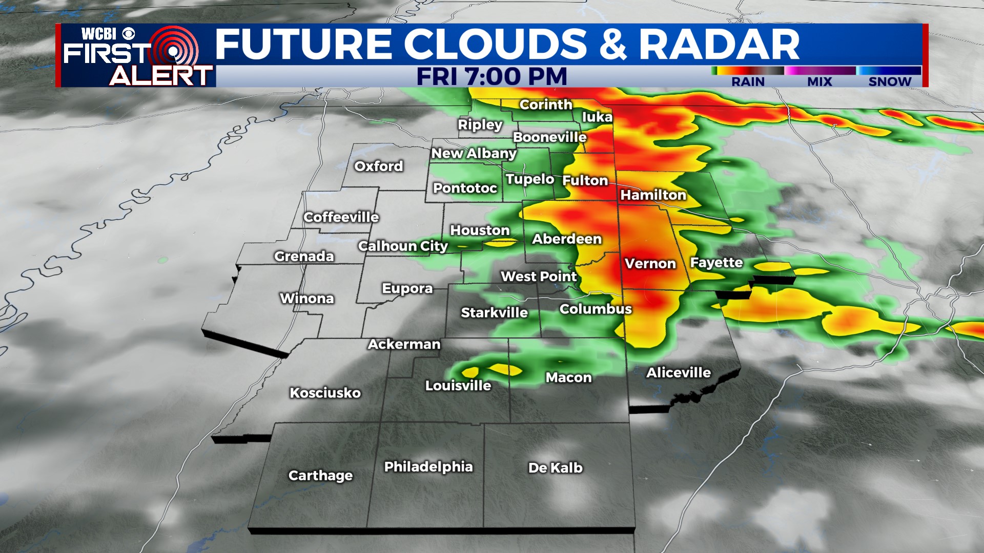
FRIDAY: Our last day of the heat wave. It’ll be very hot and humid before the storms, with highs in the mid-90s and a Heat Advisory in effect. More clouds than sun today. A few storms are likely along and north of I-22 this morning, but the main severe weather threat arrives later this afternoon. A complex of storms will begin to move through northern Mississippi around 3 pm, tracking eastward through the area, and moving into Alabama around 6 pm. Heavy rain as well as 60-70 mph damaging wind gusts are possible with these storms. According to the latest model guidance, areas north of Highway 82 have the best chance of getting heavy rain and high winds from this complex. Stay alert from 2-8 pm.
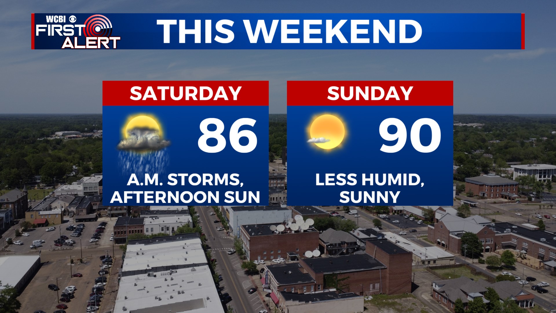
THIS WEEKEND: As the front continues to drop south, additional showers and storms will fire up Saturday morning, mainly along and south of Highway 82. Most of the rain will end by early afternoon. After that, skies quickly clear up, and we’ll see sunshine! It’ll start to feel less humid too as drier air filters in behind the front. Temperatures will be much “cooler” on Saturday, with highs only in the mid-80s! Sunday is a beautiful day. Low humidity, lots of sunshine, and a high near 90.
NEXT WEEK: Temperatures rebound slightly into the low 90s again by Monday, but still feeling slightly less humid. We’ll have dry weather and lots of sunshine to start the week. An isolated shower is possible by midweek, but rain chances are low for now.


