Storms arrive tonight then near-perfect weather returns this weekend
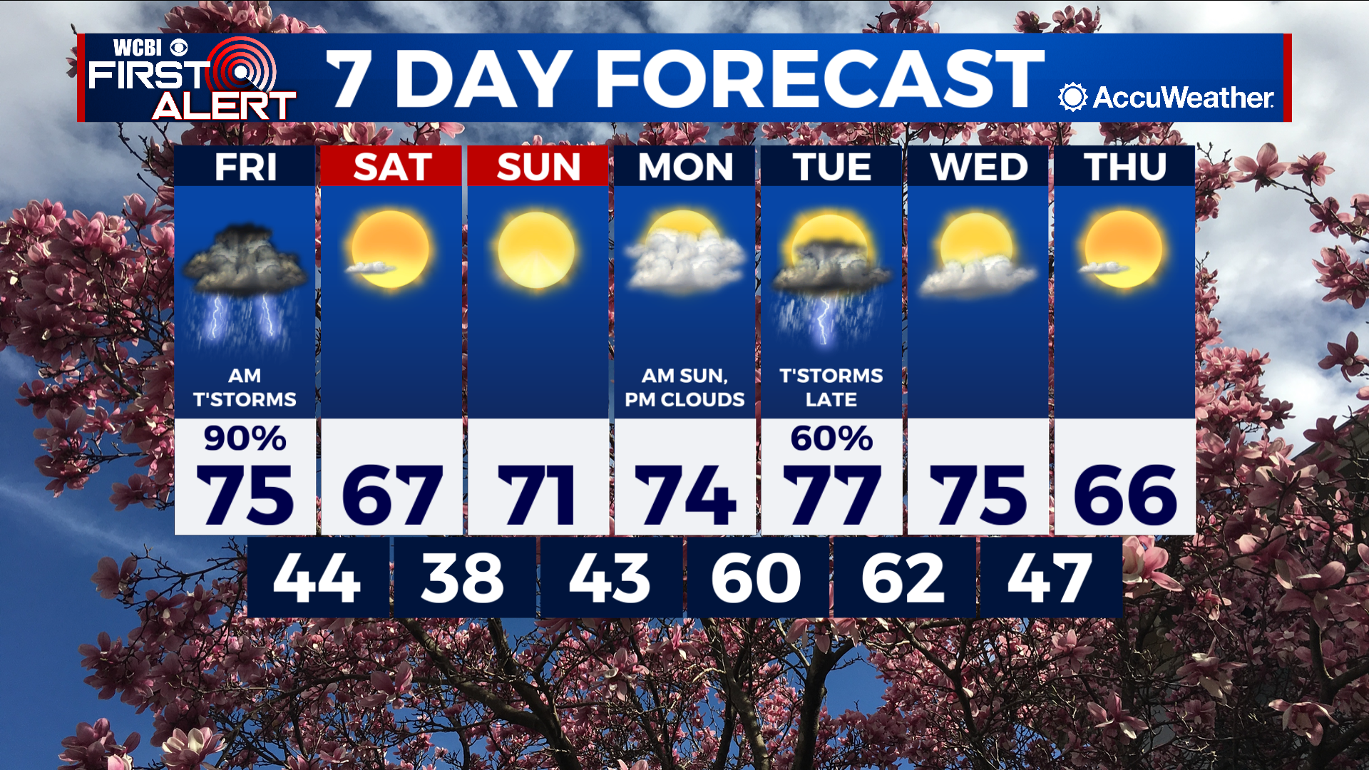
COLUMBUS, Mississippi (WCBI) – SUMMARY: Today was near perfect weather with highs in the 70s!
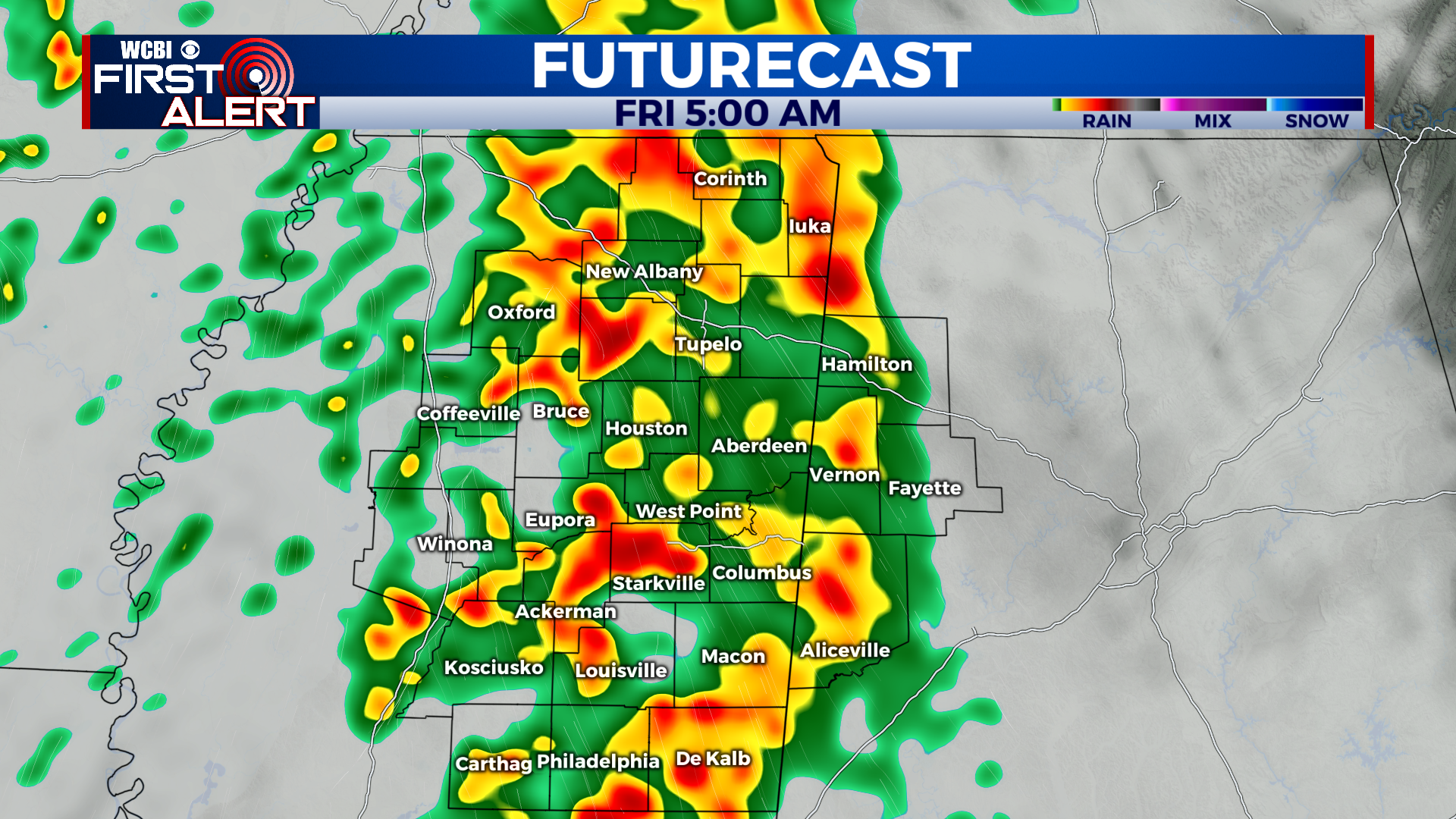
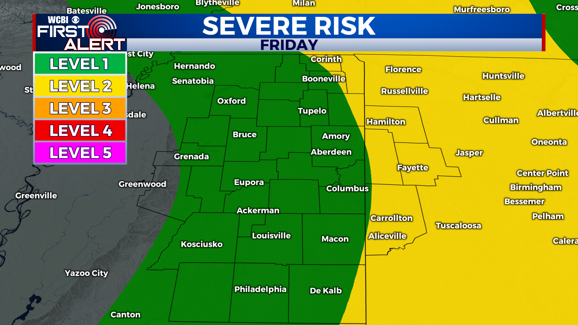
TONIGHT: Showers and thunderstorms arriving after midnight. Some storms may be severe with damaging wind gusts. Lows in the mid-50s. Southeast winds 5-15 mph.
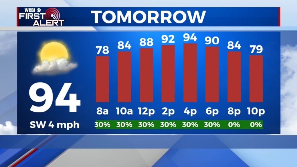
FRIDAY: Showers and thunderstorms before 11am, giving way to a mostly sunny sky by the afternoon. Highs in the mid-70s. Variable winds 5-15 mph with gusts up to 30 mph.
FRIDAY NIGHT: Partly cloudy with lows in the mid-40s. Breezy with west winds 5-15 mph.
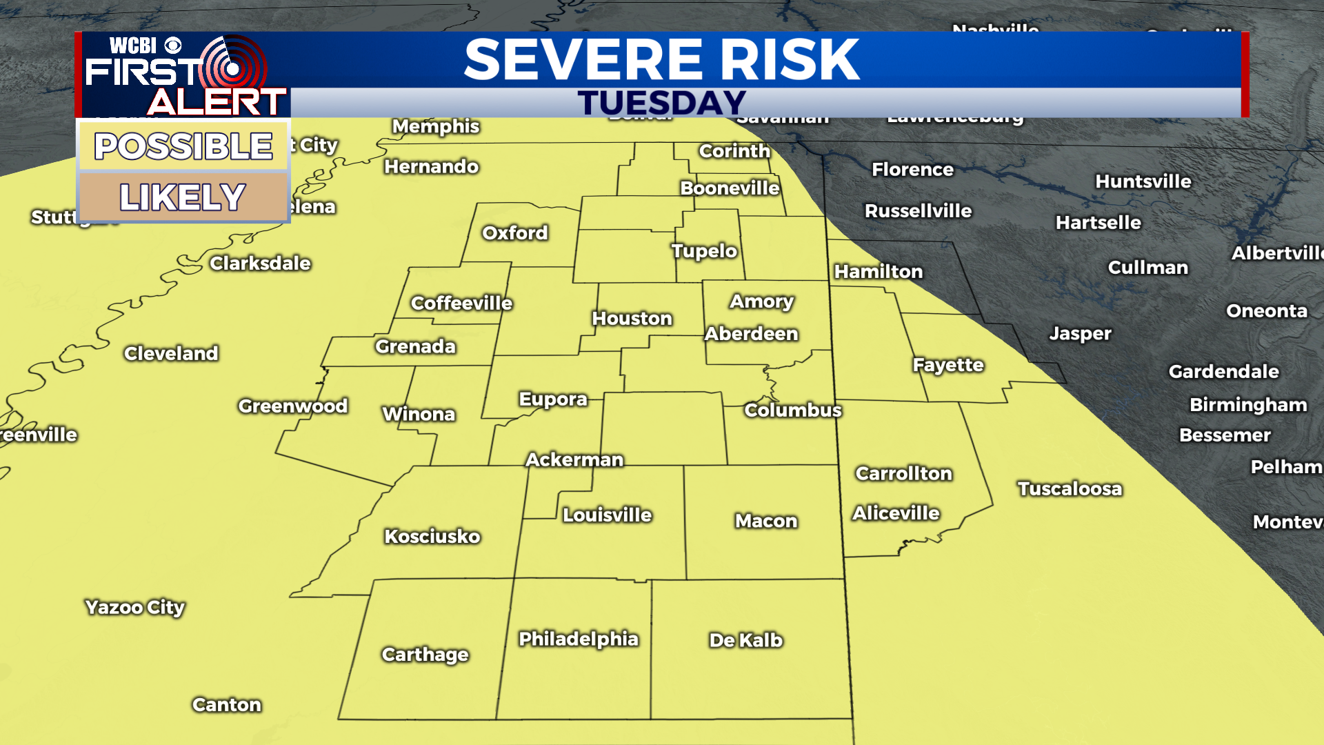
EXTENDED FORECAST: We will enjoy a beautiful weekend with highs in the 60s and 70s with sunny skies both days. An active weather pattern returns to the region next week. Monday starts off with a mostly sunny sky, then clouds will increase through the afternoon and become overcast by sundown. A few isolated showers or thunderstorms are possible late Monday night, but most of the region will stay dry. Widespread showers and thunderstorms arrive late Tuesday or Tuesday night. Forecast model data is still very inconsistent with the eventual timing; just know the potential is in place for strong to severe storms at some point Tuesday. The front is expected to move through by Wednesday and we will become mostly sunny by the afternoon. Stay tuned for additional updates on the severe weather potential.