Storms likely this week, then record heat possible next week
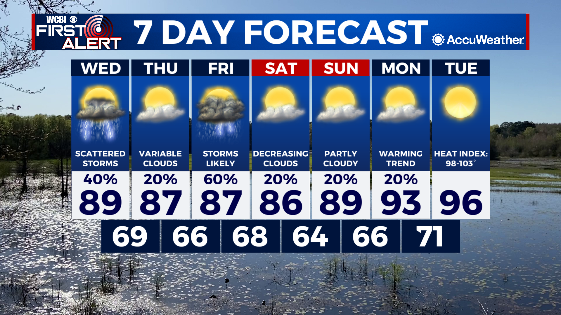
COLUMBUS, Mississippi (WCBI) – SUMMARY: Rain and storms remain in the forecast through the end of the week. Some severe weather will also be possible. Next week is expected to be very hot and very dry…

TONIGHT: Partly cloudy with a few isolated showers and thunderstorms north. A few storms may be strong with heavy rain, frequent lightning, and gusty winds. Lows in the low-70s. Chance of rain: 30%.
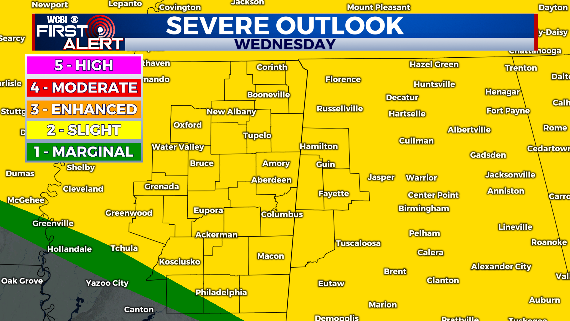
WEDNESDAY: Partly cloudy and with scattered showers and thunderstorms during the afternoon. A few storms may be strong with damaging wind gusts in excess of 60 mph possible. Highs in the low-90s. West winds 5-10 mph with gusts up to 20 mph.
WEDNESDAY NIGHT: Isolated showers and thunderstorms; otherwise, partly cloudy with lows in the low-70s. Chance of rain: 30%.

EXTENDED FORECAST: Showers and thunderstorms will come to an end as we reach the weekend, and next week will remain dry. However, long-term forecast models indicate record heat becoming possible mid-week. High temperatures will range from the mid-to-upper 90s and a few locations may break 100°. Regardless, heat index values will likely reach 105-110° at times.