Storms today, fall arrives Wednesday with much cooler air
SUMMARY: One last day of heat and humidity to get through today, and then north Mississippi and west Alabama are in for a fall treat! A big drop in temperature and humidity is expected.
TUESDAY Scattered showers and storms remain likely, especially this afternoon into early this evening as a strong cold front moves in from the northwest. The severe weather threat remains close to zero due to unfavorable placement of the best wind fields – the best shear for organized storms is lagging behind the incoming front. Before storms develop into the region, expect another toasty afternoon with highs in the 80s.
TUESDAY NIGHT: A strong front will move through the region, and a few scattered showers stay possible through the overnight hours. Expect temperatures to drop into the lower 60s by Wednesday morning.
WEDNESDAY: Gradual clearing is expected through the day as drier air works in from the north. With the fresh north breeze, expect absolutely stunning weather to bring in the first day of fall as highs stay in the middle 70s!
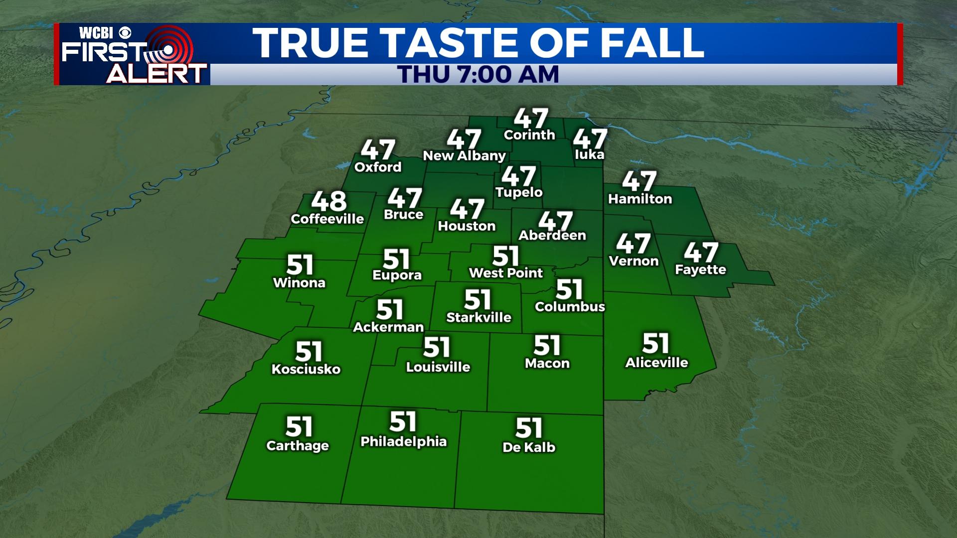
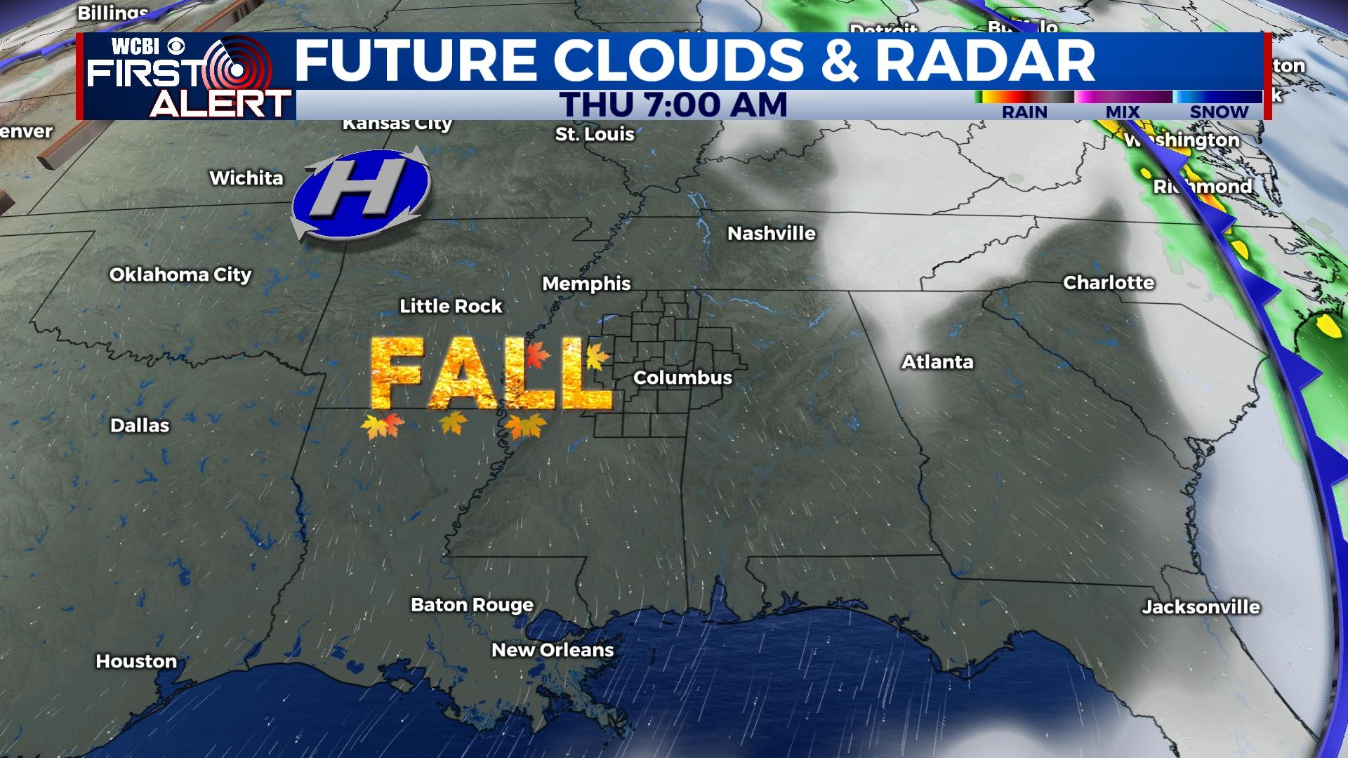
THURSDAY/FRIDAY: These still look to be the best days weather-wise. Each morning, temperatures will start in the low 50s or upper 40s with daytime highs reaching the 70s with full sunshine – it doesn’t get much better than that!
WEEKEND: Temperatures will slowly moderate back into the 80s, but humidity levels remain in check and mornings remain comfortable. Area football games look to have fantastic weather!