Storms Tonight into Tomorrow Morning, Some Could Be Severe
SUMMARY: Some showers and pop-up thunderstorms will be on the horizon. Some storms could be strong or severe. Another cold front moves through early morning bringing a line of showers and storms. We dry out Sunday afternoon with clouds lingering through the night. Monday brings some sunshine but Tuesday and Wednesday could bring more showers to the area. Lows tonight will be in the lower 40s.
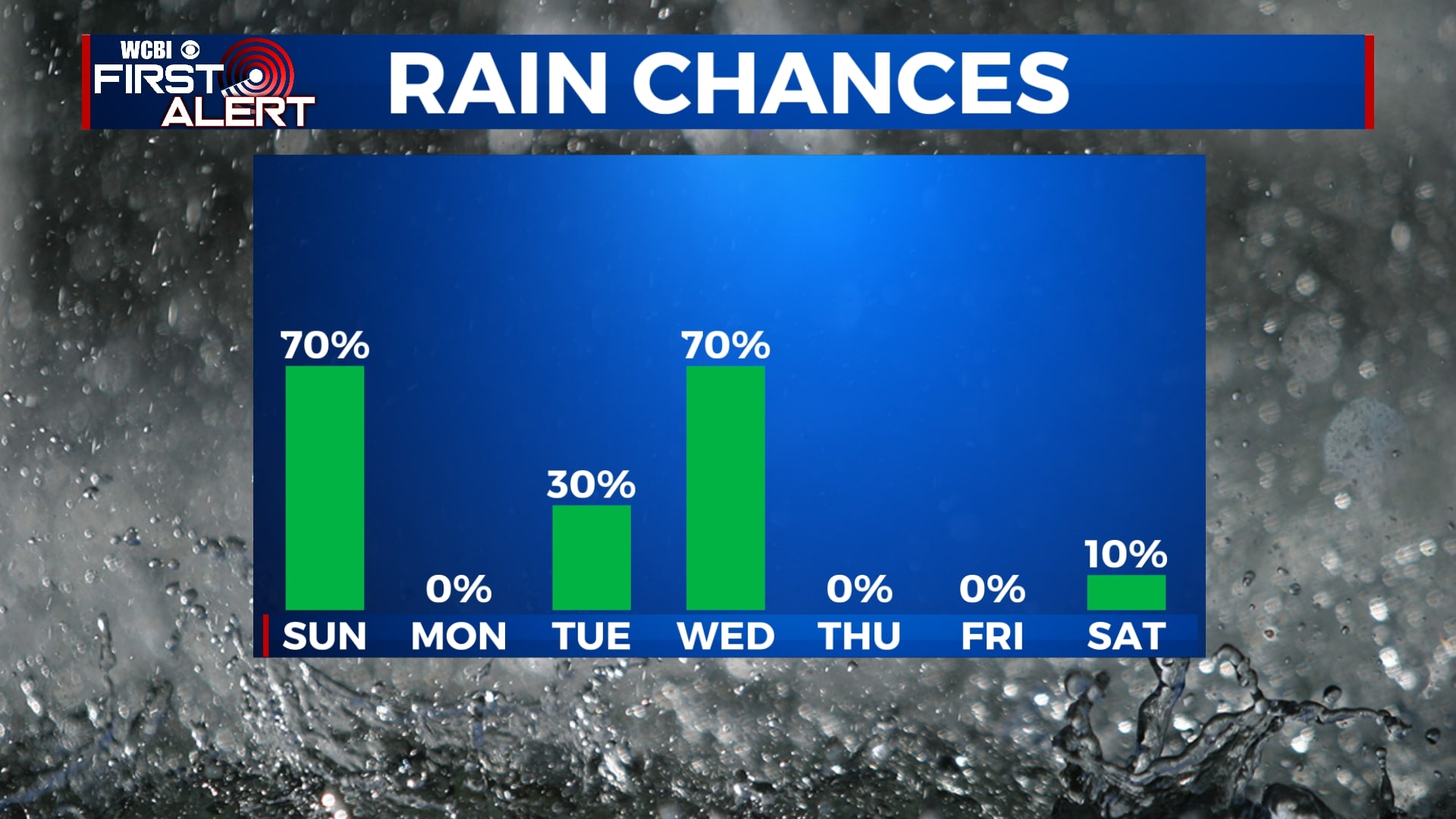
SATURDAY NIGHT: Pop-up showers and thunderstorms through midnight with a line of storms moving in early morning. Some storms could be strong and may be able to produce a tornado. Main threats looking to be hail and gusty winds. Lows tonight in the 40s.
SUNDAY: Line of showers and storms will move through early morning leaving us with parting clouds throughout the afternoon. Highs in the upper 60s and lows in the low 40s.
MONDAY: A picture perfect day with clear skies. Highs will reach the upper 60s and lows in the mid 40s.
TUESDAY: Considerable cloudiness for most of the day. An afternoon thunderstorm in spots. Rain and storms expected late afternoon and evening. Highs will reach the lower 70s and lows in the mid 50s.
WEDNESDAY: Showers and a possible thunderstorm with highs in the low 70s. Partly cloudy skies overnight with lows in the upper 30s.
THURSDAY: A bit cooler but an overall beautiful day with lots of sunshine and high temperatures in the upper 50s. Overnight lows will near the mid 30s.
FRIDAY: Warm and sunny day with highs in the mid 60s and lows in the low 40s.
SATURDAY: A mix of sun and clouds for most of the day. Highs near the mid 60s.


Leave a Reply