Stormy risk for mid-week
COLUMBUS, Mississippi (WCBI)- Tuesday will be the best weather day of the week before the next chance for showers and storms returns the middle of the week. Temperatures this week are also staying warm.
MONDAY NIGHT: It got very warm today, as high temperatures pushed their way into the lower 80s. Sky coverage will remain partly cloudy tonight, slowly continuing to clear out. Temperatures overnight will be cool in the middle to upper 40s.
TUESDAY: The last day of February will be the best to spend some time outdoors or get errands done. We are looking forward to a mostly clear day, with lots of sun and warm temperatures. High temperatures will be heading back into the upper 70s, with potential for lower 80s. Low temperatures will be mild in the middle 50s.
WEDNESDAY: Temperatures are looking to stay equally as warm for the middle of the week. High temperatures remain in the upper 70s to lower 80s. There will be extra moisture moving in, which could lead to strong showers and storms throughout the afternoon and evening. While there is not currently a strong severe risk, our eyes will stay peeled ahead of this system. Overnight temperatures drop only into the middle 60s.
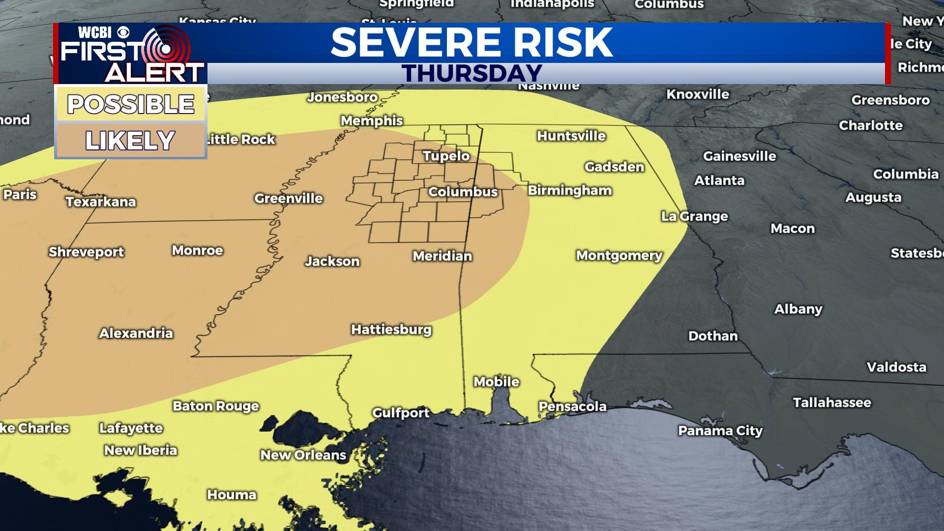
THURSDAY/FRIDAY: Following the showers and storms on Wednesday, another system will follow behind much stronger for Thursday into Friday. There are already favorable markers in place ,to bring a cautious eye, to a severe weather risk of all modes. Thursday stays warm in the upper 70s/lower 80s, while Friday will take a drop into the middle 60s as the showers clear.


