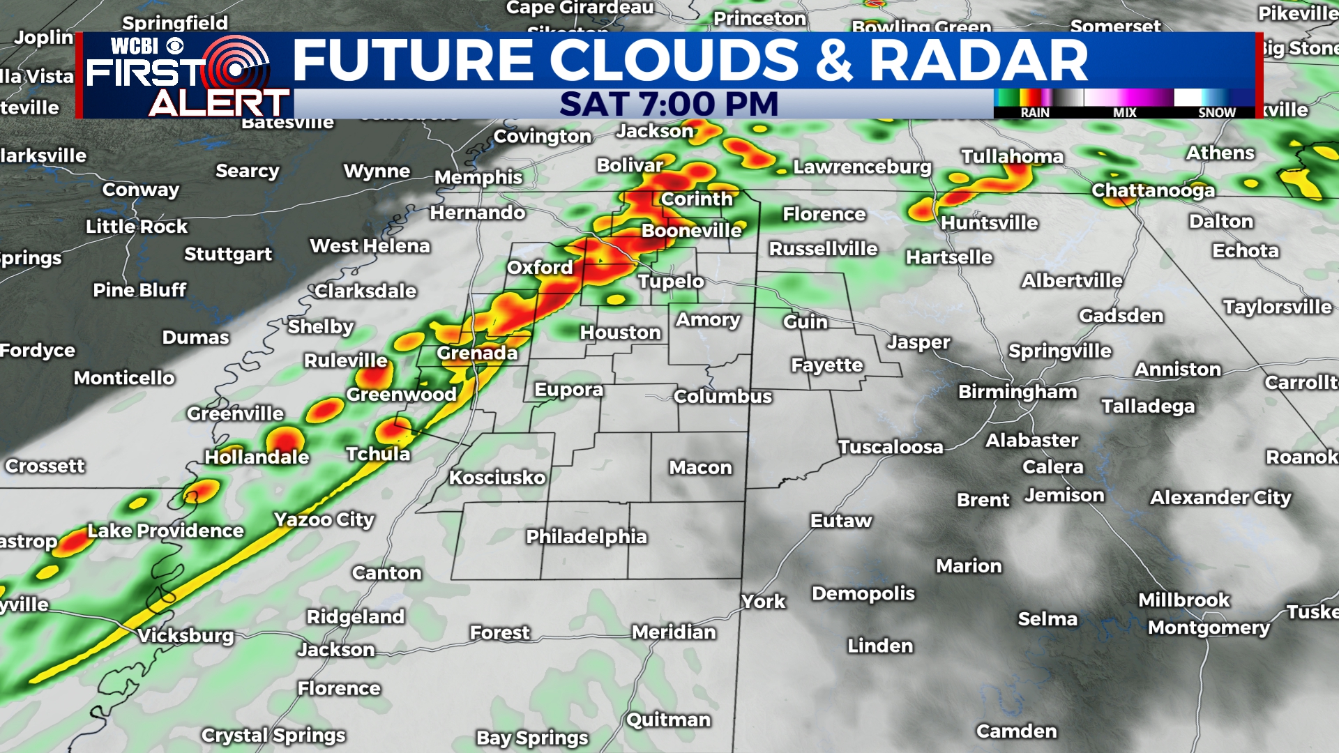
Strong Storms Likely Saturday Evening
A strong system will move across the country this weekend, bringing us the chance for some strong to severe storms Saturday afternoon and evening. After that, cooler and drier air will rush in and sunshine will return for Sunday.
FRIDAY NIGHT: Friday evening is looking cool and quiet with temperatures in the mid 60s after sunset. We’ll get down to a low of 52 under a mostly cloudy to overcast sky.
SATURDAY: We’ll start the day off dry and mostly cloudy before showers and storms start to develop after lunchtime. We’ll stay warm and breezy through the day with temperatures getting into the 70s and winds gusting upwards of 20 mph at times. The best chance for storms is after sunset, between 6pm and 11pm. This round of storms could produce damaging winds, heavy rain, and lightning. With the ingredients that are in place, an isolated tornado or two can’t be ruled out. Rain and storm activity should start to end by midnight as winds switch around from the west.
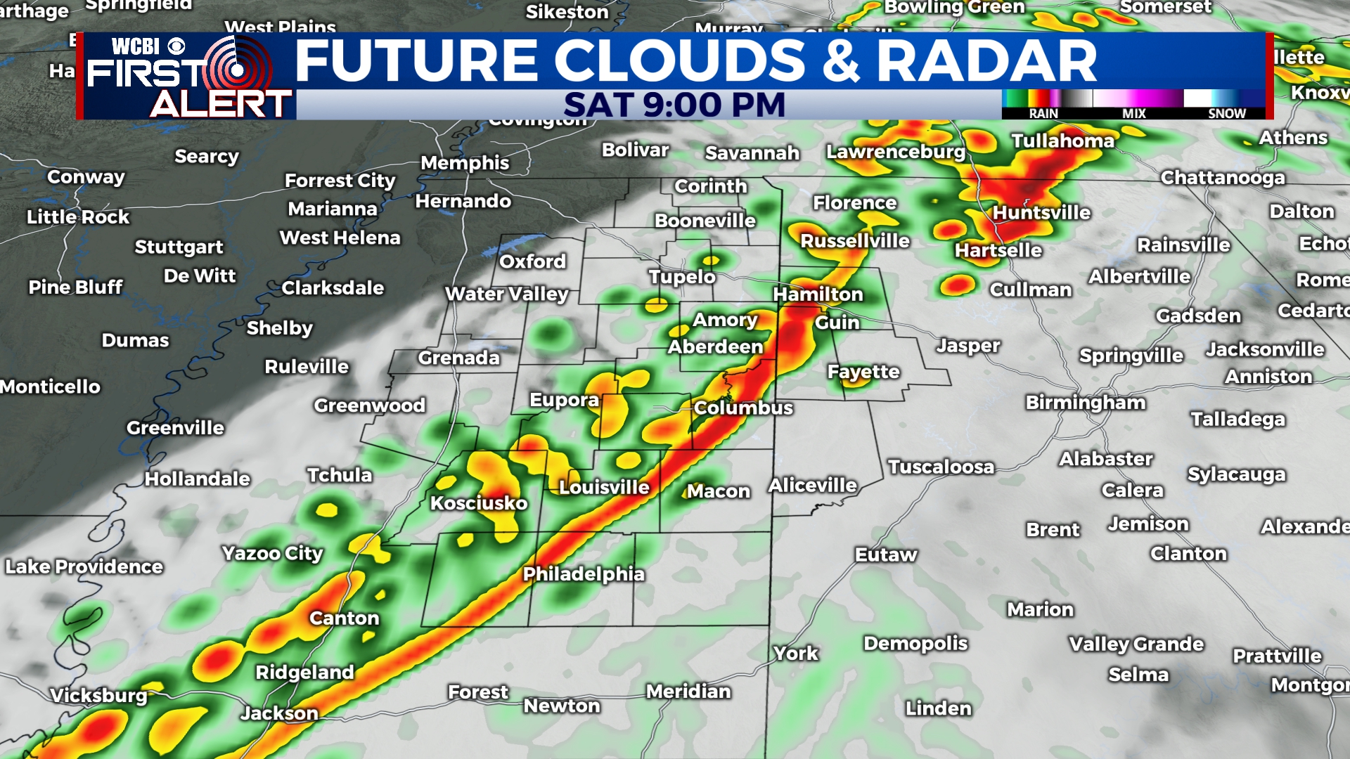
SATURDAY NIGHT: Strong storms early will give way to clearing skies after midnight. Lows will be in the upper 40s with winds gusting out of the west between 15 and 20 mph.
SUNDAY: Temperatures will be cooler with highs only in the upper 50s. We’ll remain mostly sunny through the day, but winds will still be gusting over 20 mph at times.
SUNDAY NIGHT: A cold night is in store with many areas getting close to or just below freezing. Mostly clear and calm.
MONDAY-WEDNESDAY: We’ll see a few clouds to start the week, but many of us will stay mostly sunny. Highs will be in the upper 40s on Monday, but will climb back to near 60 for Wednesday. A freeze is likely early Tuesday morning with overnight lows in the upper 20s.
THURSDAY-FRIDAY: Another system will bring the chance for some isolated showers to end the week. Highs will be near 60 with morning lows in the 30s and 40s.


Leave a Reply