Strong storms possible Tuesday, then Fall literally arrives Wednesday
A few scattered showers and thunderstorms continue across the region this evening. This activity is expected to diminish this evening and through the overnight. A strong cold front will enter the region tomorrow and bring drastic changes to our weather pattern over the coming days. Let’s get into the details.
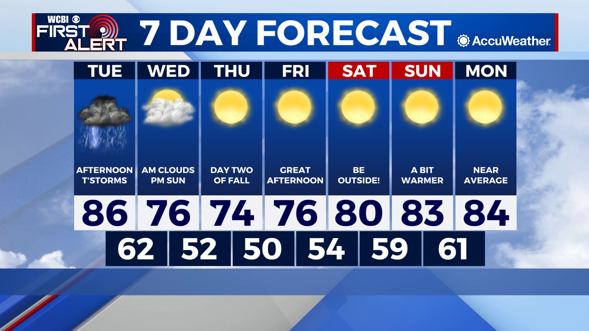
TONIGHT: Scattered showers and thunderstorms diminishing after sundown. Low temperatures in the low-70s. Chance of rain: 50% before midnight, then 10% overnight.
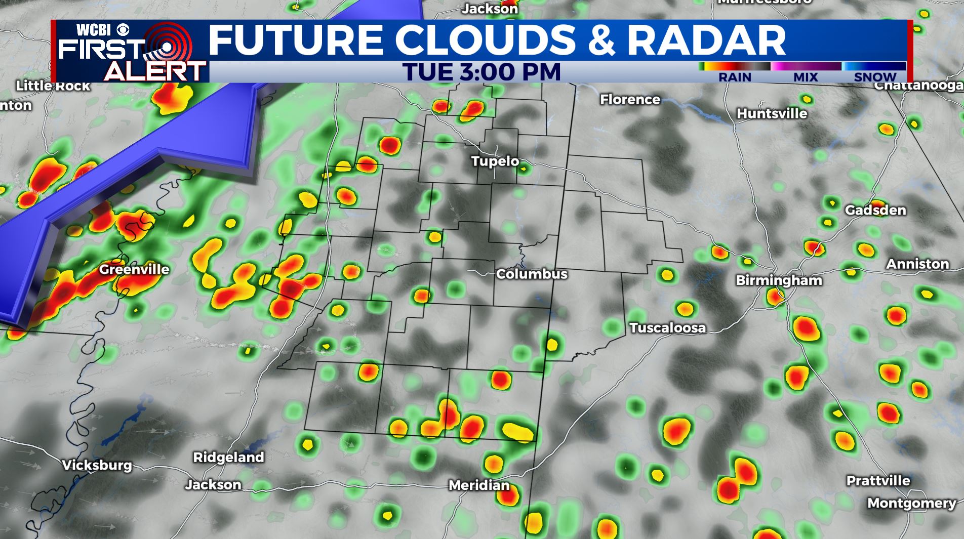
TUESDAY: Isolated showers and thunderstorms before 3pm, then becoming likely during the late afternoon and evening. Some storms may contain heavy downpours, frequent lightning, and gusty winds. High temperatures will be in the mid-to-upper 80s. Chance of rain: 70%.
TUESDAY NIGHT: Scattered showers and thunderstorms. Some storms may contain heavy downpours, frequent lightning, and gusty winds. Chance of rain: 70%. Overnight lows in the low-60s.
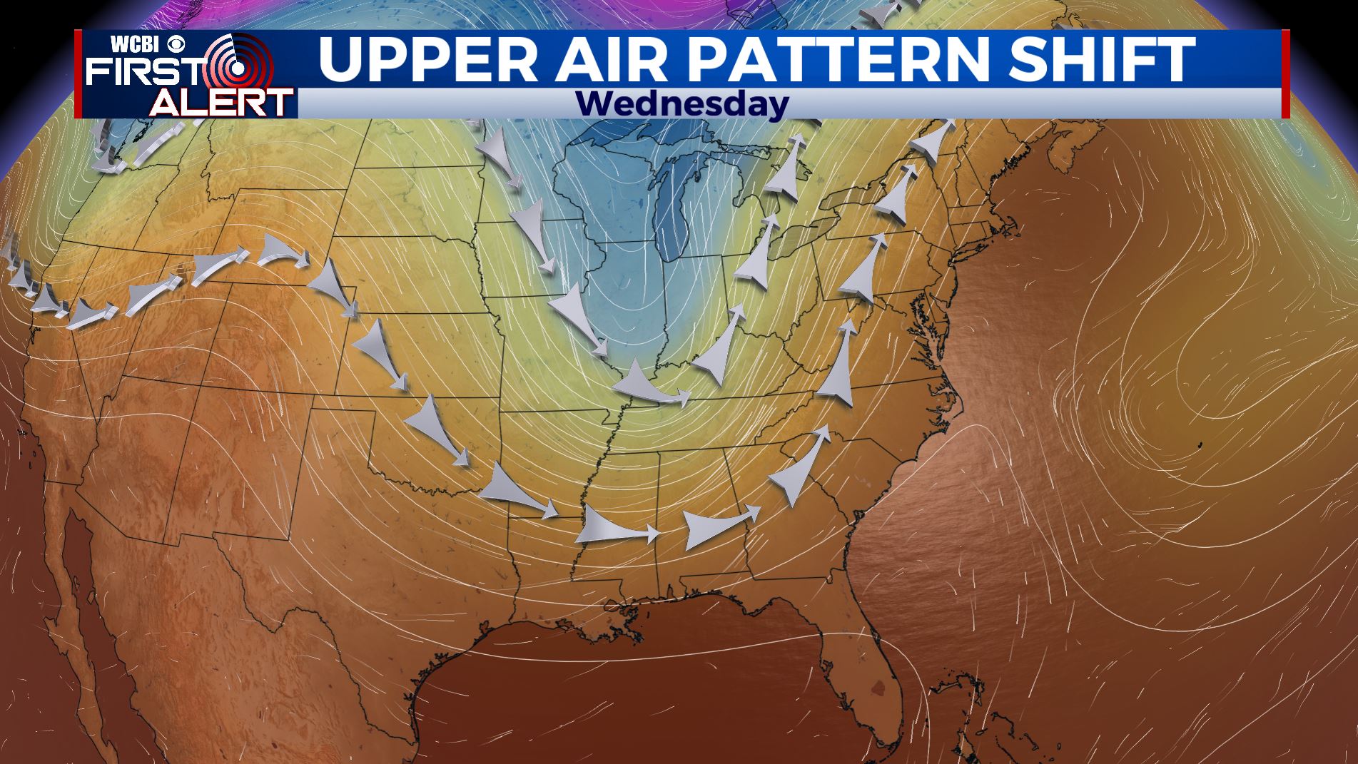
THIS WEEK: A strong cold front will deliver the best taste of Fall weather Wednesday… which also happens to be the start of Fall! Afternoon high temperatures will remain in the 70s through the end of the work week, before returning to the 80s next week. The pattern will remain calm with sunny skies after the front. A quick check of the tropics has a couple of tropical systems in the mid-Atlantic we are keeping our eye on; however, there is no threat to the U.S. at this time from any of them. Have a great rest of your evening!