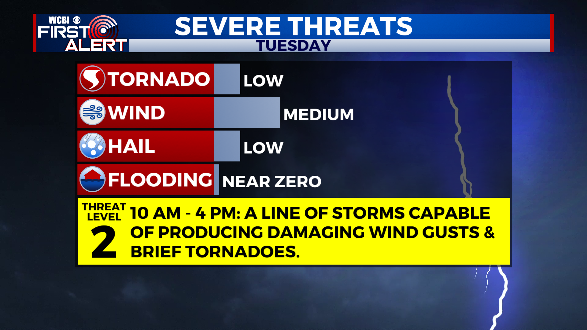
Strong to Severe Storms Possible on Tuesday
COLUMBUS, Mississippi (WCBI) – A potent cold front will move through the region tomorrow, bringing the risk for strong to severe storms during the late morning and afternoon hours.
TONIGHT: Partly cloudy skies. Warm with increasing humidity. Low near 66°. Winds will be blowing out of the southeast around 10 mph, so it will be breezy.
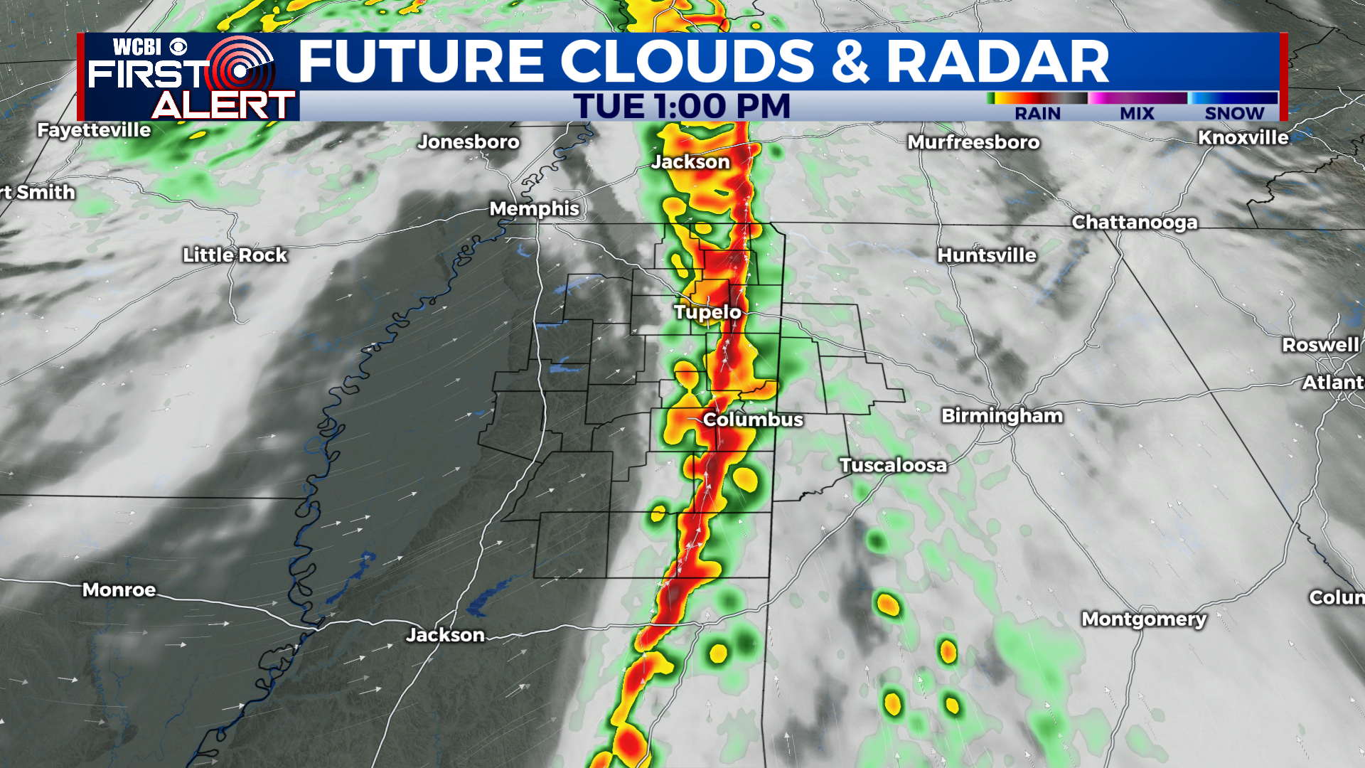
TUESDAY: Most of us should stay dry during the early morning, but a line of showers and storms will begin to approach from the west by late morning. As the line moves eastward and into our area, it will interact with lots of moisture and wind energy. This could cause the line to become stronger as it moves through. The main time-frame for strong to severe storms is between 11 AM & 4 PM. Damaging wind gusts are primary threat, but a brief tornado or two is also possible given the impressive amount of wind energy in the atmosphere. Temperatures will top out in the mid 70s tomorrow before the front moves through, and after the front, temperatures will begin to cool. The good news is, the severe risk should be ending by dinnertime. Stay weather aware tomorrow and tune in to WCBI for the latest information. We’ll have team weather coverage throughout the day from the studio, and in the field!
WEDNESDAY & BEYOND: Wednesday will be beautiful with lots of sunshine and highs in the upper 60s! We’ll stay dry and warm into the 70s on Thursday and Friday. The next rain chances looks to be on Saturday and Sunday.
Have a great night!


