Strong To Severe Storms Possible Over the Weekend
COLUMBUS, Mississippi (WCBI) – We’ll briefly enter a more active weather pattern this weekend. Storms are possible each day, and some could be severe.
TONIGHT: Showers and storms will begin to weaken after sunset, fizzling out by 10 PM. We’ll have a few clouds overhead, with temperatures dipping into the low 70s for the millionth night in a row. Things briefly dry out tonight before another active day Saturday.
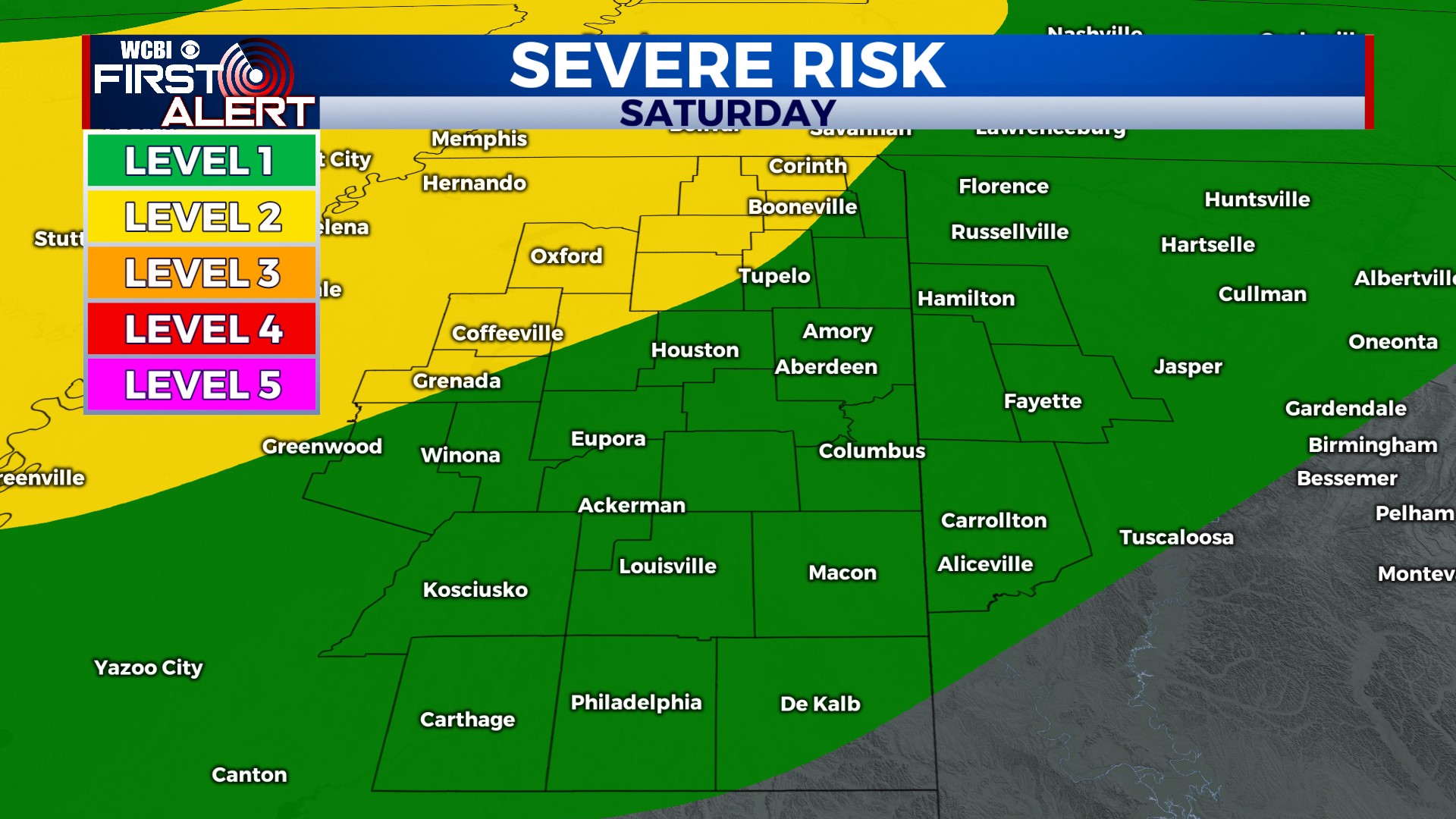
SATURDAY: The morning is mostly dry, but all bets are off after lunch. Scattered storms will begin to pop up across the region by early afternoon. Jet stream winds will be ramping up over our area, so some of the storms could become strong to severe with damaging wind gusts. Stay alert during the afternoon and evening! You’ll want to watch the radar if you have outdoor plans. Outside of thunderstorms, it’ll be hot and humid, with highs near 90°.
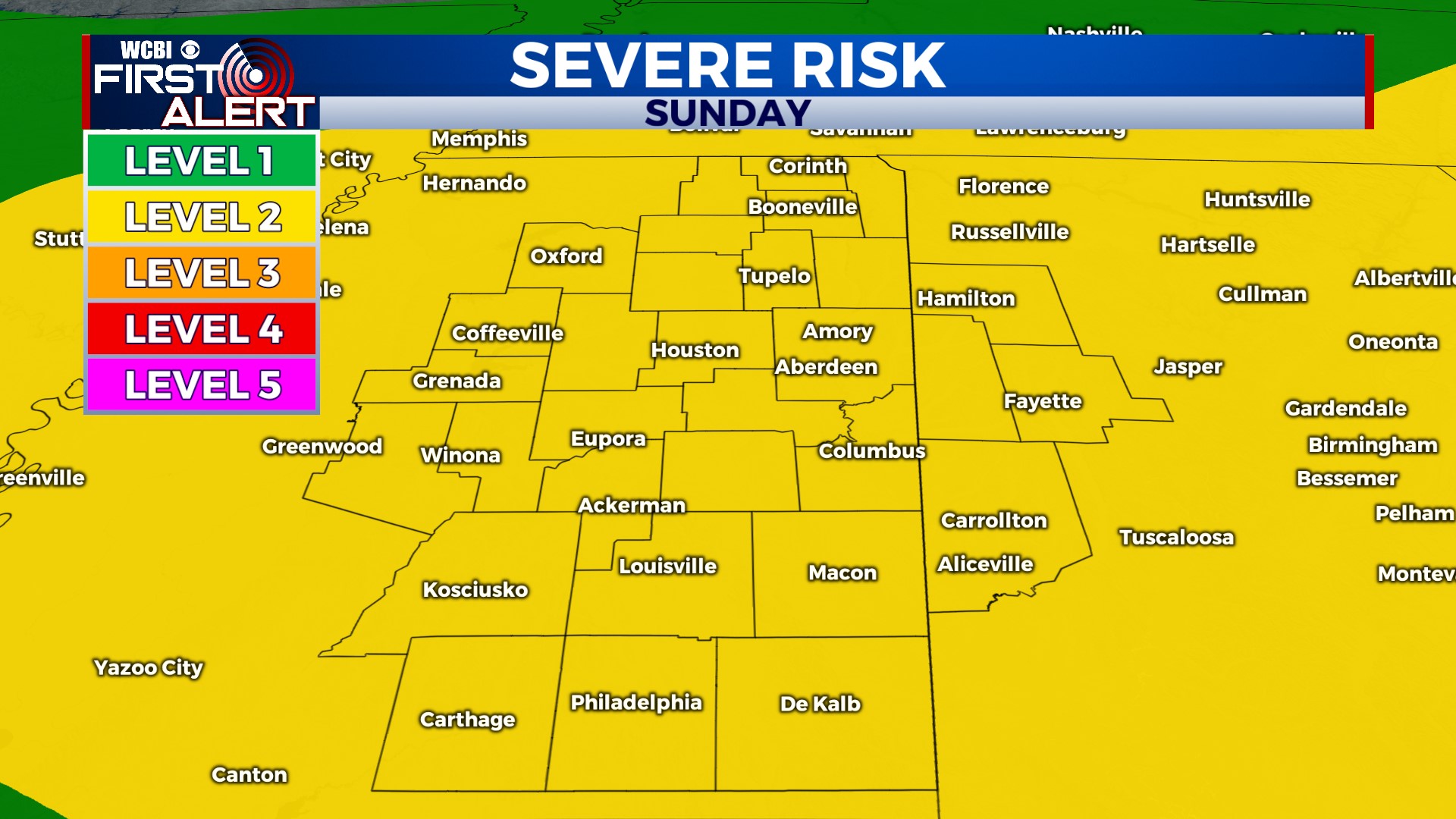
SUNDAY: Another active day, although storm timing is not as clear. At this point, we still expect the greatest chance for storms to be in the afternoon and evening. Once again, with fast jet stream winds overhead, some of them could be severe with damaging wind gusts. We’ll keep you posted! Outside of thunderstorms, mostly cloudy skies should keep temperatures slightly below average in the mid- to upper 80s.
NEXT WEEK: Calmer weather on Monday and Tuesday. Storms are still possible in the afternoon, but they’ll be much more isolated and confined to smaller areas. Rain chances are lowest on Tuesday. Starting Wednesday, afternoon pop-up storms will become more common, similar to what we’ve been dealing with this past week.
Have a great weekend!


