Temperatures reach the mid-60s tomorrow then rain returns Sunday
COLUMBUS, Mississippi (WCBI) – SUMMARY: Showers are likely Sunday with an approaching cold front. Clouds will clear the region by Monday with highs in the low-to-mid 50s to start the Thanksgiving holiday week.
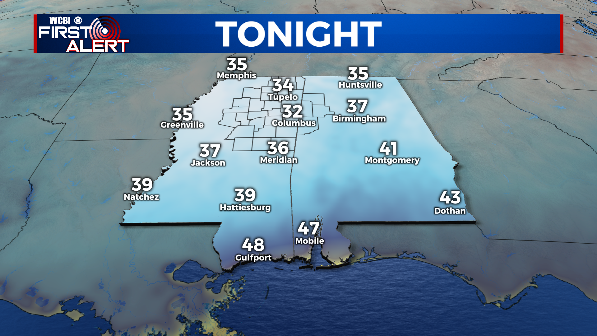
TONIGHT: Clear and cold with overnight lows in the low-30s. Calm wind. Scattered frost possible.
SATURDAY: Sunny with highs in the mid-60s. Southeast winds 3-5 mph with higher gusts up to 25 mph. Chance of rain: 30%.
SATURDAY NIGHT: Partly cloudy with overnight lows in the mid-40s. South wind 3-5 mph.
SUNDAY: Mostly cloudy and breezy with highs in the upper-60s. Scattered showers arriving during the afternoon. Variable winds 5-15 mph with higher gusts up to 20 mph. Chance of rain: 60%.
SUNDAY NIGHT: Showers likely during the evening with overnight lows with lows in the low-40s. Variable winds 5-15 mph with higher gusts up to 20 mph. Chance of rain: 60% before midnight.

NEXT WEEK: High pressure will return to the region once Sunday’s cold front pushes through. Afternoon high temperatures will be in the 50s Monday and Tuesday with sunny afternoons. We will briefly warm ahead of our next system which is set to arrive Thanksgiving afternoon with isolated showers.
HIGH SCHOOL FOOTBALL: No weather issues for tonight’s games across the region except for the colder air. Temperatures will be in the low-40s near kickoff, then upper-30s for the drive home. No chance of rain.
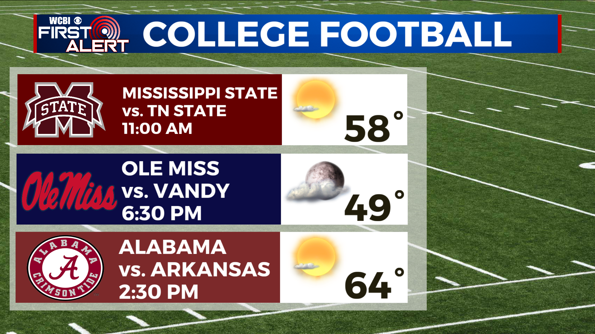
COLLEGE FOOTBALL: Kickoff forecasts will be clear and pleasant across the region tomorrow. High pressure will keep the region mostly sunny to partly cloudy at worst. Afternoon highs are in the 60s & 70s across the deep south.