Temporarily warmer with strong storms Saturday PM
COLUMBUS, Mississippi (WCBI) – Temperatures trend above average into the first half of the weekend. Strong to severe storms are possible Saturday evening.
FRIDAY: Cloud coverage slowly increases through the day, but temperatures should still reach the middle 60s by afternoon with a steady south breeze.
FRIDAY NIGHT: A few showers are possible well after sunset as moisture slowly increases. A few more showers stay possible overnight, and a couple of rumbles are also possible as elevated instability builds.
SATURDAY: The day looks variably cloudy and increasingly warm, with highs reaching into the lower 70s area-wide. While occasional showers or even a storm are possible during the day, we don’t expect any severe weather in the area until after 4 PM. From 4 PM onward to midnight, a wavy line of strong to severe storms is expected to traverse the area bringing hail, wind, and tornado potential to the region. For now, the tornado threat appears highest north of US 82 to the TN state line. After midnight, the severe threat should be shifting into north & central Alabama.
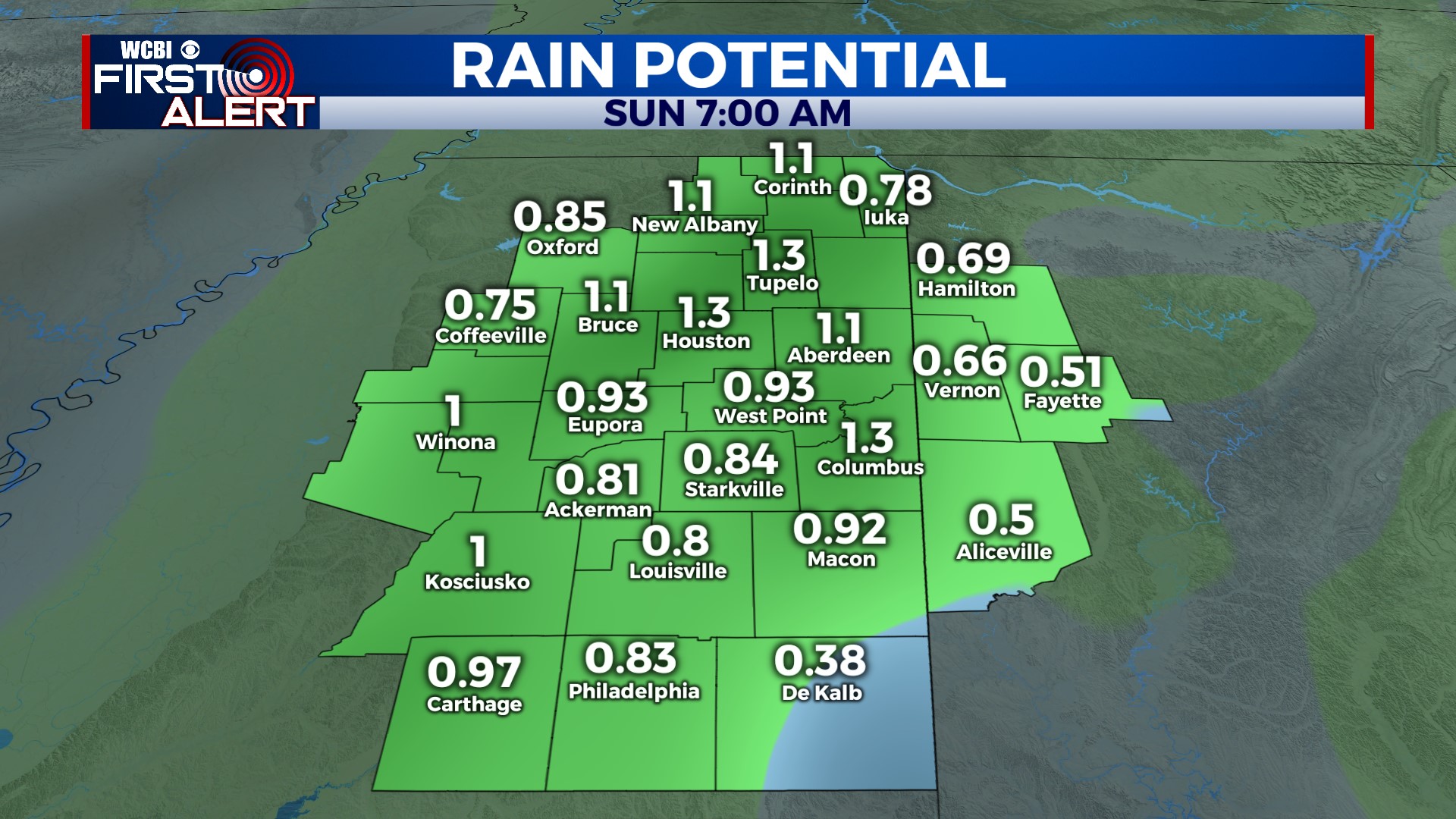
SUNDAY: Colder air rushes in behind Saturday night’s storms, and we’ll struggle to reach 50 degrees by the afternoon with a chilly northwest wind. The Columbus Christmas parade looks quite cold!
NEXT WEEK: We’re smooth sailing! Sunshine every day with seasonable mid-December temps.


