Thanksgiving cold front brings back the chills
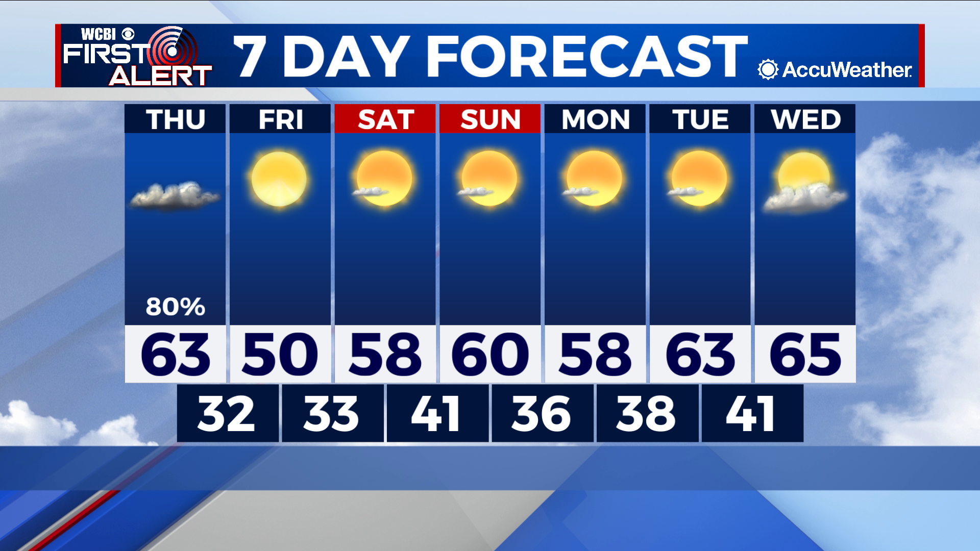
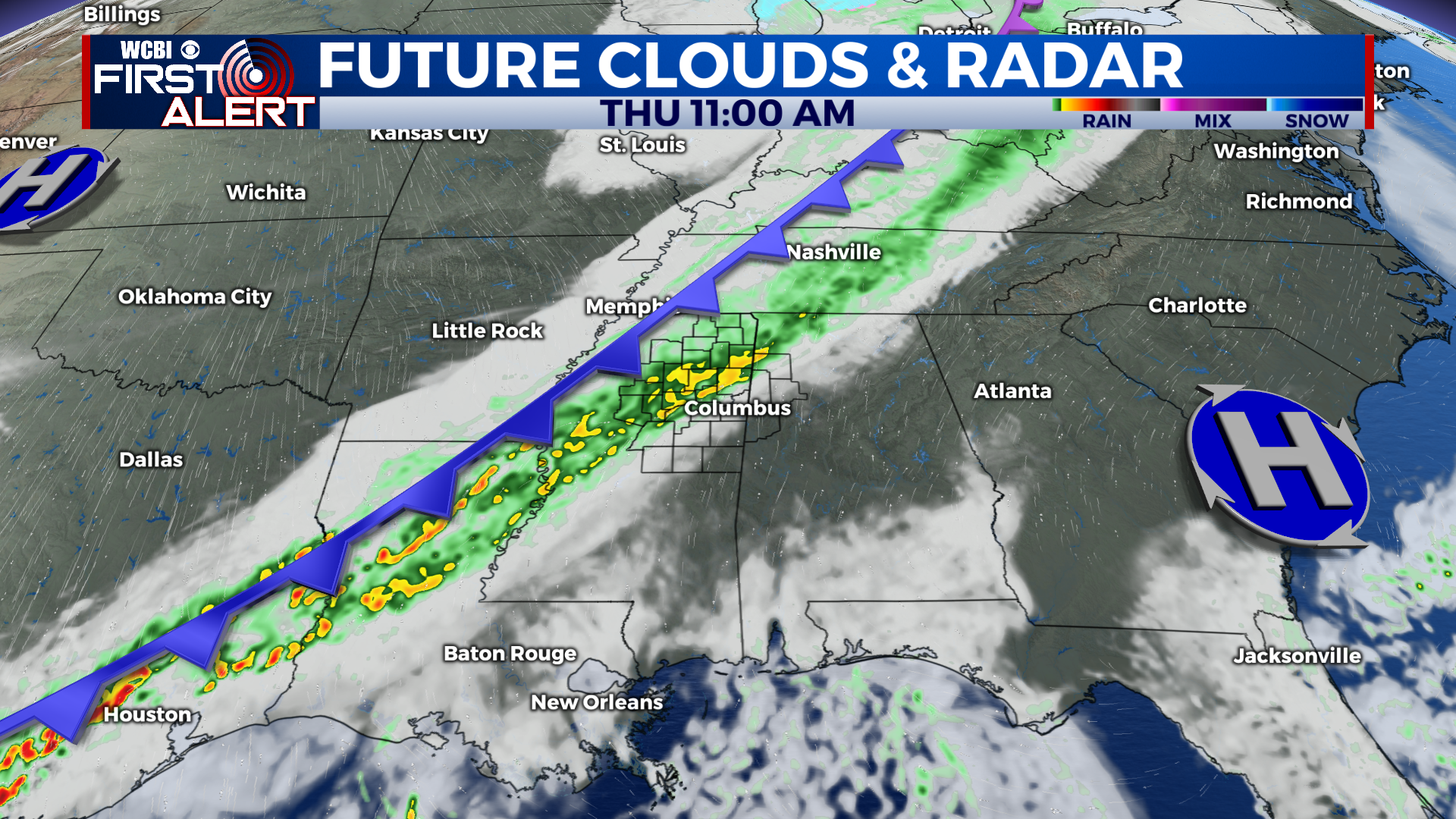
COLUMBUS – SUMMARY: A strong cold front Thursday evening brings freezing temperatures back to the area. Rain accompanies the Thursday front but the rest of the week remains dry. A slow rebound back into the mid 60s by the middle of next week is expected.
THURSDAY: Our thanksgiving starts out relatively mild compared to where we’ve been. A cold front passing through around midday brings a significant rain chance for most of us in Northeast Mississippi in addition to cooler air. Look for a steady drop in temperatures once the cold front has passed through, and lows bottom out near or at freezing in the low 30s.
FRIDAY: The cold air remains in place throughout the day without much chance for warming. Highs top out in the low 50s with lows in the low 30s. Skies do clear up but the effect of the sun on air temperature will be minimal.
SATURDAY: Conditions begin to improve as more sunshine allows highs to climb into the mid to upper 50s. Some clouds return but the skies remain dry with no rain chance expected. The overnight low temperature improves slightly, warming to the low 40s.
SUNDAY: A slightly warmer end to the weekend with high temperatures in the upper 50s and possibly touching 60. Skies clear out and the dry pattern continues. The low temperatures Sunday night are expected to drop a tad into the high 30s.
NEXT WEEK: Afternoon temperatures will continue to improve into the mid to upper 60s by Wednesday. The trend in low temperatures remains stagnant, bottoming out in the mid to high 30s to low 40s. Mostly sunny skies prevail with some partly cloudy skies sprinkled in. No rain chance is expected for the first half of next week.