Thunderstorms Likely Monday and Tuesday
COLUMBUS, Mississippi (WCBI) – It will be a calm and cool end to our Sunday with increasing clouds throughout the night. Expect cool and breezy conditions tomorrow with heavy cloud coverage and thunderstorms moving into the region tomorrow evening.
TONIGHT – It will be another chilly and mild night with overnight lows dropping into the low 30s. There will be a steady increase in cloud coverage through the overnight hours ahead of our next weather system.
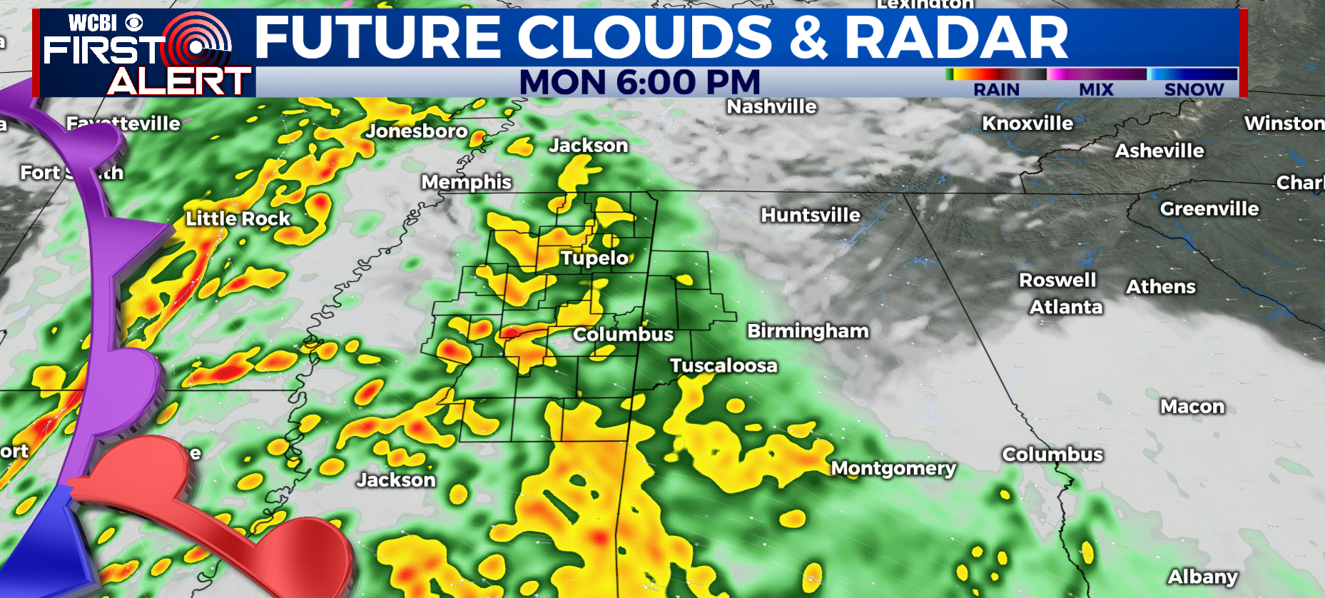
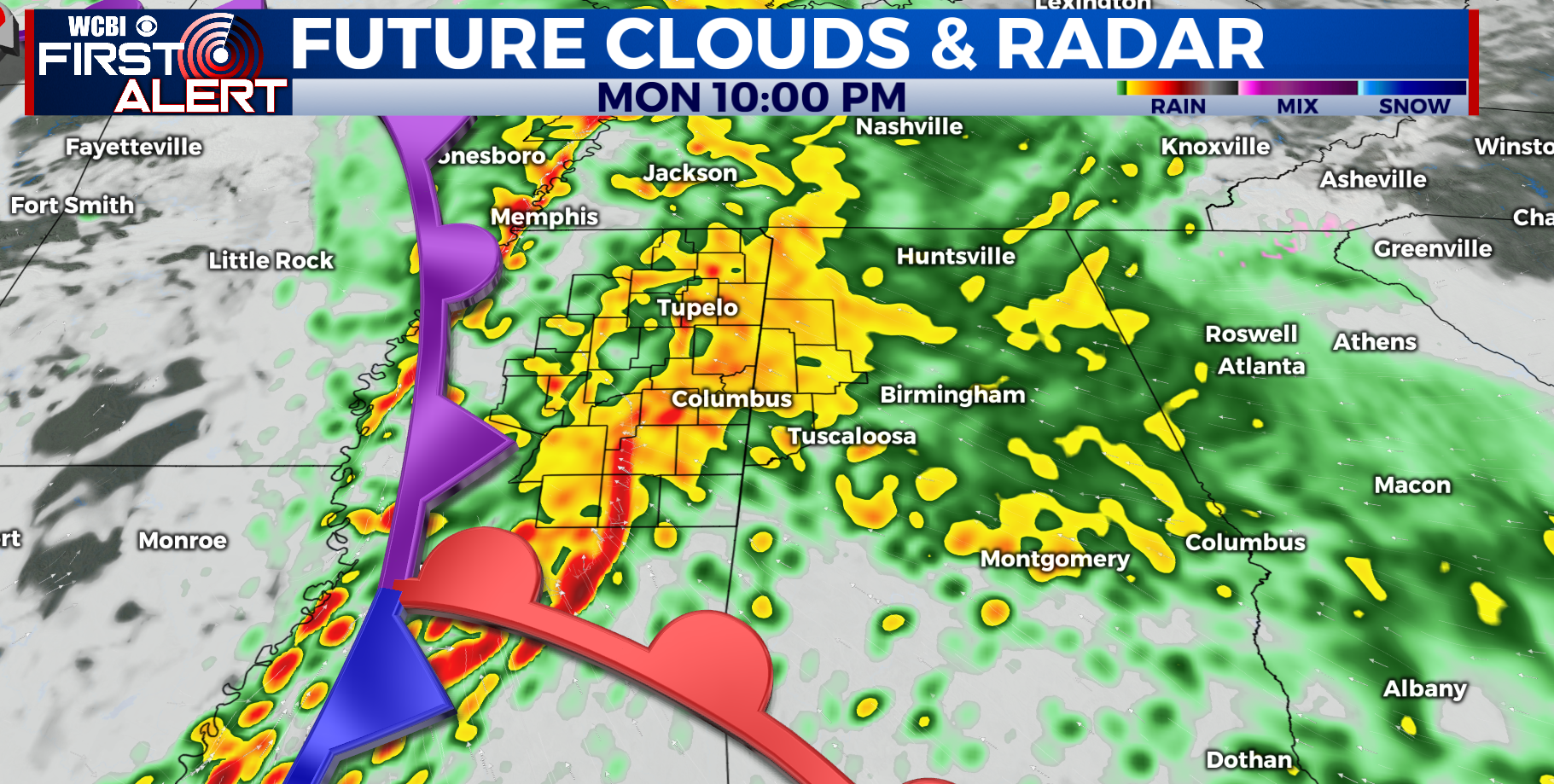
MONDAY/TUESDAY – A chilly and breezy day to start off tomorrow with temperatures in the 30s Monday morning. Things remain mostly dry through our morning and lunchtime tomorrow with highs in the mid 50s. Rain and storms begin to move into the region in the mid afternoon and into the evening hours. The storms will continue through the overnight hours and into Tuesday morning. Most of the severe storms remain to our South with a level 1 risk for severe weather for some of our southern counties. Expect lots of heavy rainfall with this system, some areas could see over 2 inches of rainfall. It will also be extremely windy through Monday and Tuesday with gusts of up to 50mph. There is a Wind Advisory in effect from Monday at 3:00 p.m. through Tuesday at 6:00 p.m. Heavy cloud coverage and lingering showers are likely for the rest of our Tuesday with highs in the mid 50s.
THIS WEEK – Rain clears out for our Wednesday and most of our Thursday, leaving us with partly cloudy sky conditions. Highs will be in the low 50s on Wednesday and high 50s by Thursday. Isolated showers are possible for Thursday evening, but most of the rain will move in for our Friday.