Trending hotter mid-week, storms possible Tuesday PM
COLUMBUS, Mississippi (WCBI) – As a ridge of high pressure builds in, some strong storms are possible Tuesday afternoon & evening. Hotter afternoons are on tap Wednesday and Thursday.
TUESDAY: Expect a mixture of clouds and sunshine with highs in the middle 90s by afternoon. The heat index ix likely to reach 103-108° for most spots, and a heat advisory is in effect for most counties. A small but potentially intense cluster of storms could move across northeastern MS after 5 PM with damaging wind gusts the primary threat. These storms should exit the region shortly after sunset.
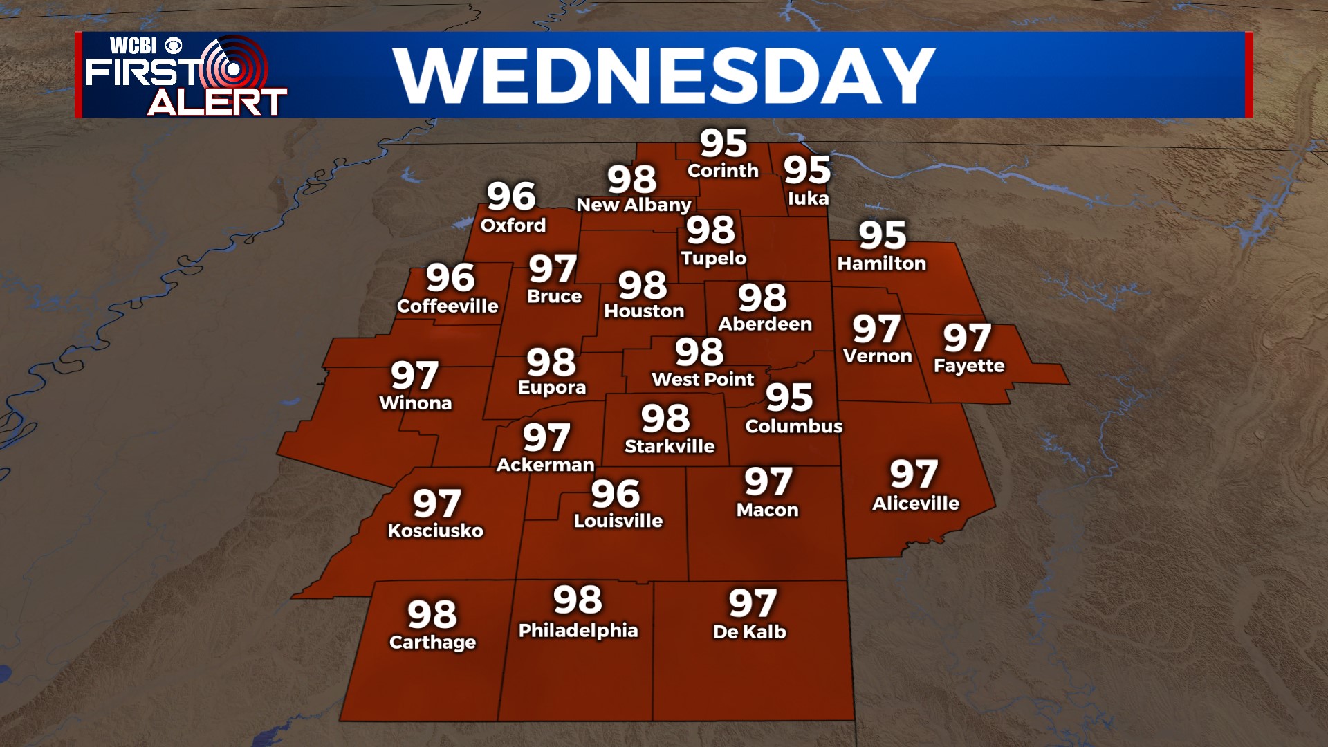
WEDNESDAY: The aforementioned ridge will have mostly built across the region, though a few storms on its eastern periphery in Alabama could inhibit parts of the region from getting too hot. That being said, highs in the mid 90s are still anticipated with areas near I-55 seeing upper 90s to near 100°.
THURSDAY: Mostly sunny and HOT. Highs will reach the upper 90s area-wide.
FRI/WEEKEND: Friday stays mostly sunny and hot with highs in the mid 90s. An approaching front could bring some showers & storms to the region by late afternoon. This front looks to continue southward, bringing an additional rain chance Saturday. Highs will drop back into the upper 80s Saturday. Drier air also builds in Saturday evening, leaving Sunday more pleasant!


