Trending hotter Tuesday, storms possible again Wednesday
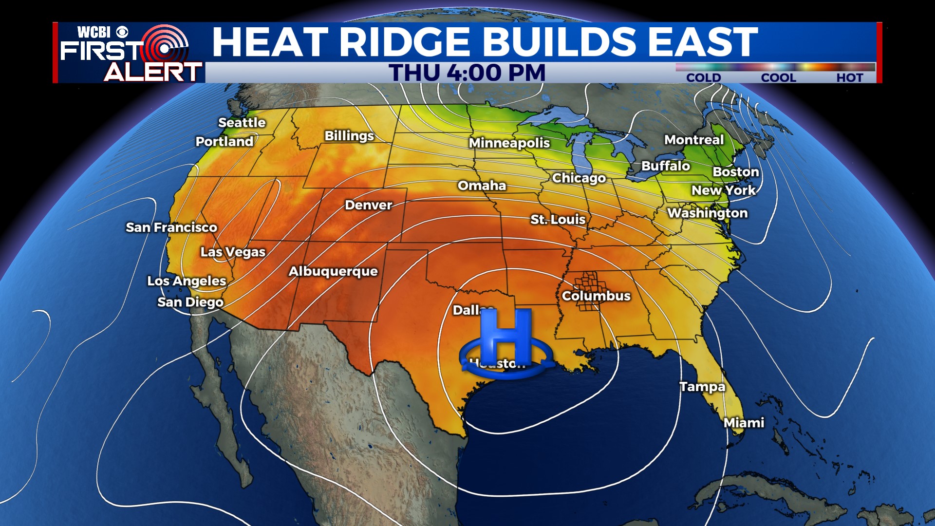
COLUMBUS, Mississippi (WCBI – An upcoming storm chance will keep a lid on excessive heat issues until late week. By Thursday and parts of the weekend, dangerous heat levels are increasingly likely.
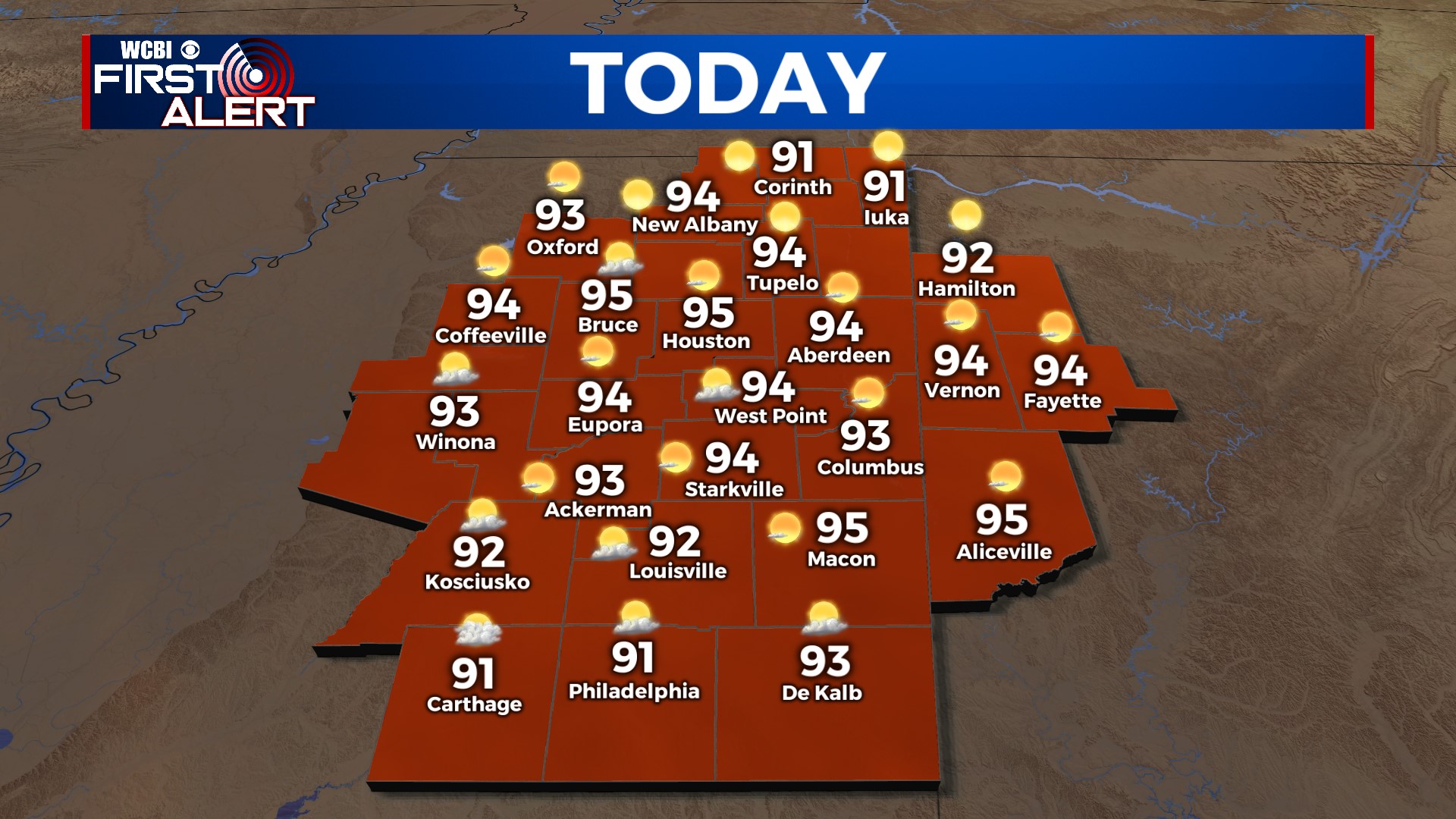
TUESDAY: Expect a good deal of sun today with highs back in the 90s, possibly reaching as high as 95° in some spots. The “good news” is heat indicies shouldn’t spike into the 100s thanks to some lingering “drier” air over the region.
TUESDAY NIGHT: Most of the evening & overnight should be quiet. However, we’ll be watching a possible storm complex in Arkansas to possible point itself in our direction toward daybreak.
WEDNESDAY: There’s increased confidence of a thunderstorm cluster rolling through north & central Mississippi during the morning hours. Potential severity still remains slightly in question, but it’s best to plan for another round of gusty winds w/the strongest storms. We should be clearing up by afternoon.
THU/FRI/SAT: A stretch of dangerously hot days is still expected. Thursday’s high temperature will reach the upper 90s, though a couple of century mark readings is possible. Heat indices will likely be at or above 110°. Friday and/or Saturday still looks to feature the worst heat – triple digit air temperatures are possible, with heat indices up to 115° or slightly higher possible. A few showers Saturday afternoon could save the day for some!