Unsettled weather continues, storms likely late Thursday
COLUMBUS, Mississippi (WCBI) – Warm and humid weather prevails through mid-week with several opportunities for storm chances.
TUESDAY: A stalling and weakening front to the northwest will help spark renewed storm development this afternoon, mainly for areas along and northwest of the Natchez Trace. Like yesterday, a few storms could reach severe limits with gusty winds and hail the primary concern. These should weaken shortly after sunset.
WEDNESDAY: Tuesday’s front becomes diffuse across north MS, becoming an effective warm front by afternoon. This could trigger a few downpours across far northern parts of the region in the afternoon, but most places are likely to stay dry. Expect a very warm and humid day with feels-like temps approaching 90 degrees.
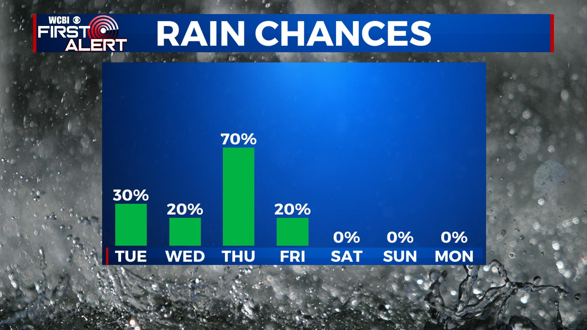
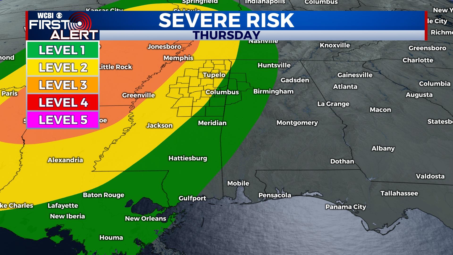
THURSDAY: The day should start dry, but another warm and very humid day will be in store. Rain chances stay limited until the evening, then showers and storms become likely into the overnight. Severe storms remain possible, including damaging winds, hail, and a couple of tornadoes.
FRIDAY: Storms may linger into the predawn hours of Friday, but gradual drying and partial clearing is expected by afternoon. Temperatures should scale back into the upper 70s.
WEEKEND: Mostly sunny both days with more tolerable weather Saturday as highs hold on in the upper 70s and morning lows dip into the 50s. Expect a much warmer day Sunday with highs back in the upper 80s.