Want a break from the rain? You’ll love our forecast
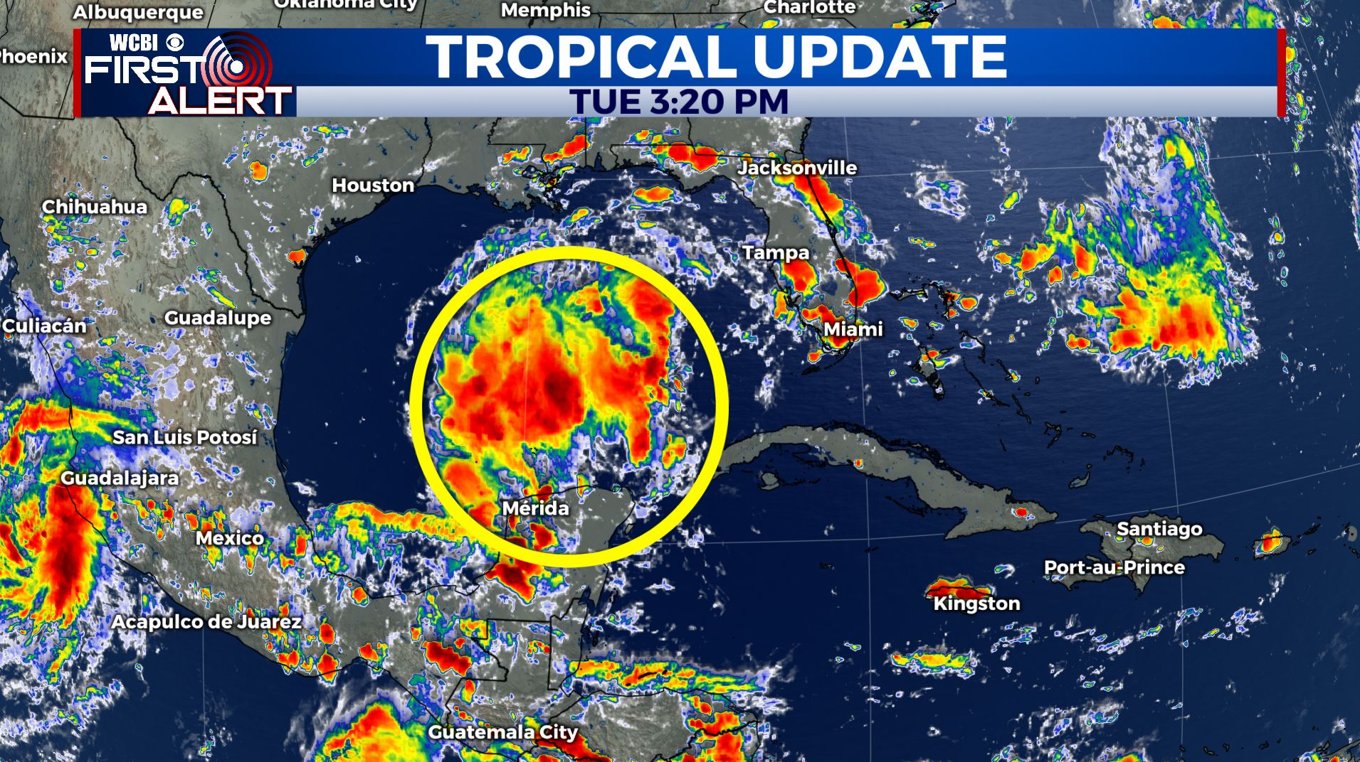
It has been a slightly warmer than average day across the region with high temperatures in the upper-80s and low-90s. We’ve also seen some clouds move through at times, but no rain. Wednesday will basically be a repeat type of day, but with more clouds draped across the area during the afternoon and evening as a weak front moves through. We will welcome in the slightly cooler and drier air mass Thursday afternoon behind the front with temperatures in the mid-80s. We are monitoring an area of showers and thunderstorms in the central Gulf of Mexico for potential development over the next few days. Regardless of development, this potential tropical system is unlikely to impact any of our area and should move to the northeast through Florida.
TONIGHT: Mostly clear and pleasant with lows in the upper-60s. Patchy fog possible after midnight.
WEDNESDAY: Partly cloudy and warm with highs in the upper-80s to low-90s.
WEDNESDAY NIGHT: Mostly cloudy early, then clearing late. Overnight lows in the low-to-mid 60s.
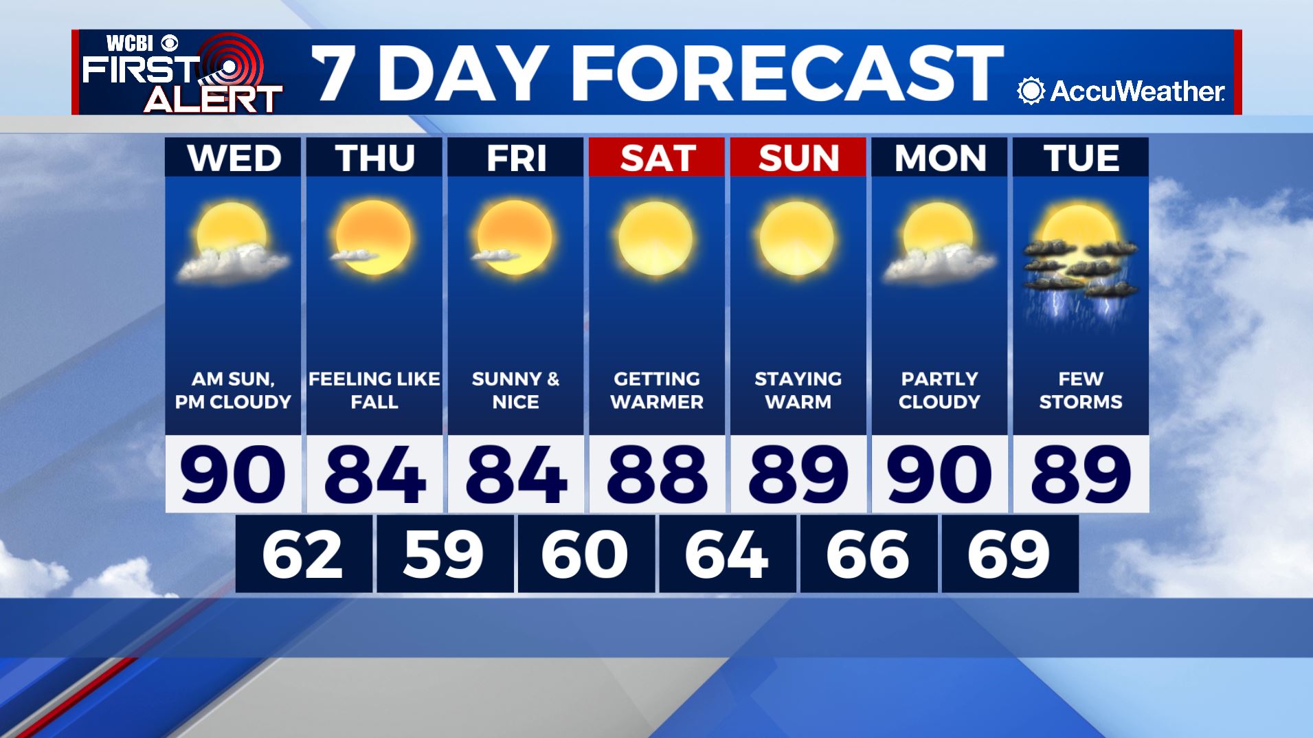
REST OF THE WEEK: We will warm into the upper-80s as we reach the weekend. Rain chances hold off until the middle of next week, with isolated storms becoming possible Tuesday afternoon.