Warm & breezy Valentine’s, stormy mid-week
COLUMBUS, Mississippi (WCBI) – Expect quite the stout breeze for Tuesday afternoon & evening. Storm chances begin ramping up Wednesday and Thursday.
VALENTINE’S DAY: Mostly cloudy, warm, and breezy with highs in the lower 70s. Wind gusts will frequently exceed 30 mph this afternoon and early this evening, so make you secure any loose objects oustide the house.
VALENTINE’S EVENING: The breeze will stick around but should steadily decrease after 8p. Scattered showers are possible between 5-9p, so keep this in mind if you’re out and about with your special someone. Overnight lows will only drop to the upper 50s.
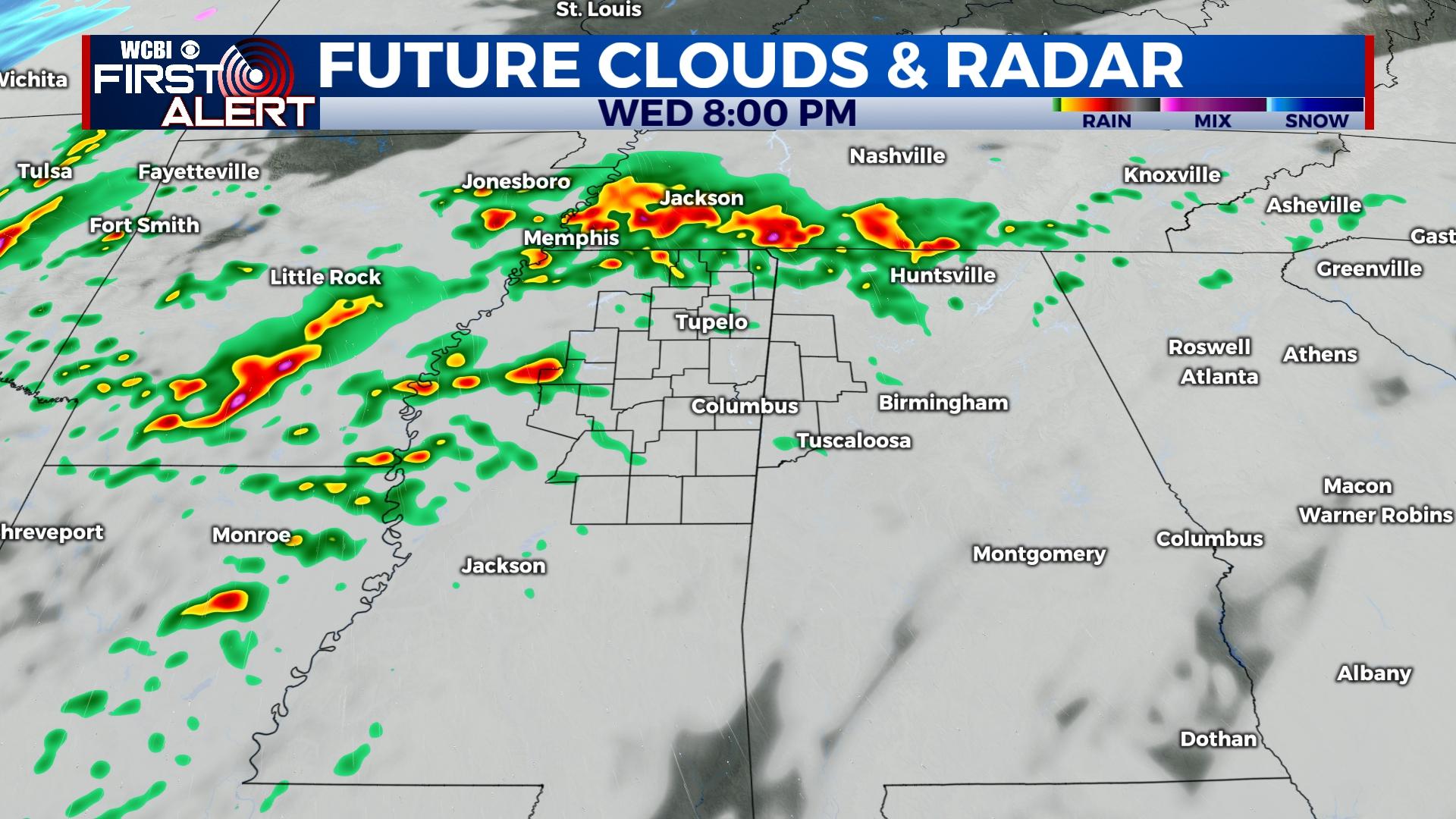
WEDNESDAY: Warmer, more humid air will be flowing northward across the state thanks to a retreating warm front. On and off showers are possible through the day as temperatures top out in the lower & middle 70s. A few strong to severe storms remain possible Wednesday night, particularly along and northwest of the Natchez Trace. All modes of severe would be possible, including a tornado risk.
THURSDAY: While exact timing remains a bit unclear, the forecast is slowly beginning to converge on the idea of a midday to early afternoon frontal passage for northeast MS. This will mean at least some if not all of the region will see a threat for additional severe storms beginning Thursday morning and lasting through mid-afternoon. All modes of severe would be possible should mature storms form, though there remains some question as to the areal extent of storm coverage.
FRIDAY/WEEKEND: Substantially colder air arrives Thursday night into Friday with temperatures just above freezing. Highs stay in the 40s Friday but should recover into the 50s Saturday and 60s Sunday. Saturday morning looks to be the coldest with morning temperatures in the mid 20s.