Warm, breezy with severe storms likely Wednesday PM
COLUMBUS, Mississippi (WCBI) – Increasingly warm, breezy weather takes hold for the next couple days. Severe storms become likely Wednesday afternoon and evening.
TUESDAY: A warm front will lift north across the state today, bringing much warmer and increasingly breezy conditions to the region. Highs should top out in the 80s with a mix of sun and clouds; wind gusts could approach 20-25 mph in the afternoon. Increasing pollen irritation could occur as well.
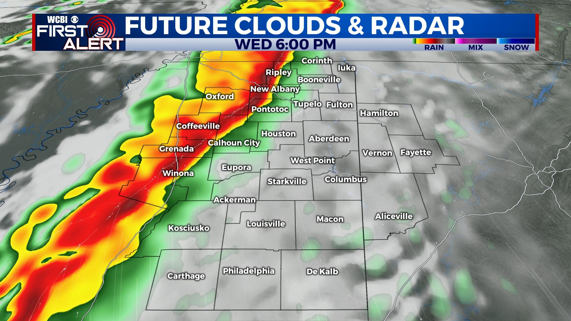
WEDNESDAY: Warm and very windy conditions are expected as non-thunderstorm wind gusts could approach 40-45 mph during the day. Highs should reach the 80s yet again, preceding any storms. The primary time frame for severe storms will be 1-9p as a fierce line of storms makes it way toward and through the region. The main concern will be significant damaging wind potential, potentially with gusts up to or exceeding hurricane force (74+ mph). However, the tornado threat must be considered as well given strong low-level shear; therefore, several tornadoes are also possible within the line. Hail looks unlikely, and flooding looks to remain limited as well.
REST OF WEEK: Increasing sunshine will be the rule with highs staying in the upper 60s and lows in the 40s.
WEEKEND: There remains a small chance for showers Saturday, but most places likely will end up remaining dry. Sunday brings nicer weather with sunshine and highs nearing 70 degrees.
NEXT WEEK: Monday starts the week dry, but more showers and storms could develop into the region by next Tuesday.


