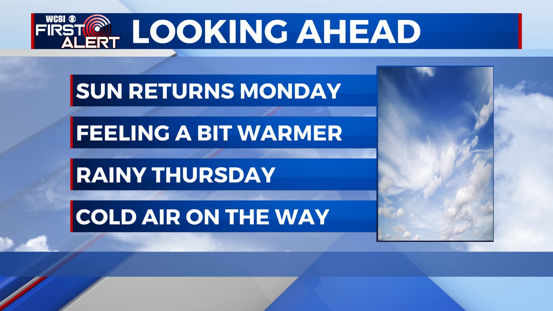
Warmer to start this week, cold by next weekend
Temperatures will be on a bit of a rollercoaster as we start the week off in the low and mid 60s for highs. It’s looking more and more likely that we’ll see a big cool-down by the weekend, if not early next week.
SUNDAY NIGHT: Clouds will linger through much of the night tonight, but we could see some clearing after midnight. It’ll be another cold one with temperatures in the upper 20s by morning.
MONDAY: We’ll see a mix of sun and clouds on Monday with temperatures climbing back into the upper 50s and low 60s by the afternoon. Winds will remain out of the southeast around 5 to 10 mph.
TUESDAY-WEDNESDAY: Skies will remain mostly cloudy on Tuesday and Wednesday with a shower or two possible each day. Temperatures will be warmer with highs in the mid to upper 60s and lows in the 40s.
THURSDAY: Steady rain will persist through the day on Thursday, some of which could be a little on the heavier side. Temperatures will likely remain in the 50s through the day with colder air moving in after the rain exits Thursday evening.
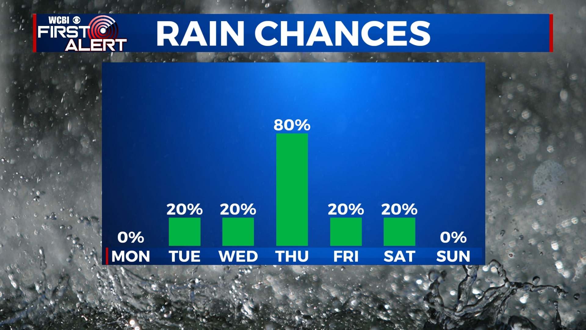
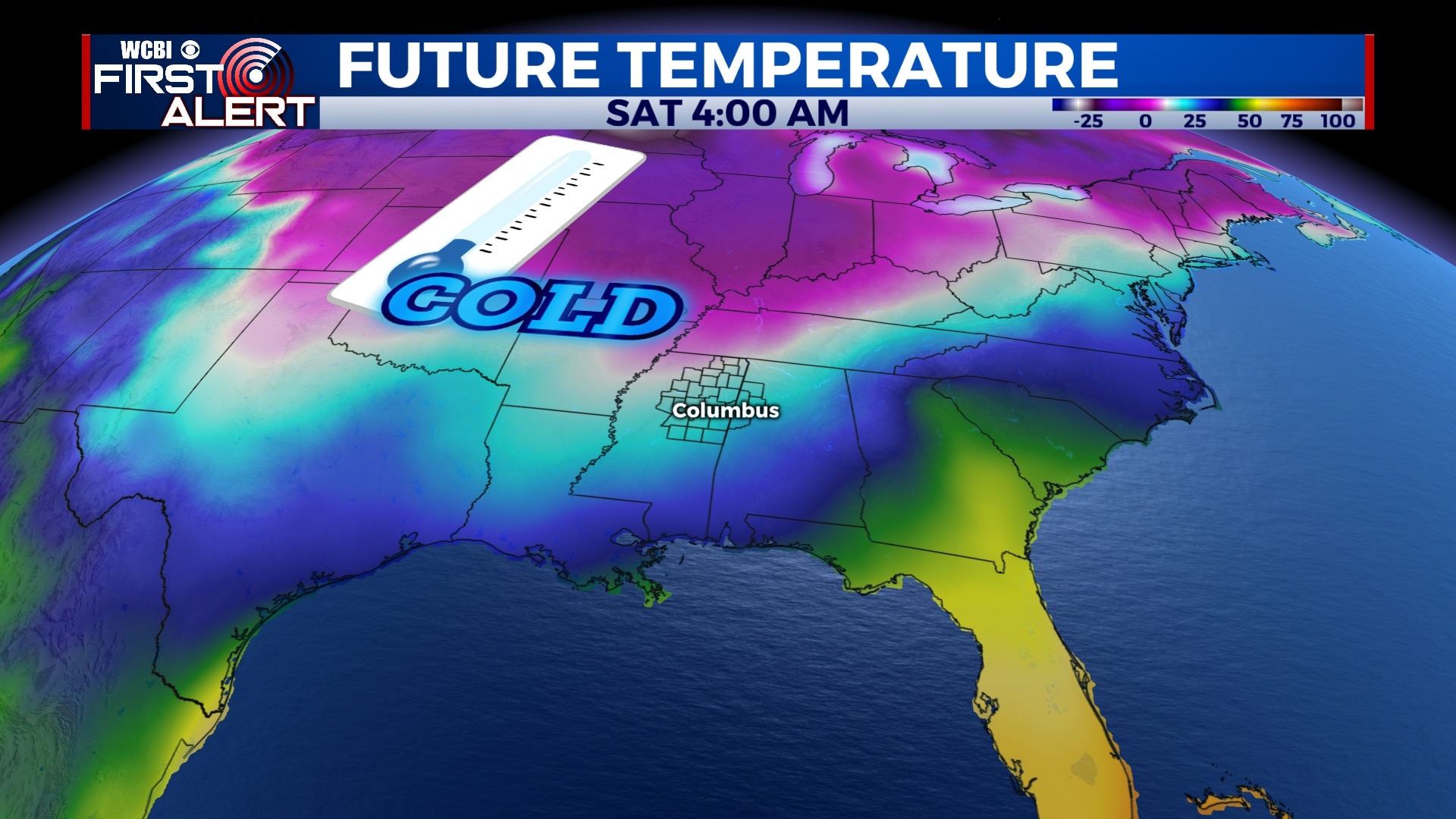
FRIDAY-SUNDAY: While the forecast is still uncertain at this point, it appears more and more likely that colder air will begin to move in this weekend. Temperatures will likely be in the 30s and 40s through much of the day with colder air through the weekend. Highs could be as low as the 30s with overnight lows around 20 degrees. Skies will remain mostly cloudy Friday and Saturday with a little sunshine by Sunday. As of now, there is no winter weather in the forecast. Temperatures could be even colder by early next week.
Follow WCBI Weather on Facebook, Twitter, and Instagram
Follow Meteorologist Trevor Birchett on Facebook and Twitter


Leave a Reply