Weekend storms out…hotter air returns soon
COLUMBUS, Mississippi (WCBI) – After multiple rounds of storms over the weekend, dry weather starts the week along with below average temperatures.
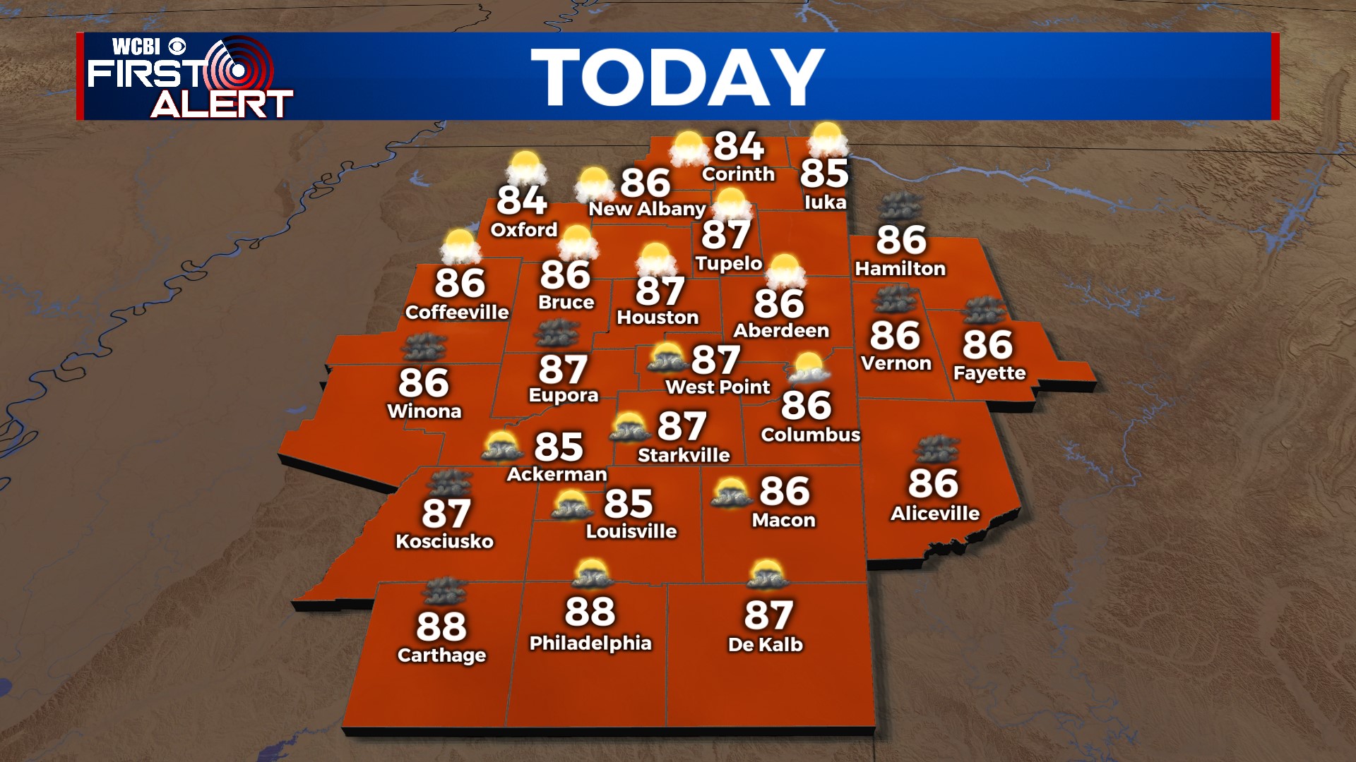
MONDAY: Clouds hold on early, but gradual clearing is expected by afternoon. Highs should hold in the middle 80s for most!
MONDAY NIGHT: Mainly clear and slightly cooler with lows in the upper 60s.
TUESDAY: Expect plenty of sun with highs back in the lower 90s. Thankfully, some slightly less humid air should slip into north MS, making it feel not quite as bad!
REST OF WEEK: The pesky and active west to northwest flow in the upper-levels of the atmosphere looks to return. This means at least some isolated storms each afternoon, with the potential of a larger storm complex to move in at times as well. Confidence in the larger storm complexes remains quite low, but it’s something we’ll watch day to day. Otherwise, increased heat stress is also likely once again – highs will sneak into the middle 90s with the heat index likely over 105° Thu-Sat.


