Windy Friday, severe threat early in the day
COLUMBUS, Mississippi (WCBI) – The last day of the work week brings high wind and severe potential to northern MS. Quiet weather returns for the weekend.
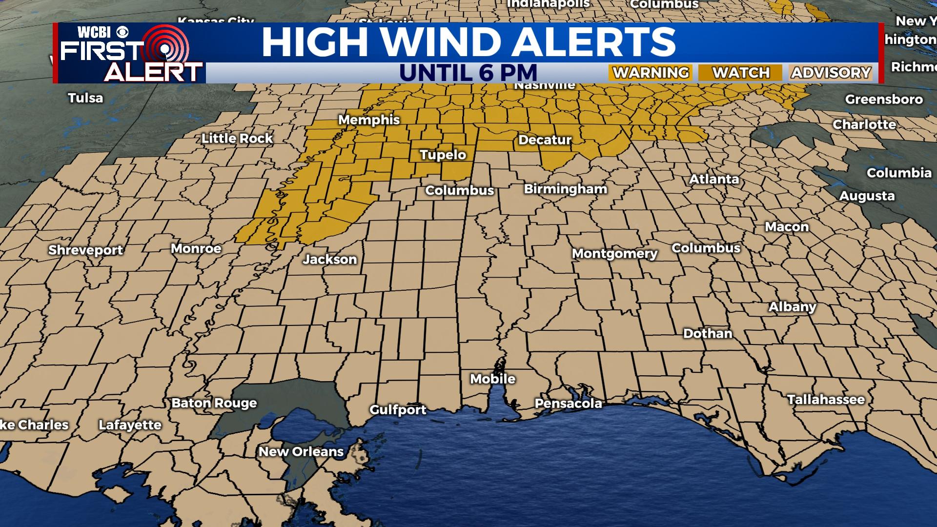
FRIDAY: A fast-moving of showers and embedded storms will move across northeastern MS this morning, bringing gusty winds and some low-end tornado potential. Outside of any storm risk, high winds will be likely as well, gusting up to 50+ mph in spots…especially north of US 82. A high wind warning is in effect for most of these areas.
FRIDAY NIGHT: Winds will relax after sunset, though clouds may be slow to clear until after midnight. Lows will drop into the 40s – much cooler!
WEEKEND: Lots of sunshine both days! We’ll have cool nights and pleasantly warm days with highs in the 60s Saturday and 70s Sunday.
NEXT WEEK: Warmer weather will start the week as highs stay in the 70s through Tuesday. Clouds increase Monday, and occasional showers are possible Monday afternoon and Tuesday. Cooler weather looks to move in starting Wednesday along with additional rain chances.


