Winter temperatures stick around as Sunday cold front brings heavy rain
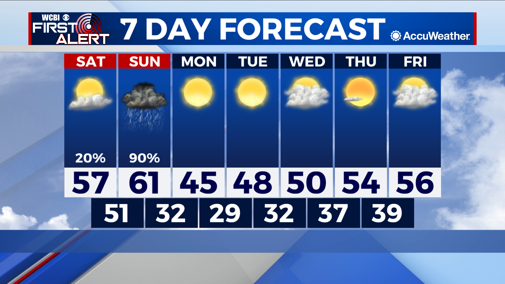
COLUMBUS – SUMMARY: Another strong cold front Sunday will keep winter temperatures in the area for at least another week. Thunderstorms on Sunday amount to the only significant rain chance this week, as next week looks to be dry. Conditions will slowly warm back into the mid to high-50s by next Friday.
SATURDAY: Saturday continues to see improvements temperature-wise as gradual warming continues. Highs top out in the high 50s Saturday afternoon with overnight lows dropping down into the low 50s. The chance for some scattered showers exists later in the night as the first signs of Sundays cold front start to appear.
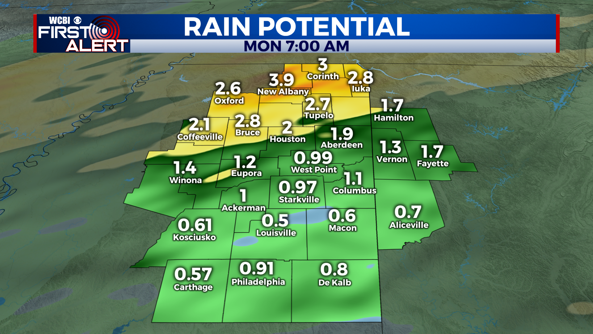
SUNDAY: Our big rain maker this week is brought to you by Sunday’s cold front. Widespread thunderstorms are expected across the region early Sunday morning, although thankfully the threat for severe weather is limited this time around. The primary effect of our rain event Sunday will be just that. Rain totals in excess of 2 to 4 inches are possible for our northern counties, while 0.5 to 1 inch of rain is possible further south. The brief tornado spin-up, hail, and or wind event cannot be discounted, but the threat is low at this time.
REST OF THE WEEK: Sunday’s cold front will drop temperatures back down into the 20s for our lows, and into the 40s for our highs. Temperatures will gradually warm back into the mid to high-50s by the turn of next weekend, but the positive news next week is that we remain dry. Lows will generally stay cold, approaching the 40s by Friday.